Eindhoven
Airport details
| Country | Netherlands |
| State | North Brabant |
| Region | EH |
| Airspace | Amsterdam Ctr |
| Municipality | Eindhoven |
| Elevation | 75ft (23m) |
| Timezone | GMT +1 |
| Coordinates | 51.44489, 5.37551 |
| Magnetic var | |
| Type | land |
| Available since | X-Plane v10.40 |
| ICAO code | EHEH |
| IATA code | EIN |
| FAA code | n/a |
Communication
| Eindhoven ATIS | 126.030 |
| Eindhoven Ground Control | 121.930 |
| Eindhoven Tower | 122.100 |
| Eindhoven Tower | 131.005 |
| Eindhoven Approach | 124.530 |
| Eindhoven Approach | 122.100 |
| Eindhoven Approach | 123.180 |
Approach frequencies
| ILS-cat-I | RW21 | 109.75 | 18.00mi |
| ILS-cat-I | RW03 | 109.75 | 18.00mi |
| 3° GS | RW21 | 109.75 | 18.00mi |
| 3° GS | RW03 | 109.75 | 18.00mi |
Nearby Points of Interest:
Berkt 50, Zandoerle
-Vilderstraat 1, Veldhoven
-statue of Sacred Heart of Jesus Christ
-Constant Rebecque Kazerne
-Batalaan 5, Best
-Armenhoef
-Witte Dame
-stella
-De Admirant
-Lichttoren (Light tower)
-Water Mill at Gennep
-Dommelstraat 9, Eindhoven
-Kasteel Oud Bijsterveld
-Klooster Mariënhage, Eindhoven
-De Laak (villa)
-Dr. A.F. Philips Observatorium
-Dommelhoef
-Old Tower
-H.H. Andreas en Antonius van Paduakerk
-Brouwerij De Kroon
-Villa Kortonjo
-Torenstraat 1, Oirschot
-Nutsschool Reigerlaan, Eindhoven
-Rooms-Katholieke Begraafplaats
-De Bult
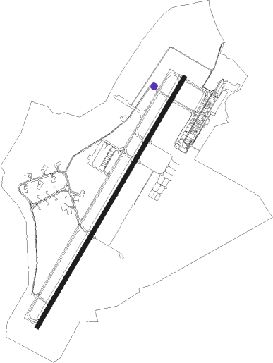
Runway info
| Runway 03 / 21 | ||
| length | 2998m (9836ft) | |
| bearing | 48° / 228° | |
| width | 45m (148ft) | |
| surface | asphalt | |
| displ threshold | 243m (797ft) / 243m (797ft) | |
Nearby beacons
| code | identifier | dist | bearing | frequency |
|---|---|---|---|---|
| EHV | EINDHOVEN TACAN | 0.1 | 350° | 117.20 |
| BBL | KLEINE BROGEL TACAN | 16.9 | 162° | 109.60 |
| VKL | VOLKEL TACAN | 17.6 | 58° | 108.30 |
| GZR | GILZE-RIJEN TACAN | 18 | 285° | 116.40 |
| BUN | BRUNO VOR/DME | 28 | 239° | 110.60 |
| NID | DME | 30 | 79° | 115.50 |
| LAA | NIEDERRHEIN NDB | 31.2 | 79° | 352 |
| NW | MAASTRICHT NDB | 31.7 | 130° | 373 |
| ONW | ANTWERP NDB | 34.6 | 251° | 355 |
| FLO | FLORA VOR/DME | 35.3 | 203° | 112.05 |
| MAS | MAASTRICHT VOR/DME | 35.9 | 129° | 108.60 |
| ANT | ANTWERP (DEURNE) VOR/DME | 37.1 | 254° | 113.50 |
| GIX | GEILENKIRCHEN TACAN | 38.3 | 126° | 108.10 |
| FRT | DME | 40.4 | 313° | 117.15 |
| DLN | DEELEN TACAN | 41.1 | 39° | 112.20 |
| OP | BRUSSELS NATIONAL NDB | 42.3 | 237° | 402 |
| OB | BRUSSELS NDB | 42.5 | 235° | 293 |
| ONL | LIEGE NDB | 45.1 | 167° | 290 |
| BUB | BRUSSELS VOR/DME | 45.3 | 237° | 114.60 |
| RTM | ROTTERDAM VOR/DME | 46 | 301° | 110.40 |
| BBE | BEAUVECHAIN TACAN | 47.2 | 221° | 116 |
| HTB | BEAUVECHAIN NDB | 47.3 | 221° | 381 |
| LGE | LIEGE VOR/DME | 47.6 | 173° | 115.45 |
| HUL | HULDENBERG VOR/DME | 50.1 | 227° | 117.55 |
| OZ | BRUSSELS NATIONAL NDB | 50.5 | 236° | 314 |
| LNO | OLNO VOR/DME | 53.1 | 159° | 112.80 |
| PAM | PAMPUS VOR/DME | 54.4 | 342° | 117.80 |
| SPI | SPRIMONT VOR/DME | 56.6 | 165° | 113.10 |
| SPL | SCHIPHOL (AMSTERDAM) VOR/DME | 58.1 | 325° | 108.40 |
| AMS | DME | 58.8 | 323° | 113.95 |
| SLV | SPA NDB | 61.5 | 151° | 386 |
| ONC | CHARLEROI NDB | 65.2 | 221° | 323 |
| GSY | GOSLY (CHARLEROI) VOR/DME | 69.2 | 223° | 115.70 |
Departure and arrival routes
| Transition altitude | 3000ft |
| SID end points | distance | outbound heading | |
|---|---|---|---|
| RW03 | |||
| TENL2J | 58mi | 47° | |
| VELN2J | 31mi | 84° | |
| OSGO3J | 26mi | 116° | |
| LNO5J | 53mi | 159° | |
| ELSI3J | 21mi | 236° | |
| WOOD5J | 38mi | 268° | |
| ABNE2J | 86mi | 280° | |
| PESE3J | 33mi | 281° | |
| TULI6J | 79mi | 301° | |
| INKE4J | 32mi | 301° | |
| EH7 | 41mi | 352° | |
| RW21 | |||
| TENL2K | 58mi | 47° | |
| VELN4K | 31mi | 84° | |
| OSGO4K | 26mi | 116° | |
| LNO6K | 53mi | 159° | |
| ELSI4K | 21mi | 236° | |
| WOOD1S, WOOD5K | 38mi | 268° | |
| ABNE2K, ABNE2S | 86mi | 280° | |
| PESE4K, PESE1S | 33mi | 281° | |
| TULI2S, TULI6K | 79mi | 301° | |
| INKE1S, INKE4K | 32mi | 301° | |
| EH5 | 41mi | 352° | |
| STAR starting points | distance | inbound heading | |
|---|---|---|---|
| ALL | |||
| ELSI2E | 20.6 | 56° | |
| HELE6E | 57.8 | 82° | |
| DENU2E | 65.6 | 83° | |
| COA5E | 75.9 | 87° | |
| REDF4E | 114.5 | 103° | |
| LAMS4E | 117.0 | 118° | |
| INKE3E | 31.6 | 121° | |
| MOLI4E | 118.6 | 121° | |
| TOPA4E | 135.0 | 137° | |
| LOPI2E | 30.5 | 153° | |
| RUME2E | 21.7 | 251° | |
| ROTE3E | 29.3 | 256° | |
| OSGO2E | 25.6 | 296° | |
| LNO4E | 53.1 | 339° | |
Instrument approach procedures
| runway | airway (heading) | route (dist, bearing) |
|---|---|---|
| RW03-Y | IPT2D (6°) | IPTAS EH582 (4mi, 100°) EH595 (7mi, 196°) 4000ft RUSAL (8mi, 196°) ERSUL (5mi, 114°) 2000ft |
| RW03-Y | OKL2D (6°) | OKLOV EH589 (8mi, 231°) DERUV (5mi, 238°) SOMEM (9mi, 238°) EH588 (8mi, 259°) 4000ft MITSA (3mi, 259°) ERSUL (5mi, 293°) 2000ft |
| RW03-Y | RUM2D (6°) | RUMER EH590 (2mi, 204°) DERUV (9mi, 204°) SOMEM (9mi, 238°) EH588 (8mi, 259°) 4000ft MITSA (3mi, 259°) ERSUL (5mi, 293°) 2000ft |
| RW03-Y | SOP2D (6°) | SOPVI EH586 (5mi, 289°) EH587 (4mi, 289°) SOMEM (3mi, 289°) EH588 (8mi, 259°) 4000ft MITSA (3mi, 259°) ERSUL (5mi, 293°) 2000ft |
| RNAV | ERSUL 2000ft EH573 (2mi, 48°) 2000ft EHEH (6mi, 50°) 124ft EH550 (4mi, 45°) 2000ft EHOJI (3mi, 228°) 3000ft EHOJI (turn) 3000ft | |
| RW03-Z | MITSA (8°) | MITSA 2000ft ERSUL (5mi, 293°) 2000ft |
| RW03-Z | TILVU (105°) | TILVU 2000ft RUSAL (8mi, 167°) ERSUL (5mi, 114°) 2000ft |
| RNAV | ERSUL 2000ft EH573 (2mi, 48°) 2000ft EHEH (6mi, 50°) 124ft EH550 (4mi, 45°) 2000ft EHOJI (3mi, 228°) 3000ft EHOJI (turn) 3000ft | |
| RW21-Y | IPT2F (6°) | IPTAS EH582 (4mi, 100°) EH594 (5mi, 91°) BESTI (3mi, 75°) 4000ft GILIV (5mi, 113°) 2000ft |
| RW21-Y | OKL2F (6°) | OKLOV EH589 (8mi, 231°) DERUV (5mi, 238°) GEMTI (8mi, 301°) 4000ft GILIV (5mi, 294°) 2000ft |
| RW21-Y | RUM2F (6°) | RUMER EH591 (1mi, 238°) VENAV (3mi, 238°) EH596 (4mi, 238°) GEMTI (3mi, 301°) 4000ft GILIV (5mi, 294°) 2000ft |
| RW21-Y | SOP2F (6°) | SOPVI EH585 (6mi, 335°) DERUV (7mi, 335°) GEMTI (8mi, 301°) 4000ft GILIV (5mi, 294°) 2000ft |
| RNAV | GILIV 2000ft EH567 (4mi, 228°) 2000ft EHEH (7mi, 226°) 117ft EH558 (3mi, 232°) 2000ft EHOJI (4mi, 48°) 3000ft EHOJI (turn) 3000ft | |
| RW21-Z | BESTI (195°) | BESTI 2000ft GILIV (5mi, 113°) 2000ft |
| RW21-Z | GEMTI (249°) | GEMTI 2000ft GILIV (5mi, 294°) 2000ft |
| RNAV | GILIV 2000ft EH567 (4mi, 228°) 2000ft EHEH (7mi, 226°) 117ft EH558 (3mi, 232°) 2000ft EHOJI (4mi, 48°) 3000ft EHOJI (turn) 3000ft |
Holding patterns
| STAR name | hold at | type | turn | heading* | altitude | leg | speed limit |
|---|---|---|---|---|---|---|---|
| COA5E | EHOJI | VHF | left | 213 (33)° | > 3000ft | 1.0min timed | ICAO rules |
| DENU2E | EHOJI | VHF | left | 213 (33)° | > 3000ft | 1.0min timed | ICAO rules |
| ELSI2E | EHOJI | VHF | left | 213 (33)° | > 3000ft | 1.0min timed | ICAO rules |
| HELE6E | EHOJI | VHF | left | 213 (33)° | > 3000ft | 1.0min timed | ICAO rules |
| INKE3E | EHOJI | VHF | left | 213 (33)° | > 3000ft | 1.0min timed | ICAO rules |
| LAMS4E | EHOJI | VHF | left | 213 (33)° | > 3000ft | 1.0min timed | ICAO rules |
| LNO4E | EHOJI | VHF | left | 213 (33)° | > 3000ft | 1.0min timed | ICAO rules |
| LOPI2E | EHOJI | VHF | left | 213 (33)° | > 3000ft | 1.0min timed | ICAO rules |
| MOLI4E | EHOJI | VHF | left | 213 (33)° | > 3000ft | 1.0min timed | ICAO rules |
| OSGO2E | EHOJI | VHF | left | 213 (33)° | > 3000ft | 1.0min timed | ICAO rules |
| REDF4E | EHOJI | VHF | left | 213 (33)° | > 3000ft | 1.0min timed | ICAO rules |
| ROTE3E | EHOJI | VHF | left | 213 (33)° | > 3000ft | 1.0min timed | ICAO rules |
| RUME2E | EHOJI | VHF | left | 213 (33)° | > 3000ft | 1.0min timed | ICAO rules |
| TOPA4E | EHOJI | VHF | left | 213 (33)° | > 3000ft | 1.0min timed | ICAO rules |
| *) magnetic outbound (inbound) holding course | |||||||
Disclaimer
The information on this website is not for real aviation. Use this data with the X-Plane flight simulator only! Data taken with kind consent from X-Plane 12 source code and data files. Content is subject to change without notice.