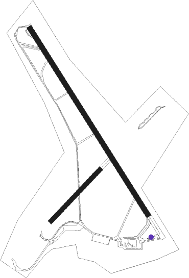
Kalmar
Airport details
| Country | Sweden |
| State | Kalmar län |
| Region | ES |
| Airspace | Sweden Ctr |
| Municipality | Kalmar |
| Elevation | 17ft (5m) |
| Timezone | GMT +1 |
| Coordinates | 56.68555, 16.28750 |
| Magnetic var | |
| Type | land |
| Available since | X-Plane v10.40 |
| ICAO code | ESMQ |
| IATA code | KLR |
| FAA code | n/a |
Communication
| Kalmar Tower | 127.055 |
| Kalmar Tower | 130.805 |
Approach frequencies
| ILS-cat-I | RW16 | 108.7 | 18.00mi |
| 3° GS | RW16 | 108.7 | 18.00mi |
Nearby beacons
| code | identifier | dist | bearing | frequency |
|---|---|---|---|---|
| KAL | KALMAR VOR/DME | 0.1 | 266° | 111.60 |
| KM | KALMAR NDB | 4.2 | 316° | 366 |
| MBL | DME | 25.1 | 164° | 115.60 |
Departure and arrival routes
| Transition altitude | 5000ft |
| SID end points | distance | outbound heading | |
|---|---|---|---|
| RW16 | |||
| MOVI3B | 32mi | 6° | |
| LATV5B | 16mi | 58° | |
| LAGI5B | 14mi | 250° | |
| TILS5B | 15mi | 282° | |
| RW34 | |||
| MOVI3C | 32mi | 6° | |
| LATV5C | 16mi | 58° | |
| STAR starting points | distance | inbound heading | |
|---|---|---|---|
| RW16 | |||
| LAGI6E | 13.9 | 70° | |
| TILS6E | 14.6 | 102° | |
| MOVI4E | 32.1 | 186° | |
| LATV6E | 15.7 | 238° | |
| RW34 | |||
| LAGI7F | 13.9 | 70° | |
| LATV7F | 15.7 | 238° | |
Instrument approach procedures
| runway | airway (heading) | route (dist, bearing) |
|---|---|---|
| RW16 | MQ851 (136°) | MQ851 2800ft MQ850 (4mi, 136°) 2000ft |
| RW16 | MQ852 (114°) | MQ852 2800ft MQ850 (5mi, 74°) 2000ft |
| RW16 | MQ853 (171°) | MQ853 2000ft MQ850 (5mi, 254°) 2000ft |
| RNAV | MQ850 2000ft MQ854 (5mi, 136°) 2000ft ESMQ (7mi, 136°) 68ft MQ550 (6mi, 136°) EMKAS (8mi, 282°) 2000ft EMKAS (turn) 2000ft | |
| RW34 | DIXOT (356°) | DIXOT 2000ft SULAX (5mi, 74°) 2000ft |
| RW34 | GOPNI (316°) | GOPNI 2000ft SULAX (4mi, 316°) 2000ft |
| RW34 | TESVI (292°) | TESVI 2000ft SULAX (5mi, 254°) 2000ft |
| RNAV | SULAX 2000ft MQ550 (4mi, 316°) 2000ft ESMQ (6mi, 316°) 66ft MQ900 (4mi, 316°) EMKAS (7mi, 217°) 2000ft EMKAS (turn) 2000ft |
Disclaimer
The information on this website is not for real aviation. Use this data with the X-Plane flight simulator only! Data taken with kind consent from X-Plane 12 source code and data files. Content is subject to change without notice.

