Nairobi - Nairobi Jomo Kanyatta Intl
Airport details
| Country | Kenya |
| State | Nairobi Province |
| Region | HK |
| Airspace | Nairobi Ctr |
| Municipality | Nairobi |
| Elevation | 5330ft (1625m) |
| Timezone | GMT +3 |
| Coordinates | -1.31619, 36.92650 |
| Magnetic var | |
| Type | land |
| Available since | X-Plane v10.40 |
| ICAO code | HKJK |
| IATA code | NBO |
| FAA code | n/a |
Communication
| Nairobi Jomo Kanyatta Intl ATIS | 126.200 |
| Nairobi Jomo Kanyatta Intl Tower | 118.700 |
| Nairobi Jomo Kanyatta Intl Approach | 122.300 |
| Nairobi Jomo Kanyatta Intl Approach | 119.700 |
Approach frequencies
| ILS-cat-I | RW06 | 110.3 | 18.00mi |
| 3° GS | RW06 | 110.3 | 18.00mi |
Nearby Points of Interest:
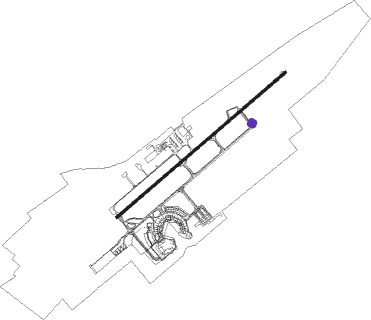
Olorgesailie
Nearby beacons
| code | identifier | dist | bearing | frequency |
|---|---|---|---|---|
| NV | NAVEX VOR/DME | 1.9 | 60° | 113.10 |
| NO | NAIROBI NDB | 4.8 | 232° | 278 |
| TH | ATHI RIVER (NAIROBI) NDB | 12.5 | 153° | 329 |
| TV | STONY VOR | 12.6 | 153° | 115.50 |
| GV | NGONG VOR | 17.9 | 254° | 115.90 |
Departure and arrival routes
| Transition altitude | 9000ft |
| Transition level | 10000ft |
| SID end points | distance | outbound heading | |
|---|---|---|---|
| RW06 | |||
| ATUD1D | 264mi | 46° | |
| GABS1Z, GABS1Y | 100mi | 157° | |
| STON1D | 83mi | 175° | |
| EVAT1Z, EVAT1X, EVAT1Y | 68mi | 205° | |
| PARI4B | 97mi | 254° | |
| APLO2B | 121mi | 265° | |
| APKU1A | 49mi | 286° | |
| NAKA4B, NAKA1Z, NAKA1Y | 98mi | 287° | |
| ANTU2D, UTER1A | 49mi | 311° | |
| NAVE2D, LANE2B | 76mi | 323° | |
| KAMA1Y, KAMA1X, KAMA1W | 188mi | 340° | |
| NAK3Y, NAK3X, LOTA1Z, LOTA1Y, ETOR1A | 141mi | 350° | |
| RW24 | |||
| APNO2E | 51mi | 123° | |
| GABS1U | 100mi | 157° | |
| EVAT1U | 68mi | 205° | |
| NAKA1U | 98mi | 287° | |
| IBRA3E | 49mi | 311° | |
| KAMA1U, KAMA1V | 188mi | 340° | |
| LOTA1U, NAK3U | 141mi | 350° | |
| STAR starting points | distance | inbound heading | |
|---|---|---|---|
| RW06 | |||
| LOSI3A | 119.3 | 24° | |
| EVAT2P | 67.5 | 25° | |
| MAGA1A | 69.7 | 42° | |
| PARI3A, PARI2P | 97.4 | 74° | |
| XAGI1A | 48.2 | 82° | |
| APLO1P, APLO1A | 120.9 | 85° | |
| NAKA2P, NAKA4A | 97.9 | 107° | |
| IBKA1A | 48.8 | 117° | |
| LANE1A, NAK2P | 76.3 | 143° | |
| KIME1P, KIME1A | 169.2 | 150° | |
| KAMA1P, KAMA1A | 187.8 | 160° | |
| LOTA2P, LOTA3A | 140.9 | 170° | |
| WAJI1P, WAJI1A | 264.1 | 226° | |
| IBRO1P, IBRO1A | 188.0 | 251° | |
| EVOG1A, EVOG1P | 174.8 | 279° | |
| NORV1A, NORV1P | 180.3 | 301° | |
| UTEP1A | 50.1 | 329° | |
| GABS3A, GABS2P | 99.9 | 337° | |
| UTAT3A, UTAT2P | 82.5 | 355° | |
| RW24 | |||
| EVAT2R, EVAT4B | 67.5 | 25° | |
| MAGA2C | 69.7 | 42° | |
| PARI4C, PARI2R | 97.4 | 74° | |
| XAGI1B | 48.2 | 82° | |
| APLO1R, APLO4C | 120.9 | 85° | |
| NAKA2R, NAKA3C | 97.9 | 107° | |
| IBKA1B | 48.8 | 117° | |
| NAK2R, LANE2C | 76.3 | 143° | |
| KIME1R, KIME2D | 169.2 | 150° | |
| KAMA2D, KAMA1R | 187.8 | 160° | |
| LOTA2R, LOTA4D | 140.9 | 170° | |
| WAJI1R | 264.1 | 226° | |
| OKRI1C | 51.9 | 240° | |
| IBRO1R, IBRO2C | 188.0 | 251° | |
| EVOG1R, EVOG2C | 174.8 | 279° | |
| NORV2C, NORV1R | 180.3 | 301° | |
| UTEP2C | 50.1 | 329° | |
| GABS4C, GABS2R | 99.9 | 337° | |
| UTAT2R, UTAT4C | 82.5 | 355° | |
Instrument approach procedures
| runway | airway (heading) | route (dist, bearing) |
|---|---|---|
| RW06 | APNOM (26°) | APNOM 9100ft IMDIS (6mi, 324°) 7900ft |
| RW06 | ATUDU (261°) | ATUDU APNOM (24mi, 234°) JK005 (6mi, 234°) JK004 (5mi, 234°) JK003 (5mi, 234°) GEREB (6mi, 321°) IBRAT (10mi, 54°) IMDIS (6mi, 54°) |
| RW06 | GEREB (53°) | GEREB IBRAT (10mi, 54°) IMDIS (6mi, 54°) |
| RW06 | GV (74°) | GV NESOD (3mi, 107°) 9100ft IMDIS (5mi, 107°) 7900ft |
| RW06 | IBRAT (53°) | IBRAT 9100ft IMDIS (6mi, 54°) 7900ft |
| RW06 | TEVOX (17°) | TEVOX APNOM (16mi, 10°) JK005 (6mi, 234°) JK004 (5mi, 234°) JK003 (5mi, 234°) GEREB (6mi, 321°) IBRAT (10mi, 54°) IMDIS (6mi, 54°) |
| RW06 | TIBET (86°) | TIBET GV (16mi, 100°) JK001 (6mi, 237°) JK002 (5mi, 234°) GEREB (7mi, 147°) IBRAT (10mi, 54°) IMDIS (6mi, 54°) |
| RNAV | IMDIS 7900ft ANTUK (6mi, 54°) 7100ft HKJK (6mi, 52°) 5380ft APDUS (18mi, 54°) (2234mi, 272°) 8100ft TV (2225mi, 92°) TV (turn) | |
| RW24 | APDUS (234°) | APDUS 9100ft EPNIB (6mi, 234°) 8100ft |
| RW24 | ATUDU (261°) | ATUDU 9100ft EPNIB (6mi, 324°) 8100ft |
| RW24 | AVEN1 (92°) | AVENA EPNIB (7mi, 204°) 8100ft |
| RW24 | AVEN2 (92°) | AVENA JK011 (9mi, 53°) JK010 (5mi, 54°) EPMOM (6mi, 198°) APDUS (9mi, 233°) EPNIB (6mi, 234°) |
| RW24 | JK006 (278°) | JK006 ATUDU (6mi, 54°) JK007 (6mi, 54°) JK008 (9mi, 54°) JK009 (5mi, 54°) EPMOM (8mi, 285°) APDUS (9mi, 233°) EPNIB (6mi, 234°) |
| RW24 | TV (333°) | TV ATUDU (16mi, 30°) JK007 (6mi, 54°) JK008 (9mi, 54°) JK009 (5mi, 54°) EPMOM (8mi, 285°) APDUS (9mi, 233°) EPNIB (6mi, 234°) |
| RNAV | EPNIB 8100ft ETMED (6mi, 234°) 7000ft HKJK (7mi, 236°) 5331ft IBRAT (18mi, 233°) (2205mi, 272°) 9100ft TV (2225mi, 92°) TV (turn) |
Holding patterns
| STAR name | hold at | type | turn | heading* | altitude | leg | speed limit |
|---|---|---|---|---|---|---|---|
| EVAT2R | TV | NDB | left | 107 (287)° | 10000ft - 14000ft | 1.0min timed | ICAO rules |
| KAMA1P | GV | NDB | right | 309 (129)° | 10000ft - 14000ft | 1.0min timed | ICAO rules |
| KIME1P | GV | NDB | right | 309 (129)° | 10000ft - 14000ft | 1.0min timed | ICAO rules |
| LOTA2P | GV | NDB | right | 309 (129)° | 10000ft - 14000ft | 1.0min timed | ICAO rules |
| NAK2P | GV | NDB | right | 309 (129)° | 10000ft - 14000ft | 1.0min timed | ICAO rules |
| NAKA2P | GV | NDB | right | 309 (129)° | 10000ft - 14000ft | 1.0min timed | ICAO rules |
| PARI2R | TV | NDB | left | 107 (287)° | 10000ft - 14000ft | 1.0min timed | ICAO rules |
| *) magnetic outbound (inbound) holding course | |||||||
Disclaimer
The information on this website is not for real aviation. Use this data with the X-Plane flight simulator only! Data taken with kind consent from X-Plane 12 source code and data files. Content is subject to change without notice.