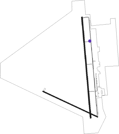
Great Bend - Great Bend Muni
Airport details
| Country | United States of America |
| State | Kansas |
| Region | K3 |
| Airspace | Kansas City Ctr |
| Municipality | Great Bend |
| Elevation | 1887ft (575m) |
| Timezone | GMT -6 |
| Coordinates | 38.34425, -98.85919 |
| Magnetic var | |
| Type | land |
| Available since | X-Plane v10.40 |
| ICAO code | KGBD |
| IATA code | GBD |
| FAA code | GBD |
Communication
| Great Bend Muni AWOS 3 | 119.275 |
| Great Bend Muni CTAF/UNICOM | 122.800 |
Approach frequencies
| ILS-cat-I | RW35 | 111.9 | 18.00mi |
| 3° GS | RW35 | 111.9 | 18.00mi |
Nearby beacons
| code | identifier | dist | bearing | frequency |
|---|---|---|---|---|
| GB | BABSY NDB | 5.5 | 178° | 419 |
| HY | NETTE (HAYS) NDB | 31.4 | 317° | 374 |
| HYS | HAYS VORTAC | 36 | 320° | 110.40 |
| HU | SALTT (HUTCHINSON) NDB | 45.9 | 103° | 404 |
| HUT | HUTCHINSON VOR/DME | 48.4 | 111° | 116.80 |
Instrument approach procedures
| runway | airway (heading) | route (dist, bearing) |
|---|---|---|
| RW17 | DISKS (142°) | DISKS FEVDI (11mi, 4°) 4000ft FEVDI (turn) 4000ft |
| RW17 | HYS (140°) | HYS JIPKU (23mi, 134°) 4000ft FEVDI (5mi, 90°) 4000ft |
| RNAV | FEVDI 4000ft CONPI (6mi, 179°) 3600ft EJAFA (3mi, 179°) 2620ft KGBD (3mi, 182°) 1926ft (5822mi, 111°) 2084ft HESMA (5823mi, 291°) 3600ft HESMA (turn) | |
| RW35 | DISKS (142°) | DISKS HESMA (13mi, 176°) 3600ft HESMA (turn) 3600ft |
| RW35 | HARAN (289°) | HARAN PUCIS (10mi, 236°) 3600ft HESMA (5mi, 270°) 3600ft |
| RW35 | SOSPE (68°) | SOSPE JAPRU (16mi, 95°) 3600ft HESMA (5mi, 90°) 3600ft |
| RNAV | HESMA 3600ft FENOB (6mi, 359°) 3600ft VACUR (3mi, 359°) 2620ft KGBD (3mi, 357°) 1931ft WEDEG (5mi, 1°) YUCUK (8mi, 270°) 4500ft SOSPE (19mi, 227°) SOSPE (turn) |
Disclaimer
The information on this website is not for real aviation. Use this data with the X-Plane flight simulator only! Data taken with kind consent from X-Plane 12 source code and data files. Content is subject to change without notice.

