Hyannis - Barnstable Muni
Airport details
| Country | United States of America |
| State | Massachusetts |
| Region | K6 |
| Airspace | Boston Ctr |
| Municipality | Barnstable |
| Elevation | 55ft (17m) |
| Timezone | GMT -5 |
| Coordinates | 41.66933, -70.28036 |
| Magnetic var | |
| Type | land |
| Available since | X-Plane v10.35 |
| ICAO code | KHYA |
| IATA code | HYA |
| FAA code | HYA |
Communication
| Barnstable Muni ATIS | 123.800 |
| Barnstable Muni UNICOM | 122.950 |
| Barnstable Muni CTAF | 119.500 |
| Barnstable Muni Clearance and Delivery | 125.150 |
| Barnstable Muni Ground | 118.450 |
| Barnstable Muni Tower | 119.500 |
| Barnstable Muni Boston Aproach and Departure | 118.200 |
Approach frequencies
| ILS-cat-I | RW15 | 108.95 | 18.00mi |
| ILS-cat-I | RW24 | 109.15 | 18.00mi |
| 3.1° GS | RW15 | 108.95 | 18.00mi |
| 3° GS | RW24 | 109.15 | 18.00mi |
Nearby Points of Interest:
Capt. Allen H. Bearse House
-Seth Hallett House
-Capt. Thomas Gray House
-Capt. Sylvester Baxter House
-Capt. Seth Baker Jr. House
-Building at 237–239 Main Street
-Pleasant-School Street Historic District
-Baxter Mill
-Dr. Edward Francis Gleason House
-Canary-Hartnett House
-Municipal Group Historic District
-Capt. Oliver Bearse House
-Yarmouth Camp Ground Historic District
-Capt. Rodney J. Baxter House
-Capt. William Hallett House
-Crowell-Smith House
-Building at 600 Main Street
-Building at 606 Main Street
-Building at 614 Main Street
-S. Alexander Hinckley House
-Hyannis Road Historic District
-Benjamin Baker Jr. House
-Nathaniel Baker House
-Capt. Alexander Crocker House
-Lot Crocker House
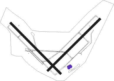
Runway info
Runway 15 / 33  | ||
| length | 1602m (5256ft) | |
| bearing | 132° / 312° | |
| width | 46m (151ft) | |
| surface | asphalt | |
| displ threshold | 0m (0ft) / 46m (151ft) | |
| Runway 6 / 24 | ||
| length | 1655m (5430ft) | |
| bearing | 58° / 238° | |
| width | 46m (151ft) | |
| surface | asphalt | |
| displ threshold | 124m (407ft) / 0m (0ft) | |
| blast zone | 88m (289ft) / 0m (0ft) | |
Nearby beacons
| code | identifier | dist | bearing | frequency |
|---|---|---|---|---|
| HY | BOGEY (HYANNIS) NDB | 4.4 | 59° | 342 |
| FMH | OTIS (FALMOUTH) TACAN | 10.4 | 268° | 115.80 |
| CQX | NAUSET (CHATHAM) NDB | 13.1 | 86° | 279 |
| MVY | MARTHA'S VINEYARD VOR/DME | 22.1 | 231° | 114.50 |
| LFV | MARCONI (NORTH TRURO) VOR/DME | 23.5 | 35° | 114.70 |
| PVC | PROVINCETOWN NDB | 24.1 | 8° | 389 |
| ACK | NANTUCKET VOR/DME | 25.9 | 147° | 116.20 |
| OW | STOGE (NORWOOD) NDB | 46.5 | 298° | 397 |
| BOS | BOSTON VOR/DME | 52 | 314° | 112.70 |
Instrument approach procedures
| runway | airway (heading) | route (dist, bearing) |
|---|---|---|
| RW06 | ACK (327°) | ACK LULIY (21mi, 296°) 2000ft FIXUG (5mi, 312°) 2000ft |
| RW06 | FIXUG (57°) | FIXUG 2000ft |
| RW06 | GAILS (149°) | GAILS JEBIM (18mi, 210°) 3000ft FIXUG (5mi, 131°) 2000ft |
| RW06 | HOPTU (98°) | HOPTU JEBIM (24mi, 111°) 2000ft FIXUG (5mi, 131°) 2000ft |
| RW06 | MVY (51°) | MVY FIXUG (10mi, 42°) 2000ft |
| RW06 | TUTOR (89°) | TUTOR JEBIM (18mi, 98°) 2000ft FIXUG (5mi, 131°) 2000ft |
| RNAV | FIXUG 2000ft COVOD (6mi, 58°) 2000ft KHYA (6mi, 56°) 81ft (4528mi, 121°) 316ft MECEJ (4523mi, 301°) 1700ft MECEJ (turn) | |
| RW15 | BOS (134°) | BOS DUCEG (40mi, 135°) 2000ft |
| RW15 | LFV (215°) | LFV ALOTY (17mi, 248°) 2000ft DUCEG (5mi, 238°) 2000ft |
| RW15 | MVY (51°) | MVY DUCEG (27mi, 20°) 2000ft DUCEG (turn) 2000ft |
| RNAV | DUCEG 2000ft KENAD (6mi, 131°) 2000ft KHYA (6mi, 130°) 109ft BOWLE (4mi, 134°) COOKK (6mi, 82°) LFV (23mi, 8°) 2000ft LFV (turn) | |
| RW24 | DONNN (238°) | DONNN 1700ft |
| RW24 | LFV (215°) | LFV NOVCE (11mi, 215°) 1700ft DONNN (5mi, 132°) 1700ft |
| RW24 | SOFOB (258°) | SOFOB DONNN (5mi, 312°) 1700ft |
| RNAV | DONNN 1700ft ASHIP (6mi, 238°) 1700ft KHYA (6mi, 239°) 89ft FIXUG (12mi, 237°) 2000ft FIXUG (turn) | |
| RW33 | ACK (327°) | ACK VIGYU (13mi, 343°) 2000ft |
| RW33 | LFV (215°) | LFV HOXUD (26mi, 171°) 2000ft VIGYU (8mi, 238°) 2000ft |
| RW33 | MVY (51°) | MVY JANIR (18mi, 86°) 2000ft VIGYU (7mi, 58°) 2000ft |
| RNAV | VIGYU 2000ft ZASAB (7mi, 312°) 2000ft KHYA (6mi, 313°) 103ft (4528mi, 121°) 293ft DUCEG (4538mi, 301°) 2000ft DUCEG (turn) |
Disclaimer
The information on this website is not for real aviation. Use this data with the X-Plane flight simulator only! Data taken with kind consent from X-Plane 12 source code and data files. Content is subject to change without notice.