Washington - Washington Dulles Intl
Airport details
| Country | United States of America |
| State | Virginia |
| Region | K6 |
| Airspace | Washington Ctr |
| Municipality | Loudoun County |
| Elevation | 312ft (95m) |
| Timezone | GMT -5 |
| Coordinates | 38.94744, -77.45995 |
| Magnetic var | |
| Type | land |
| Available since | X-Plane v10.40 |
| ICAO code | KIAD |
| IATA code | IAD |
| FAA code | IAD |
Communication
| Washington Dulles Intl ATIS | 134.850 |
| Washington Dulles Intl UNICOM | 122.950 |
| Washington Dulles Intl Clearance DEL | 135.700 |
| Washington Dulles Intl Ground Control {East) | 121.900 |
| Washington Dulles Intl Ground Control (West) | 121.625 |
| Washington Dulles Intl Tower (Rwys 01L-19R, 12-30) | 134.425 |
| Washington Dulles Intl Tower (Rwy 01R-19L) | 120.100 |
| Washington Dulles Intl Tower (Rwy01C-19C) | 120.250 |
| Washington Dulles Intl POTOMAC Approach (331-090) | 126.100 |
| Washington Dulles Intl POTOMAC Approach (091-240) | 128.525 |
| Washington Dulles Intl POTOMAC Approach (241-330) | 120.450 |
| Washington Dulles Intl POTOMAC Departure (190-300) | 126.650 |
| Washington Dulles Intl POTOMAC Departure (300-010) | 125.050 |
Approach frequencies
| ILS-cat-III | RW01R | 110.1 | 18.00mi |
| ILS-cat-III | RW19R | 110.75 | 18.00mi |
| ILS-cat-III | RW01L | 110.75 | 18.00mi |
| ILS-cat-III | RW19C | 111.3 | 18.00mi |
| ILS-cat-II | RW01C | 111.3 | 18.00mi |
| ILS-cat-II | RW19L | 110.1 | 18.00mi |
| ILS-cat-I | RW12 | 109.3 | 18.00mi |
| 3° GS | RW19L | 110.1 | 18.00mi |
| 3° GS | RW01C | 111.3 | 18.00mi |
| 3° GS | RW01L | 110.75 | 18.00mi |
| 3° GS | RW19R | 110.75 | 18.00mi |
| 3° GS | RW01R | 110.1 | 18.00mi |
| 3° GS | RW19C | 111.3 | 18.00mi |
| 3° GS | RW12 | 109.3 | 18.00mi |
Nearby Points of Interest:
Merrybrook
-Floris Historic District
-Arcola Slave Quarters
-Sully Historic Site
-Vestal's Gap Road and Lanesville Historic District
-A. Smith Bowman Distillery
-Fleetwood Farm
-Dranesville Tavern
-Bloomfield
-Vale School-Community House
-Oak Hill
-Fair Oaks
-Little River Turnpike Bridge
-Oakton Trolley Station
-Great Falls Grange Hall and Forestville School
-Mount Nebo
-William Gunnell House (Great Falls, Virginia)
-Four Stairs
-John Gunnell House
-Locust Bottom
-Spring Hill Farm (McLean, Virginia)
-Cornwell Farm
-Mt. Olive Methodist Episcopal Church
-William Gunnell House
-Old Fairfax County Jail
Runway info
Runway 1L / 19R  | ||
| length | 2871m (9419ft) | |
| bearing | 1° / 181° | |
| width | 46m (150ft) | |
| surface | concrete | |
| blast zone | 122m (400ft) / 122m (400ft) | |
| Runway 1C / 19C | ||
| length | 3513m (11526ft) | |
| bearing | 1° / 181° | |
| width | 46m (150ft) | |
| surface | concrete | |
| blast zone | 122m (400ft) / 0m (0ft) | |
| Runway 1R / 19L | ||
| length | 3513m (11526ft) | |
| bearing | 1° / 181° | |
| width | 46m (150ft) | |
| surface | concrete | |
| blast zone | 0m (0ft) / 115m (377ft) | |
| Runway 12 / 30 | ||
| length | 3196m (10486ft) | |
| bearing | 106° / 286° | |
| width | 46m (150ft) | |
| surface | concrete | |
| blast zone | 0m (0ft) / 122m (400ft) | |
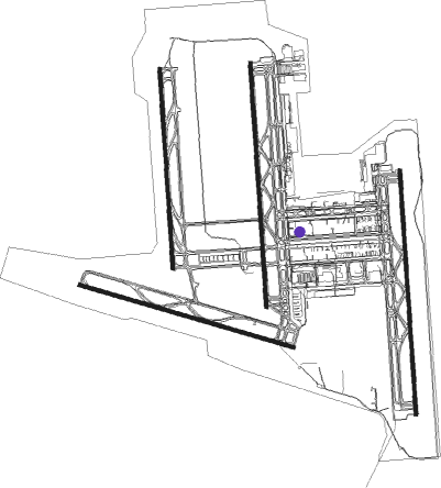
Airport layout - parking location B72
Taxiway locations
|
Parking locations
|
Nearby beacons
| code | identifier | dist | bearing | frequency |
|---|---|---|---|---|
| AML | ARMEL (WASH.,D.C.) VOR/DME | 0.8 | 208° | 113.50 |
| GTN | GEORGETOWN (WASH., D.C.) NDB | 15.7 | 93° | 323 |
| DCA | WASHINGTON, D.C. VOR/DME | 20.4 | 102° | 111 |
| DCA | OXONN (WASHINGTON) NDB | 22.9 | 113° | 332 |
| DAA | DAVEE (FT BELVOIR) NDB | 23.7 | 129° | 223 |
| CSN | CASANOVA VORTAC | 26.4 | 233° | 116.30 |
| FDK | FREDERICK VOR | 28.1 | 10° | 109 |
| ADW | ANDREWS (CAMP SPRINGS) VORTAC | 29 | 103° | 113.10 |
| MRB | MARTINSBURG VORTAC | 31.9 | 318° | 112.10 |
| BUH | ANNE ARUNDEL (FT MEADE) NDB | 33.6 | 79° | 260 |
| LDN | LINDEN VORTAC | 35.2 | 263° | 114.30 |
| MSQ | NAILR (CULPEPER) NDB | 36.2 | 222° | 351 |
| OTT | NOTTINGHAM VORTAC | 36.4 | 109° | 113.70 |
| BRV | BROOKE VORTAC | 37 | 170° | 114.50 |
| FND | ELLICOTT (BALTIMORE) NDB | 37.8 | 64° | 371 |
| BAL | BALTIMORE VORTAC | 39.5 | 74° | 115.10 |
| EMI | WESTMINSTER VORTAC | 39.7 | 41° | 117.90 |
| EZF | SHANNON (FREDERICKSBURG) NDB | 40.9 | 179° | 237 |
| HGR | HAGERSTOWN VOR | 48.6 | 332° | 109.80 |
| THS | SAINT THOMAS VORTAC | 63.4 | 334° | 115 |
| GVE | GORDONSVILLE VORTAC | 64.8 | 217° | 115.60 |
Departure and arrival routes
| Transition altitude | 18000ft |
| Transition level | 18000ft |
| SID end points | distance | outbound heading | |
|---|---|---|---|
| ALL | |||
| JDUBB4 | 142mi | 219° | |
| CLTCH3 | 109mi | 240° | |
| RW01 (ALL) | |||
| JERES2 | 42mi | 0° | |
| WOOLY2, JCOBY4 | 59mi | 81° | |
| SCRAM6 | 118mi | 227° | |
| RNLDI4 | 35mi | 263° | |
| BUNZZ3 | 35mi | 271° | |
| MCRAY2 | 40mi | 326° | |
| RW01C | |||
| CPTAL1 | 19mi | 31° | |
| RW01L | |||
| CPTAL1 | 19mi | 31° | |
| RW01R | |||
| CPTAL1 | 19mi | 31° | |
| RW12 | |||
| CPTAL1 | 19mi | 31° | |
| RW19 (ALL) | |||
| JERES2 | 42mi | 0° | |
| JCOBY4, WOOLY2 | 59mi | 81° | |
| SCRAM6 | 118mi | 227° | |
| RNLDI4 | 35mi | 263° | |
| BUNZZ3 | 35mi | 271° | |
| MCRAY2 | 40mi | 326° | |
| RW19C | |||
| CPTAL1 | 19mi | 31° | |
| RW19L | |||
| CPTAL1 | 19mi | 31° | |
| RW19R | |||
| CPTAL1 | 19mi | 31° | |
| RW30 | |||
| JERES2 | 42mi | 0° | |
| CPTAL1 | 19mi | 31° | |
| JCOBY4, WOOLY2 | 59mi | 81° | |
| SCRAM6 | 118mi | 227° | |
| RNLDI4 | 35mi | 263° | |
| BUNZZ3 | 35mi | 271° | |
| MCRAY2 | 40mi | 326° | |
| STAR starting points | distance | inbound heading | |
|---|---|---|---|
| ALL | |||
| COATT5 | 59.6 | 7° | |
| WIGOL2 | 66.6 | 44° | |
| PRIVO2 | 69.4 | 166° | |
| SEG6 | 113.8 | 197° | |
| DELRO5 | 72.3 | 219° | |
| RW01 (ALL) | |||
| CAVLR4 | 42.5 | 2° | |
| DOCCS3 | 40.4 | 74° | |
| GIBBZ4 | 14.0 | 94° | |
| RW01C | |||
| MAPEL3 | 34.1 | 166° | |
| HYPER8, LEGGO6 | 45.5 | 198° | |
| RW01L | |||
| MAPEL3 | 34.1 | 166° | |
| HYPER8, LEGGO6 | 45.5 | 198° | |
| RW01R | |||
| MAPEL3 | 34.1 | 166° | |
| LEGGO6, HYPER8 | 45.5 | 198° | |
| RW12 | |||
| DOCCS3 | 40.4 | 74° | |
| RW19 (ALL) | |||
| CAVLR4 | 42.5 | 2° | |
| DOCCS3 | 40.4 | 74° | |
| GIBBZ4 | 14.0 | 94° | |
| RW19C | |||
| MAPEL3 | 34.1 | 166° | |
| LEGGO6, HYPER8 | 45.5 | 198° | |
| RW19L | |||
| MAPEL3 | 34.1 | 166° | |
| HYPER8, LEGGO6 | 45.5 | 198° | |
| RW19R | |||
| MAPEL3 | 34.1 | 166° | |
| LEGGO6, HYPER8 | 45.5 | 198° | |
| RW30 | |||
| CAVLR4 | 42.5 | 2° | |
| DOCCS3 | 40.4 | 74° | |
| GIBBZ4 | 14.0 | 94° | |
Instrument approach procedures
| runway | airway (heading) | route (dist, bearing) |
|---|---|---|
| RW01CY | BARIN (345°) | BARIN ERACE (9mi, 322°) 4000ft CARRY (6mi, 1°) 2900ft |
| RW01CY | GILBY (101°) | GILBY KIESS (16mi, 176°) 4000ft ERACE (5mi, 90°) 4000ft CARRY (6mi, 1°) 2900ft |
| RNAV | CARRY 2900ft SKINS (2mi, 1°) 2300ft KIAD (7mi, 1°) 340ft BOYDS (16mi, 1°) 3000ft BOYDS (turn) | |
| RW01CZ | BRV (350°) | BRV ERACE (23mi, 344°) 4000ft |
| RW01CZ | DRUZZ (104°) | DRUZZ CSN (39mi, 137°) 5000ft ERACE (19mi, 80°) 4000ft |
| RW01CZ | SHNON (89°) | SHNON CSN (20mi, 147°) 5000ft ERACE (19mi, 80°) 4000ft |
| RNAV | ERACE 4000ft SKINS (8mi, 1°) 2300ft KIAD (7mi, 1°) 340ft WASMA (1mi, 2°) HARPP (25mi, 294°) 5000ft HARPP (turn) | |
| RW01L | CSN (53°) | CSN CINNA (18mi, 84°) 4000ft FAZER (4mi, 1°) 3000ft |
| RNAV | FAZER 3000ft MORCE (7mi, 1°) 1900ft KIAD (5mi, 11°) 351ft COCAV (5mi, 347°) PRISM (10mi, 286°) MRB (20mi, 330°) 4000ft MRB (turn) | |
| RW01RY | BRV (350°) | BRV MOSBY (23mi, 347°) 3000ft |
| RW01RY | CSN (53°) | CSN MOSBY (21mi, 80°) 3000ft |
| RNAV | MOSBY 3000ft WAXIN (8mi, 1°) 1900ft KIAD (6mi, 348°) 365ft FUREE (4mi, 23°) BLITZ (16mi, 57°) 3000ft BLITZ (turn) | |
| RW01RZ | BRV (350°) | BRV MOSBY (23mi, 347°) 3000ft |
| RW01RZ | DRUZZ (104°) | DRUZZ CSN (39mi, 137°) 5000ft MOSBY (21mi, 80°) 3000ft |
| RW01RZ | SHNON (89°) | SHNON CSN (20mi, 147°) 5000ft MOSBY (21mi, 80°) 3000ft |
| RNAV | MOSBY 3000ft WAXIN (8mi, 1°) 1900ft KIAD (6mi, 348°) 365ft FUREE (4mi, 23°) HARPP (25mi, 289°) 5000ft HARPP (turn) | |
| RW12 | DOCCS (74°) | DOCCS SHNON (17mi, 44°) 5700ft KNUCK (14mi, 69°) 4500ft |
| RW12 | DRUZZ (104°) | DRUZZ RAZZZ (8mi, 96°) 4800ft KNUCK (20mi, 106°) 4500ft |
| RNAV | KNUCK 4500ft JETMO (11mi, 106°) 1700ft OKRAE (2mi, 106°) 1180ft KIAD (4mi, 98°) 359ft OTSUE (4mi, 115°) ZULKA (9mi, 191°) OLIVR (23mi, 284°) 4000ft OLIVR (turn) | |
| RW19CY | DRUZZ (104°) | DRUZZ CRVER (33mi, 78°) 4800ft DIMKE (11mi, 90°) 4000ft BOYDS (6mi, 181°) 4000ft |
| RW19CY | MULRR (190°) | MULRR DIMKE (20mi, 200°) 4000ft BOYDS (6mi, 181°) 4000ft |
| RW19CY | SHNON (89°) | SHNON CRVER (29mi, 45°) 4400ft DIMKE (11mi, 90°) 4000ft BOYDS (6mi, 181°) 4000ft |
| RNAV | BOYDS 4000ft FEMKO (11mi, 181°) 1500ft KIAD (5mi, 181°) 323ft BOPAC (4mi, 181°) CSN (24mi, 239°) 4000ft CSN (turn) | |
| RW19CZ | DRUZZ (104°) | DRUZZ CRVER (33mi, 78°) 4100ft DIMKE (11mi, 90°) 4000ft BOYDS (6mi, 181°) 4000ft |
| RW19CZ | MULRR (190°) | MULRR DIMKE (20mi, 200°) 4000ft BOYDS (6mi, 181°) 4000ft |
| RW19CZ | SHNON (89°) | SHNON CRVER (29mi, 45°) 4100ft DIMKE (11mi, 90°) 4000ft BOYDS (6mi, 181°) 4000ft |
| RW19CZ | TRING (233°) | TRING BGBRO (10mi, 17°) 4000ft BOYDS (7mi, 276°) 4000ft |
| RNAV | BOYDS 4000ft CIREP (7mi, 181°) 2500ft FEMKO (3mi, 181°) 1500ft KIAD (5mi, 181°) 323ft BOPAC (4mi, 181°) BLUES (22mi, 258°) 4000ft BLUES (turn) | |
| RW19LY | DRUZZ (104°) | DRUZZ CRVER (33mi, 78°) 4800ft YYANG (12mi, 90°) 4000ft IZUMI (7mi, 181°) 3000ft |
| RW19LY | MULRR (190°) | MULRR YYANG (20mi, 196°) 4000ft IZUMI (7mi, 181°) 3000ft |
| RW19LY | SHNON (89°) | SHNON CRVER (29mi, 45°) 4400ft YYANG (12mi, 90°) 4000ft IZUMI (7mi, 181°) 3000ft |
| RNAV | IZUMI 3000ft DOMSE (10mi, 181°) 1700ft KIAD (5mi, 198°) 348ft WAXIN (6mi, 168°) 2000ft WAXIN (turn) | |
| RW19LZ | DRUZZ (104°) | DRUZZ CRVER (33mi, 78°) 4100ft YYANG (12mi, 90°) 4000ft IZUMI (7mi, 181°) 3000ft |
| RW19LZ | MULRR (190°) | MULRR YYANG (20mi, 196°) 4000ft IZUMI (7mi, 181°) 3000ft |
| RW19LZ | SHNON (89°) | SHNON CRVER (29mi, 45°) 4100ft YYANG (12mi, 90°) 4000ft IZUMI (7mi, 181°) 3000ft |
| RW19LZ | TRING (233°) | TRING PERTE (9mi, 27°) 4000ft IZUMI (7mi, 279°) 3000ft |
| RNAV | IZUMI 3000ft DOMSE (10mi, 181°) 1700ft KIAD (5mi, 198°) 348ft WAXIN (6mi, 168°) 2000ft WAXIN (turn) | |
| RW19R | DRUZZ (104°) | DRUZZ CRVER (33mi, 78°) 4800ft BEEZY (11mi, 108°) 4000ft LAUGH (5mi, 181°) 3000ft |
| RW19R | MULRR (190°) | MULRR BEEZY (24mi, 199°) 4000ft LAUGH (5mi, 181°) 3000ft |
| RW19R | SHNON (89°) | SHNON CRVER (29mi, 45°) 4400ft BEEZY (11mi, 108°) 4000ft LAUGH (5mi, 181°) 3000ft |
| RNAV | LAUGH 3000ft MULKY (7mi, 181°) 1700ft KIAD (6mi, 172°) 332ft HIMRA (4mi, 195°) OLIVR (19mi, 270°) 5000ft OLIVR (turn) |
Holding patterns
| STAR name | hold at | type | turn | heading* | altitude | leg | speed limit |
|---|---|---|---|---|---|---|---|
| CAVLR4 | BNTLY | VHF | right | 214 (34)° | DME 10.0mi | 230 | |
| CAVLR4 | CAVLR | VHF | left | 217 (37)° | 6001ft - 14000ft | DME 5.0mi | 210 |
| CAVLR4 | DORRN | VHF | left | 214 (34)° | DME 10.0mi | ICAO rules | |
| CAVLR4 | MEEGO | VHF | right | 217 (37)° | 6001ft - 14000ft | DME 10.0mi | 210 |
| COATT5 | BRV | NDB | left | 214 (34)° | 1.0min timed | ICAO rules | |
| COATT5 | FALKO | VHF | left | 211 (31)° | 6001ft - 14000ft | 1.0min timed | 210 |
| COATT5 | OGATE | VHF | left | 211 (31)° | 1.0min timed | ICAO rules | |
| DELRO5 | BINNS | VHF | right | 68 (248)° | 1.0min timed | 265 | |
| DELRO5 | HYPER | VHF | left | 65 (245)° | 6001ft - 14000ft | 1.0min timed | 210 |
| DOCCS3 | DOCCS | VHF | right | 259 (79)° | 6001ft - 14000ft | 1.0min timed | 210 |
| DOCCS3 | FINKS | VHF | right | 259 (79)° | 18000ft - 45000ft | 1.5min timed | ICAO rules |
| GIBBZ4 | HESEE | VHF | right | 265 (85)° | < 60000ft | DME 10.0mi | 250 |
| GIBBZ4 | IGGGY | VHF | right | 293 (113)° | 6001ft - 14000ft | DME 6.0mi | 210 |
| GIBBZ4 | KILMR | VHF | right | 263 (83)° | 6001ft - 14000ft | DME 6.0mi | 210 |
| GIBBZ4 | MGW | NDB | left | 307 (127)° | 18000ft - 45000ft | 1.5min timed | ICAO rules |
| HYPER8 | BINNS | VHF | right | 68 (248)° | 1.0min timed | 265 | |
| HYPER8 | HYPER | VHF | left | 65 (245)° | 6001ft - 14000ft | 1.0min timed | 210 |
| LEGGO6 | HYPER | VHF | left | 65 (245)° | 6001ft - 14000ft | 1.0min timed | 210 |
| LEGGO6 | PRTZL | VHF | right | 21 (201)° | 6001ft - 14000ft | 1.0min timed | 210 |
| LEGGO6 | SEG | NDB | right | 17 (197)° | 6001ft - 14000ft | 1.0min timed | 210 |
| MAPEL3 | DAFIX | VHF | left | 357 (177)° | 6001ft - 14000ft | 1.0min timed | 210 |
| PRIVO2 | DAFIX | VHF | left | 357 (177)° | 6001ft - 14000ft | 1.0min timed | 210 |
| SEG6 | HYPER | VHF | left | 65 (245)° | 6001ft - 14000ft | 1.0min timed | 210 |
| SEG6 | PRTZL | VHF | right | 21 (201)° | 6001ft - 14000ft | 1.0min timed | 210 |
| SEG6 | SEG | NDB | right | 17 (197)° | 6001ft - 14000ft | 1.0min timed | 210 |
| WIGOL2 | BBILL | VHF | left | 233 (53)° | DME 10.0mi | ICAO rules | |
| WIGOL2 | JUDGG | VHF | left | 269 (89)° | DME 10.0mi | ICAO rules | |
| *) magnetic outbound (inbound) holding course | |||||||
Disclaimer
The information on this website is not for real aviation. Use this data with the X-Plane flight simulator only! Data taken with kind consent from X-Plane 12 source code and data files. Content is subject to change without notice.