Islip - Long Island Mac Arthur
Airport details
| Country | United States of America |
| State | New York |
| Region | K6 |
| Airspace | Boston Ctr |
| Municipality | Suffolk County |
| Elevation | 99ft (30m) |
| Timezone | GMT -5 |
| Coordinates | 40.79884, -73.10720 |
| Magnetic var | |
| Type | land |
| Available since | X-Plane v10.40 |
| ICAO code | KISP |
| IATA code | ISP |
| FAA code | ISP |
Communication
| Long Island Mac Arthur ATIS | 120.725 |
| Long Island Mac Arthur UNICOM | 122.950 |
| Long Island Mac Arthur Clearance DEL | 121.850 |
| Long Island Mac Arthur Ground Control | 135.300 |
| Long Island Mac Arthur Tower | 119.300 |
| Long Island Mac Arthur NEW YORK Approach/Departure | 120.050 |
Approach frequencies
| ILS-cat-II | RW06 | 108.3 | 18.00mi |
| ILS-cat-I | RW24 | 108.3 | 18.00mi |
| 3° GS | RW06 | 108.3 | 18.00mi |
| 3° GS | RW24 | 108.3 | 18.00mi |
Nearby Points of Interest:
Bayport Aerodrome
-Bald Hill Schoolhouse
-Jacob Ockers House
-First Congregational Church of New Village
-St. Johns Episcopal Church and Cemetery
-Joseph Wood House
-Westbrook, Suffolk County, New York
-Rudolph Oyster House
-Priscilla
-Modesty
-United States Post Office
-Saint James District
-Smith-Rourke House
-Kate Annette Wetherill Estate
-Caleb Smith State Park Preserve
-Mills Pond District
-Nathaniel Longbotham House
-Modern Times School
-Wereholme
-East Farm
-Davis Town Meeting House
-Bay Shore Hose Company No. 1 Firehouse
-Hawkins Homestead
-Obadiah Smith House
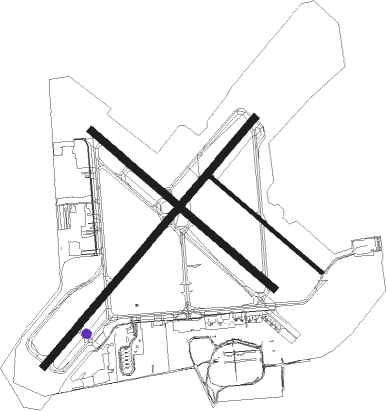
Runway info
Runway 15R / 33L  | ||
| length | 1580m (5184ft) | |
| bearing | 127° / 307° | |
| width | 46m (150ft) | |
| surface | asphalt | |
| blast zone | 0m (0ft) / 61m (200ft) | |
| Runway 6 / 24 | ||
| length | 2135m (7005ft) | |
| bearing | 53° / 233° | |
| width | 46m (150ft) | |
| surface | asphalt | |
| blast zone | 61m (200ft) / 61m (200ft) | |
| Runway 15L / 33R | ||
| length | 967m (3173ft) | |
| bearing | 127° / 307° | |
| width | 23m (75ft) | |
| surface | asphalt | |
Nearby beacons
| code | identifier | dist | bearing | frequency |
|---|---|---|---|---|
| DPK | DEER PARK VOR/DME | 8.9 | 268° | 117.70 |
| CCC | CALVERTON VOR/DME | 16 | 67° | 117.20 |
| FR | FRIKK (FARMINGDALE) NDB | 17.1 | 267° | 407 |
| BDR | BRIDGEPORT VOR/DME | 21.7 | 357° | 108.80 |
| FOK | SUFFOLK CO (WESTHAMPTON B TACAN | 21.7 | 85° | 111 |
| HVN | HAVEN DME | 29.5 | 26° | 109.80 |
| JFK | KENNEDY (NEW YORK) VOR/DME | 31.8 | 256° | 115.90 |
| LGA | LA GUARDIA (NEW YORK) VOR/DME | 34.6 | 269° | 113.10 |
| CMK | CARMEL VOR/DME | 36 | 315° | 116.60 |
| MAD | MADISON VOR/DME | 36.1 | 39° | 110.40 |
| HTO | HAMPTON (EAST HAMPTON) VORTAC | 36.6 | 81° | 113.60 |
| CRI | CANARSIE VOR/DME | 37.5 | 257° | 112.30 |
| TEB | TETERBORO VOR/DME | 43.5 | 273° | 108.40 |
| HFD | HARTFORD VOR/DME | 56.5 | 34° | 114.90 |
| SKU | STANWYCK (NEWBURGH) NDB | 60.9 | 308° | 261 |
| IGN | KINGSTON VOR/DME | 61.2 | 320° | 117.60 |
| PWL | PAWLING (POUGHKEEPSIE) VOR/DME | 62.4 | 333° | 114.30 |
Departure and arrival routes
| Transition altitude | 18000ft |
| Transition level | 18000ft |
| STAR starting points | distance | inbound heading | |
|---|---|---|---|
| ALL | |||
| LOVES2 | 62.4 | 153° | |
| NELIE3 | 71.1 | 200° | |
Instrument approach procedures
| runway | airway (heading) | route (dist, bearing) |
|---|---|---|
| RW06 | CCC (247°) | CCC DEERY (28mi, 241°) 2000ft DEERY (turn) 2000ft |
| RNAV | DEERY 2000ft YOSUR (7mi, 53°) 1600ft KISP (5mi, 50°) 144ft (4642mi, 119°) 600ft CCC (4630mi, 299°) 2000ft CCC (turn) | |
| RW15R | CCC (247°) | CCC FORMU (21mi, 270°) 2000ft FORMU (turn) 2000ft |
| RNAV | FORMU 2000ft ZIVUX (6mi, 127°) 1600ft WENGA (3mi, 127°) 640ft KISP (2mi, 132°) 159ft (4642mi, 119°) 600ft CCC (4630mi, 299°) 2000ft CCC (turn) | |
| RW24 | CCC (247°) | CCC CORAM (6mi, 266°) 2000ft |
| RNAV | CORAM 2000ft UKEGE (6mi, 233°) 1400ft JUMUM (1mi, 233°) 940ft KISP (3mi, 237°) 151ft (4642mi, 119°) 600ft BJACK (4633mi, 299°) 2000ft BJACK (turn) | |
| RW33L | CCC (247°) | CCC BJACK (17mi, 207°) 2000ft BJACK (turn) 2000ft |
| RNAV | BJACK 2000ft JATEV (6mi, 307°) 1500ft KISP (5mi, 306°) 124ft (4642mi, 119°) 600ft CCC (4630mi, 299°) 2000ft CCC (turn) |
Holding patterns
| STAR name | hold at | type | turn | heading* | altitude | leg | speed limit |
|---|---|---|---|---|---|---|---|
| LOVES2 | LOVES | VHF | left | 336 (156)° | 1.0min timed | ICAO rules | |
| *) magnetic outbound (inbound) holding course | |||||||
Disclaimer
The information on this website is not for real aviation. Use this data with the X-Plane flight simulator only! Data taken with kind consent from X-Plane 12 source code and data files. Content is subject to change without notice.