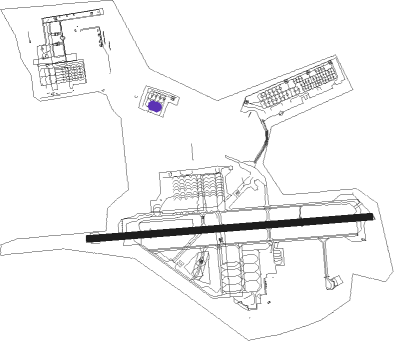
Norfolk - Naval Air Station Norfolk
Airport details
| Country | United States of America |
| State | Virginia |
| Region | K6 |
| Airspace | Washington Ctr |
| Municipality | Norfolk |
| Elevation | 15ft (5m) |
| Timezone | GMT -5 |
| Coordinates | 36.93843, -76.29201 |
| Magnetic var | |
| Type | land |
| Available since | X-Plane v10.40 |
| ICAO code | KNGU |
| IATA code | NGU |
| FAA code | NGU |
Communication
| Naval Air Station Norfolk ATIS | 118.425 |
| Naval Air Station Norfolk Clearance DEL | 120.700 |
| Naval Air Station Norfolk CHAMBERS Ground Control | 121.800 |
| Naval Air Station Norfolk CHAMBERS Tower | 124.300 |
| Naval Air Station Norfolk CHAMBERS Tower | 126.375 |
| Naval Air Station Norfolk Approach | 118.900 |
| Naval Air Station Norfolk Departure | 125.200 |
Approach frequencies
| ILS-cat-I | RW10 | 108.95 | 18.00mi |
| 3° GS | RW10 | 108.95 | 18.00mi |
Nearby Points of Interest:
Talbot Hall
-Boush-Tazewell House
-Lambert's Point Knitting Mill
-Norfolk and Western Railroad Historic District
-Lafayette Residence Park
-Quarters 17
-James Blair Junior High School
-Williamston-Woodland Historic District
-Southern Bagging Company
-North Ghent
-Ballentine Place Historic District
-Fort Monroe National Monument
-Reuben Clark House
-Newport News Middle Ground Light
-Norfolk Auto Row Historic District
-Fort Norfolk
-Attucks Theatre
-Virginia Ice & Freezing Corporation Cold Storage Warehouse
-Queen Street Baptist Church
-American Cigar Company
-Security Storage and Safe Deposit Company Warehouse
-Seaboard Air Line Railway Building
-Kenmure (Norfolk, Virginia)
-West Freemason Street Area Historic District
-Hampton National Cemetery
Runway info
| Runway 10 / 28 | ||
| length | 2544m (8346ft) | |
| bearing | 90° / 270° | |
| width | 61m (200ft) | |
| surface | asphalt | |
| displ threshold | 96m (315ft) / 300m (984ft) | |
| blast zone | 223m (732ft) / 3m (10ft) | |
Nearby beacons
| code | identifier | dist | bearing | frequency |
|---|---|---|---|---|
| NGU | CHAMBERS (NORFOLK) TACAN | 0.7 | 84° | 113.95 |
| ORF | NORFOLK VORTAC | 5.2 | 117° | 116.90 |
| OR | INGLE (NORFOLK) NDB | 6.1 | 157° | 329 |
| LFI | LANGLEY (HAMPTON) TACAN | 9.4 | 335° | 112.30 |
| NTU | OCEANA TACAN | 14 | 114° | 116.60 |
| NFE | CHESAPEAKE TACAN | 16.2 | 147° | 108.25 |
| CCV | CAPE CHARLES VORTAC | 28.3 | 36° | 112.20 |
| AKQ | WAKEFIELD NDB | 34.1 | 274° | 274 |
| HCM | HARCUM VORTAC | 36.6 | 321° | 108.80 |
| FKN | FRANKLIN VORTAC | 37.1 | 253° | 110.60 |
| LLW | WOODVILLE (ELIZABETH CITY) NDB | 40.5 | 181° | 254 |
| ECG | ELIZABETH CITY VOR/DME | 41.2 | 170° | 112.50 |
| CVI | COFIELD VORTAC | 43.9 | 226° | 114.60 |
| HPW | HOPEWELL VORTAC | 45.8 | 295° | 112 |
Departure and arrival routes
| Transition altitude | 18000ft |
| Transition level | 18000ft |
| STAR starting points | distance | inbound heading | |
|---|---|---|---|
| ALL | |||
| DRONE2 | 30.6 | 43° | |
| TERKS2 | 146.1 | 109° | |
Instrument approach procedures
| runway | airway (heading) | route (dist, bearing) |
|---|---|---|
| RW10 | HCM (141°) | HCM 2300ft OGTOE (18mi, 188°) 2300ft NONNU (18mi, 131°) 2300ft |
| RW10 | NONNU (90°) | NONNU 2300ft |
| RNAV | NONNU 2300ft HISAM (5mi, 90°) 1500ft KNGU (5mi, 89°) 63ft (4749mi, 116°) 800ft GLEEP (4740mi, 296°) 3000ft GLEEP (turn) 4000ft | |
| RW28 | CCV (216°) | CCV 2300ft ELMER (10mi, 181°) 2300ft MIMAE (14mi, 195°) 2300ft |
| RW28 | SCHOL (247°) | SCHOL 2300ft MIMAE (22mi, 235°) 2300ft |
| RNAV | MIMAE 2300ft MESLE (7mi, 270°) 1100ft KNGU (4mi, 271°) 57ft (4749mi, 116°) 415ft NONNU (4759mi, 296°) 3000ft NONNU (turn) 4000ft |
Holding patterns
| STAR name | hold at | type | turn | heading* | altitude | leg | speed limit |
|---|---|---|---|---|---|---|---|
| DRONE2 | DRONE | VHF | right | 233 (53)° | 1.0min timed | ICAO rules | |
| *) magnetic outbound (inbound) holding course | |||||||
Disclaimer
The information on this website is not for real aviation. Use this data with the X-Plane flight simulator only! Data taken with kind consent from X-Plane 12 source code and data files. Content is subject to change without notice.