Oklahoma City - Wiley Post
Airport details
| Country | United States of America |
| State | Oklahoma |
| Region | K4 |
| Airspace | Ft Worth Ctr |
| Municipality | Oklahoma City |
| Elevation | 1296ft (395m) |
| Timezone | GMT -6 |
| Coordinates | 35.53417, -97.64706 |
| Magnetic var | |
| Type | land |
| Available since | X-Plane v10.40 |
| ICAO code | KPWA |
| IATA code | PWA |
| FAA code | PWA |
Communication
| Wiley Post ATIS | 128.725 |
| Wiley Post CTAF | 126.900 |
| Wiley Post UNICOM | 122.950 |
| Wiley Post Ground Control | 121.700 |
| Wiley Post Tower | 126.900 |
| Wiley Post OKE CITY Approach/Departure | 124.600 |
| Wiley Post OKE CITY Approach/Departure | 120.450 |
| Wiley Post OKE CITY Approach/Departure | 124.200 |
Approach frequencies
| ILS-cat-I | RW17L | 110.15 | 18.00mi |
| ILS-cat-I | RW35R | 110.15 | 18.00mi |
| 3° GS | RW17L | 110.15 | 18.00mi |
| 3° GS | RW35R | 110.15 | 18.00mi |
Nearby Points of Interest:
Founders Tower
-Donald Pollock House
-Yukon Public Library
-Czech Hall
-Milk Bottle Grocery
-Harding Charter Preparatory High School
-Gold Dome
-The Classen
-Paseo Arts District
-Pilgrim Congregational Church
-First Christian Church
-First Church of Christ, Scientist
-Automobile Alley
-Elks Lodge Building
-Cain's Coffee Building
-Oklahoma County Courthouse
-Hightower Building
-St. Paul's Cathedral
-The Heritage
-United States Post Office, Courthouse, and Federal Office Building
-Braniff Building
-Oklahoma Publishing Company Building
-First National Center
-Elks Victory Lodge-Ruby's Grill Building
-Meloy House
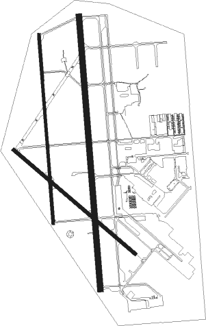
Runway info
Runway 17L / 35R  | ||
| length | 2201m (7221ft) | |
| bearing | 180° / 0° | |
| width | 46m (151ft) | |
| surface | concrete | |
| displ threshold | 0m (0ft) / 109m (358ft) | |
| blast zone | 0m (0ft) / 43m (141ft) | |
| Runway 17R / 35L | ||
| length | 1527m (5010ft) | |
| bearing | 180° / 0° | |
| width | 23m (75ft) | |
| surface | asphalt | |
| Runway 13 / 31 | ||
| length | 1286m (4219ft) | |
| bearing | 129° / 309° | |
| width | 30m (98ft) | |
| surface | concrete | |
| displ threshold | 0m (0ft) / 4m (13ft) | |
| blast zone | 0m (0ft) / 75m (246ft) | |
Nearby beacons
| code | identifier | dist | bearing | frequency |
|---|---|---|---|---|
| PWA | WILEY POST (OKLAHOMA CITY VOR/DME | 0 | 186° | 113.40 |
| IRW | WILL ROGERS (OKLAHOMA CIT VORTAC | 10.7 | 168° | 114.10 |
| TIK | TINKER (OKLAHOMA CITY) TACAN | 14.3 | 110° | 115.80 |
| RG | GALLY (OKLAHOMA CITY) NDB | 14.6 | 166° | 350 |
| IFI | KINGFISHER VORTAC | 23.8 | 307° | 114.70 |
| EI | GARFY (ENID) NDB | 45 | 349° | 341 |
| SWO | STILLWATER VOR/DME | 49.7 | 39° | 108.40 |
| SRE | SEMINOLE NDB | 50.1 | 105° | 278 |
| SW | BLAKI (STILLWATER) NDB | 50.1 | 39° | 255 |
| END | VANCE (ENID) VORTAC | 50.4 | 341° | 115.40 |
| ODG | WOODRING (ENID) VOR/DME | 50.8 | 350° | 109 |
Departure and arrival routes
| Transition altitude | 18000ft |
| Transition level | 18000ft |
| SID end points | distance | outbound heading | |
|---|---|---|---|
| RW13 | |||
| WENDY3 | 37mi | 18° | |
| TRUPR3 | 57mi | 71° | |
| FUNNL3 | 77mi | 93° | |
| RDHWK3 | 66mi | 114° | |
| TEBRD3 | 80mi | 128° | |
| KRMSN4 | 75mi | 137° | |
| MUDDE3 | 83mi | 160° | |
| THRPE3 | 37mi | 197° | |
| OLGUY3 | 75mi | 264° | |
| STPHN3 | 74mi | 271° | |
| SSYKO3 | 28mi | 355° | |
| RW17 (ALL) | |||
| WENDY3 | 37mi | 18° | |
| TRUPR3 | 57mi | 71° | |
| FUNNL3 | 77mi | 93° | |
| RDHWK3 | 66mi | 114° | |
| TEBRD3 | 80mi | 128° | |
| KRMSN4 | 75mi | 137° | |
| MUDDE3 | 83mi | 160° | |
| THRPE3 | 37mi | 197° | |
| OLGUY3 | 75mi | 264° | |
| STPHN3 | 74mi | 271° | |
| SSYKO3 | 28mi | 355° | |
| RW31 | |||
| WENDY3 | 37mi | 18° | |
| TRUPR3 | 57mi | 71° | |
| FUNNL3 | 77mi | 93° | |
| RDHWK3 | 66mi | 114° | |
| TEBRD3 | 80mi | 128° | |
| KRMSN4 | 75mi | 137° | |
| MUDDE3 | 83mi | 160° | |
| THRPE3 | 37mi | 197° | |
| OLGUY3 | 75mi | 264° | |
| STPHN3 | 74mi | 271° | |
| SSYKO3 | 28mi | 355° | |
| RW35 (ALL) | |||
| WENDY3 | 37mi | 18° | |
| TRUPR3 | 57mi | 71° | |
| FUNNL3 | 77mi | 93° | |
| RDHWK3 | 66mi | 114° | |
| TEBRD3 | 80mi | 128° | |
| KRMSN4 | 75mi | 137° | |
| MUDDE3 | 83mi | 160° | |
| THRPE3 | 37mi | 197° | |
| OLGUY3 | 75mi | 264° | |
| STPHN3 | 74mi | 271° | |
| SSYKO3 | 28mi | 355° | |
| STAR starting points | distance | inbound heading | |
|---|---|---|---|
| ALL | |||
| GULLI2 | 37.7 | 226° | |
| FAKEY1 | 42.9 | 289° | |
| RW17L | |||
| BASTS1 | 27.7 | 28° | |
| CCASH1 | 23.8 | 53° | |
| DAWKS1 | 16.9 | 98° | |
| JUDDG2 | 27.7 | 226° | |
| WAYMN1 | 28.9 | 339° | |
| RW35R | |||
| BASTS1 | 27.7 | 28° | |
| CCASH1 | 23.8 | 53° | |
| DAWKS1 | 16.9 | 98° | |
| JUDDG2 | 27.7 | 226° | |
| WAYMN1 | 28.9 | 339° | |
Instrument approach procedures
| runway | airway (heading) | route (dist, bearing) |
|---|---|---|
| RW17L | IFI (127°) | IFI WABDU (18mi, 104°) 3000ft |
| RNAV | WABDU 3000ft ZOVUM (5mi, 180°) 3000ft KPWA (6mi, 181°) 1345ft (5779mi, 110°) 1700ft IFI (5795mi, 290°) 3400ft IFI (turn) | |
| RW17R | IFI (127°) | IFI WOLSA (18mi, 104°) 3000ft |
| RNAV | WOLSA 3000ft ZEKUP (5mi, 180°) 3000ft KPWA (6mi, 179°) 1328ft (5779mi, 110°) 1700ft IFI (5795mi, 290°) 3400ft IFI (turn) | |
| RW35L | IRW (348°) | IRW IYOCU (3mi, 309°) 2900ft |
| RW35L | NEADS (29°) | NEADS IYOCU (31mi, 36°) 2900ft |
| RW35L | PWA (6°) | PWA IYOCU (8mi, 181°) 2900ft IYOCU (turn) 2900ft |
| RNAV | IYOCU 2900ft WIGOK (3mi, 0°) 2900ft ZEROK (3mi, 0°) 1820ft KPWA (2mi, 4°) 1320ft (5779mi, 110°) 1700ft IFI (5795mi, 290°) 3400ft IFI (turn) | |
| RW35R | IRW (348°) | IRW MEHUF (2mi, 241°) 2900ft MEHUF (turn) 2900ft |
| RW35R | NEADS (29°) | NEADS HUSOK (26mi, 30°) 2900ft MEHUF (5mi, 90°) 2900ft |
| RW35R | PWA (6°) | PWA MEHUF (12mi, 179°) 2900ft MEHUF (turn) 2900ft |
| RNAV | MEHUF 2900ft NORRM (6mi, 360°) 2900ft KPWA (5mi, 359°) 1349ft BAHHI (6mi, 1°) IFI (20mi, 296°) 3100ft IFI (turn) |
Holding patterns
| STAR name | hold at | type | turn | heading* | altitude | leg | speed limit |
|---|---|---|---|---|---|---|---|
| GULLI2 | GULLI | VHF | right | 23 (203)° | 1.0min timed | ICAO rules | |
| *) magnetic outbound (inbound) holding course | |||||||
Disclaimer
The information on this website is not for real aviation. Use this data with the X-Plane flight simulator only! Data taken with kind consent from X-Plane 12 source code and data files. Content is subject to change without notice.