San Jose - Norman Y Mineta San Jose Intl
Airport details
| Country | United States of America |
| State | California |
| Region | K2 |
| Airspace | Oakland Ctr |
| Municipality | San Jose |
| Elevation | 62ft (19m) |
| Timezone | GMT -8 |
| Coordinates | 37.36267, -121.92911 |
| Magnetic var | |
| Type | land |
| Available since | X-Plane v10.40 |
| ICAO code | KSJC |
| IATA code | SJC |
| FAA code | SJC |
Communication
| Norman Y Mineta San Jose Intl ATIS | 126.950 |
| Norman Y Mineta San Jose Intl CTAF | 124.000 |
| Norman Y Mineta San Jose Intl Clearance DEL | 118.000 |
| Norman Y Mineta San Jose Intl Ground Control | 121.700 |
| Norman Y Mineta San Jose Intl Tower | 124.000 |
| Norman Y Mineta San Jose Intl NORCAL Approach | 124.525 |
| Norman Y Mineta San Jose Intl NORCAL Approach | 125.350 |
| Norman Y Mineta San Jose Intl NORCAL Approach | 126.475 |
| Norman Y Mineta San Jose Intl NORCAL Approach | 120.100 |
| Norman Y Mineta San Jose Intl NORCAL Approach | 134.500 |
| Norman Y Mineta San Jose Intl NORCAL Departure | 121.300 |
Approach frequencies
| ILS-cat-II | RW30L | 110.9 | 18.00mi |
| ILS-cat-I | RW12R | 110.9 | 18.00mi |
| 3° GS | RW30L | 110.9 | 18.00mi |
| 3° GS | RW12R | 110.9 | 18.00mi |
Nearby Points of Interest:
Charles Copeland Morse House
-Andrew J. Landrum House
-Leib Carriage House
-Agnews Developmental Center
-James Lick Mansion
-Twohy Building
-Dohrmann Building
-Arthur Monroe Free House
-East San Jose Carnegie Library
-Ross House
-Ashworth-Remillard House
-Milpitas Grammar School
-Campbell Union Grammar School
-Campbell High School
-Galindo-Leigh House
-Capt. James A. Hamilton House
-Jose Maria Alviso Adobe
-Le Petit Trianon
-Hangar One
-Saratoga
-Unitary Plan Wind Tunnel
-Hayes Mansion
-Coyote Creek
-Rengstorff House
-McCullagh-Jones House
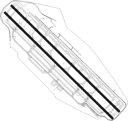
Runway info
Runway 12R / 30L  | ||
| length | 3354m (11004ft) | |
| bearing | 132° / 312° | |
| width | 46m (151ft) | |
| surface | concrete | |
| displ threshold | 395m (1296ft) / 773m (2536ft) | |
| blast zone | 61m (200ft) / 18m (59ft) | |
| Runway 12L / 30R | ||
| length | 3354m (11004ft) | |
| bearing | 132° / 312° | |
| width | 46m (151ft) | |
| surface | concrete | |
| displ threshold | 398m (1306ft) / 773m (2536ft) | |
| blast zone | 40m (131ft) / 44m (144ft) | |
Nearby beacons
| code | identifier | dist | bearing | frequency |
|---|---|---|---|---|
| SJC | SAN JOSE VOR/DME | 1 | 308° | 114.10 |
| NUQ | MOFFETT (MOUNTAIN VIEW) TACAN | 7.4 | 299° | 117.60 |
| OSI | WOODSIDE VOR/DME | 16.9 | 275° | 113.90 |
| LV | REIGA (LIVERMORE) NDB | 22.9 | 37° | 374 |
| OAK | OAKLAND VOR/DME | 25.9 | 321° | 116.80 |
| SFO | SAN FRANCISCO VOR/DME | 26.2 | 300° | 115.80 |
| SAU | SAUSALITO VOR/DME | 40.9 | 310° | 116.20 |
| CCR | CONCORD VOR/DME | 41.3 | 350° | 117 |
| MR | MUNSO (MONTEREY) NDB | 44.5 | 181° | 385 |
| SNS | SALINAS VORTAC | 44.7 | 155° | 117.30 |
| MOD | MODESTO VOR/DME | 48.9 | 75° | 114.60 |
| SUU | TRAVIS (FAIRFIELD) TACAN | 53 | 359° | 116.60 |
| SGD | SCAGGS ISLAND (NAPA) VORTAC | 53.3 | 331° | 112.10 |
| UAD | CHUALAR (SALINAS) NDB | 56.7 | 152° | 263 |
| LIN | LINDEN VOR/DME | 61.3 | 52° | 114.80 |
| PYE | POINT REYES VOR/DME | 61.9 | 307° | 113.70 |
Departure and arrival routes
| Transition altitude | 18000ft |
| Transition level | 18000ft |
| SID end points | distance | outbound heading | |
|---|---|---|---|
| RW12 (ALL) | |||
| ALMDN4, BMRNG4 | 66mi | 47° | |
| TECKY3 | 130mi | 128° | |
| RW30L | |||
| SJC3 | 67mi | 119° | |
| TECKY3 | 130mi | 128° | |
| LOUPE5 | 15mi | 352° | |
| RW30R | |||
| SJC3 | 67mi | 119° | |
| TECKY3 | 130mi | 128° | |
| LOUPE5 | 15mi | 352° | |
| STAR starting points | distance | inbound heading | |
|---|---|---|---|
| ALL | |||
| BRIXX3 | 26.1 | 120° | |
| FRLON2 | 50.8 | 120° | |
| BRINY2, PYE3 | 61.9 | 127° | |
| RISTI1 | 23.9 | 238° | |
| ROBIE5 | 94.0 | 326° | |
| RW12 (ALL) | |||
| RAZRR4 | 41.5 | 288° | |
| SILCN5 | 57.1 | 330° | |
| RW30 (ALL) | |||
| RAZRR4 | 41.5 | 288° | |
| SILCN5 | 57.1 | 330° | |
Instrument approach procedures
| runway | airway (heading) | route (dist, bearing) |
|---|---|---|
| RW12LZ | ARTAQ (132°) | ARTAQ OMSEE (2mi, 129°) 1800ft HINIR (2mi, 132°) 1100ft |
| RW12LZ | HITIR (63°) | HITIR 4000ft ZORSA (3mi, 312°) 3000ft NIBUY (4mi, 20°) 1800ft HINIR (2mi, 103°) 1100ft |
| RW12LZ | WADVA (96°) | WADVA 4500ft RERAE (4mi, 88°) 3500ft NIBUY (5mi, 77°) 1800ft HINIR (2mi, 103°) 1100ft |
| RNAV | HINIR 1100ft KSJC (4mi, 134°) 95ft COKOR (6mi, 132°) GILRO (19mi, 131°) 4600ft GILRO (turn) | |
| RW12RZ | ARTAQ (132°) | ARTAQ SUNNE (2mi, 132°) 1800ft FOXAG (2mi, 132°) 1100ft |
| RW12RZ | HITIR (63°) | HITIR 4000ft ZORSA (3mi, 312°) 3000ft PUAKO (4mi, 21°) 1800ft FOXAG (2mi, 104°) 1100ft |
| RW12RZ | WADVA (96°) | WADVA 4500ft RERAE (4mi, 88°) 3500ft PUAKO (5mi, 78°) 1800ft FOXAG (2mi, 104°) 1100ft |
| RNAV | FOXAG 1100ft KSJC (4mi, 132°) 96ft HOSBO (8mi, 133°) GILRO (17mi, 131°) 4600ft GILRO (turn) | |
| RW30LY | BORED (277°) | BORED SWIGS (10mi, 240°) 5200ft KLIDE (4mi, 240°) 4000ft ZULUP (3mi, 313°) 2800ft |
| RW30LY | KLIDE (313°) | KLIDE 4000ft ZULUP (3mi, 313°) 2800ft |
| RNAV | ZULUP 2800ft HIVAK (4mi, 313°) 2600ft FORUL (5mi, 312°) 1000ft KSJC (3mi, 313°) 111ft (6898mi, 107°) 257ft MUSSK (6901mi, 287°) 2300ft MUSSK (turn) | |
| RW30LZ | BORED (277°) | BORED 5200ft SWIGS (10mi, 240°) 5200ft KLIDE (4mi, 240°) 4000ft ZULUP (3mi, 313°) 3600ft HOSBO (4mi, 313°) 2600ft WOXAR (3mi, 312°) 1600ft |
| RW30LZ | JILNA (61°) | JILNA 7000ft YADUT (7mi, 103°) 5300ft HEPAP (2mi, 86°) 4700ft FODPA (3mi, 68°) 3400ft JEGSA (3mi, 68°) 2800ft WOXAR (3mi, 14°) 1600ft |
| RW30LZ | KLIDE (313°) | KLIDE 4000ft ZULUP (3mi, 313°) 3600ft HOSBO (4mi, 313°) 2600ft WOXAR (3mi, 312°) 1600ft |
| RNAV | WOXAR 1600ft KSJC (5mi, 313°) 111ft ARTAQ (8mi, 312°) 2000ft ARTAQ (turn) | |
| RW30RY | BORED (277°) | BORED SWIGS (10mi, 240°) 5200ft KLIDE (4mi, 240°) 4000ft ZULUP (3mi, 313°) 3600ft |
| RW30RY | KLIDE (313°) | KLIDE 4000ft ZULUP (3mi, 313°) 3600ft |
| RNAV | ZULUP 3600ft KIRVE (4mi, 314°) 2600ft COKOR (2mi, 313°) 2000ft HILUD (3mi, 312°) 960ft KSJC (3mi, 311°) 110ft (6898mi, 107°) 255ft MUSSK (6901mi, 287°) 2300ft MUSSK (turn) | |
| RW30RZ | BORED (277°) | BORED 5200ft SWIGS (10mi, 240°) 5200ft KLIDE (4mi, 240°) 4000ft ZULUP (3mi, 313°) 3600ft KIRVE (4mi, 314°) 2600ft TUZGY (4mi, 313°) 1600ft |
| RW30RZ | JILNA (61°) | JILNA 7000ft YADUT (7mi, 103°) 5300ft HEPAP (2mi, 86°) 4700ft FODPA (3mi, 68°) 3400ft SIBAE (3mi, 68°) 2800ft TUZGY (3mi, 14°) 1600ft |
| RW30RZ | KLIDE (313°) | KLIDE 4000ft ZULUP (3mi, 313°) 3600ft KIRVE (4mi, 314°) 2600ft TUZGY (4mi, 313°) 1600ft |
| RNAV | TUZGY 1600ft KSJC (5mi, 311°) 110ft (6898mi, 107°) 600ft ARTAQ (6901mi, 287°) 2000ft ARTAQ (turn) |
Holding patterns
| STAR name | hold at | type | turn | heading* | altitude | leg | speed limit |
|---|---|---|---|---|---|---|---|
| BRINY2 | BRINY | VHF | right | 237 (57)° | < 17999ft | 1.0min timed | ICAO rules |
| BRINY2 | PYE | NDB | right | 325 (145)° | 1.0min timed | ICAO rules | |
| BRIXX3 | ZINNN | VHF | right | 345 (165)° | DME 10.0mi | ICAO rules | |
| PYE3 | PYE | NDB | right | 325 (145)° | 1.0min timed | ICAO rules | |
| PYE3 | STINS | VHF | right | 324 (144)° | 1.0min timed | ICAO rules | |
| RAZRR4 | RAZRR | VHF | left | 70 (250)° | DME 10.0mi | ICAO rules | |
| RAZRR4 | SCOPR | VHF | left | 85 (265)° | DME 8.0mi | ICAO rules | |
| ROBIE5 | GILRO | VHF | left | 121 (301)° | < 17999ft | 1.0min timed | ICAO rules |
| ROBIE5 | ROBIE | VHF | right | 128 (308)° | 1.5min timed | ICAO rules | |
| SILCN5 | TROXX | VHF | left | 129 (309)° | DME 10.0mi | ICAO rules | |
| SILCN5 | WLSSN | VHF | left | 148 (328)° | DME 10.0mi | ICAO rules | |
| *) magnetic outbound (inbound) holding course | |||||||
Disclaimer
The information on this website is not for real aviation. Use this data with the X-Plane flight simulator only! Data taken with kind consent from X-Plane 12 source code and data files. Content is subject to change without notice.