Jacksonville - Cecil Fld
Airport details
| Country | United States of America |
| State | Florida |
| Region | K7 |
| Airspace | Jacksonville Ctr |
| Municipality | Jacksonville |
| Elevation | 81ft (25m) |
| Timezone | GMT -5 |
| Coordinates | 30.21878, -81.87717 |
| Magnetic var | |
| Type | land |
| Available since | X-Plane v10.40 |
| ICAO code | KVQQ |
| IATA code | VQQ |
| FAA code | VQQ |
Communication
| Cecil Fld ATIS | 125.275 |
| Cecil Fld CTAF | 126.100 |
| Cecil Fld UNICOM | 122.950 |
| Cecil Fld Ground Control | 121.625 |
| Cecil Fld Tower | 126.100 |
| Cecil Fld JACKSONVILLE Approach | 123.800 |
| Cecil Fld JACKSONVILLE Departure | 123.800 |
Approach frequencies
| ILS-cat-I | RW36R | 109.5 | 18.00mi |
| 3° GS | RW36R | 109.5 | 18.00mi |
Nearby Points of Interest:
William Clarke Estate
-William Westcott House
-Haskell-Long House
-George Randolph Frisbee, Jr. House
-Frosard W. Budington House
-Clark-Chalker House
-George A. Chalker House
-Jacksonville-Baldwin Rail Trail
-William Helffrich House
-Joseph Green House
-Orange Park Negro Elementary School
-River Road Historic District
-Winterbourne
-Lane-Towers House
-Maple Leaf
-Mandarin Store and Post Office
-Red Bank Plantation
-Prime F. Osborn III Convention Center
-South Jacksonville Grammar School
-Theatre Jacksonville
-Brewster Hospital
-El Modelo Block
-Masonic Temple
-J. P. Small Memorial Stadium
-Schultz Building
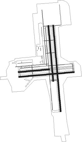
Runway info
Runway 18L / 36R  | ||
| length | 3824m (12546ft) | |
| bearing | 179° / 359° | |
| width | 61m (200ft) | |
| surface | asphalt | |
| blast zone | 0m (0ft) / 255m (837ft) | |
| Runway 9R / 27L | ||
| length | 2435m (7989ft) | |
| bearing | 90° / 270° | |
| width | 61m (200ft) | |
| surface | asphalt | |
| Runway 18R / 36L | ||
| length | 2447m (8028ft) | |
| bearing | 179° / 359° | |
| width | 61m (200ft) | |
| surface | asphalt | |
| blast zone | 31m (102ft) / 34m (112ft) | |
| Runway 9L / 27R | ||
| length | 1351m (4432ft) | |
| bearing | 90° / 270° | |
| width | 61m (200ft) | |
| surface | asphalt | |
| blast zone | 0m (0ft) / 255m (837ft) | |
Nearby beacons
| code | identifier | dist | bearing | frequency |
|---|---|---|---|---|
| NZC | CECIL TACAN | 0.3 | 76° | 114.10 |
| NIP | JACKSONVILLE TACAN | 10.5 | 85° | 108.20 |
| JA | DINNS (JACKSONVILLE) NDB | 15.2 | 17° | 344 |
| RYD | REYNOLDS (GREEN COVE SPRINGS) NDB | 18.9 | 139° | 338 |
| CRG | CRAIG (JACKSONVILLE) VORTAC | 20.3 | 72° | 114.50 |
| NRB | MAYPORT TACAN | 25.6 | 69° | 111.40 |
| SGJ | SAINT AUGUSTINE VOR/DME | 32.4 | 116° | 109.40 |
| GN | WYNDS (GAINESVILLE) NDB | 36.3 | 208° | 269 |
| LCQ | LAKE CITY NDB | 36.4 | 267° | 204 |
| GNV | GATORS VORTAC | 37.7 | 217° | 116.20 |
| TAY | TAYLOR VORTAC | 38.9 | 293° | 112.90 |
| SSI | BRUNSWICK (ST SIMONS I) VORTAC | 54.6 | 27° | 109.80 |
| OMN | ORMOND BEACH VORTAC | 67.9 | 140° | 112.60 |
| HOE | HOMERVILLE NDB | 68.2 | 313° | 209 |
Departure and arrival routes
| Transition altitude | 18000ft |
| Transition level | 18000ft |
| STAR starting points | distance | inbound heading | |
|---|---|---|---|
| ALL | |||
| AMG2 | 85.5 | 154° | |
| HOTAR1 | 54.0 | 233° | |
| POGIE2 | 104.5 | 342° | |
Instrument approach procedures
| runway | airway (heading) | route (dist, bearing) |
|---|---|---|
| RW09R | IMAHA (112°) | IMAHA 2100ft ZORMI (6mi, 179°) 2000ft |
| RW09R | LIKFO (65°) | LIKFO 2100ft ZORMI (6mi, 359°) 2000ft |
| RW09R | ZORMI (89°) | ZORMI 2000ft |
| RNAV | ZORMI 2000ft SHARL (6mi, 90°) 1800ft TOTWY (3mi, 90°) 760ft KVQQ (3mi, 86°) 130ft (4984mi, 110°) 700ft COURA (4977mi, 290°) 2000ft COURA (turn) | |
| RW18L | BRAET (150°) | BRAET 2000ft COTAP (6mi, 90°) 2000ft |
| RW18L | COTAP (180°) | COTAP 2000ft |
| RW18L | ESLAC (210°) | ESLAC 2100ft COTAP (6mi, 270°) 2000ft |
| RNAV | COTAP 2000ft MAUGA (6mi, 179°) 1700ft SOLSE (3mi, 179°) 760ft KVQQ (3mi, 183°) 129ft (4984mi, 110°) 1000ft ZORMI (4996mi, 290°) 2000ft ZORMI (turn) | |
| RW27L | EXKAF (297°) | EXKAF JUZSO (6mi, 360°) 2100ft |
| RW27L | JUZSO (271°) | JUZSO 2100ft |
| RW27L | OZICO (244°) | OZICO JUZSO (6mi, 180°) 2100ft |
| RNAV | JUZSO 2100ft OSTAF (6mi, 270°) 1300ft HATFI (2mi, 270°) 680ft KVQQ (2mi, 273°) 114ft (4984mi, 110°) 393ft ZORMI (4996mi, 290°) 2000ft ZORMI (turn) | |
| RW36R | COURA (330°) | COURA 2100ft ROGSY (6mi, 270°) 2000ft |
| RW36R | POTGE (28°) | POTGE 2000ft ROGSY (6mi, 90°) 2000ft |
| RW36R | ROGSY (359°) | ROGSY 2000ft |
| RNAV | ROGSY 2000ft ACETI (6mi, 359°) 1800ft OJJEK (3mi, 359°) 780ft KVQQ (3mi, 356°) 121ft (4984mi, 110°) 1000ft ZORMI (4996mi, 290°) 2000ft ZORMI (turn) |
Holding patterns
| STAR name | hold at | type | turn | heading* | altitude | leg | speed limit |
|---|---|---|---|---|---|---|---|
| POGIE2 | SHINR | VHF | right | 175 (355)° | DME 8.0mi | ICAO rules | |
| *) magnetic outbound (inbound) holding course | |||||||
Disclaimer
The information on this website is not for real aviation. Use this data with the X-Plane flight simulator only! Data taken with kind consent from X-Plane 12 source code and data files. Content is subject to change without notice.