Rota - Cadiz Rota
Airport details
| Country | Spain |
| State | Andalusia |
| Region | LE |
| Airspace | Madrid Ctr |
| Municipality | Rota |
| Elevation | 87ft (27m) |
| Timezone | GMT +1 |
| Coordinates | 36.64323, -6.33759 |
| Magnetic var | |
| Type | land |
| Available since | X-Plane v10.32 |
| ICAO code | LERT |
| IATA code | ROZ |
| FAA code | n/a |
Communication
| Cadiz Rota ATIS | 267.600 |
| Cadiz Rota Ground Control | 130.700 |
| Cadiz Rota Tower | 119.750 |
| Cadiz Rota Tower HEL | 341.150 |
| Cadiz Rota SEVILLA Approach | 128.500 |
Approach frequencies
| ILS-cat-I | RW10 | 108.7 | 18.00mi |
| 3° GS | RW10 | 108.7 | 18.00mi |
Nearby Points of Interest:
Castillo de Santa Catalina de El Puerto de Santa María
-Iglesia Mayor Prioral
-Antigua Lonja de Pescado
-El Vaporcito de El Puerto
-Fuente de las Galeras
-Antiguo Monasterio de la Victoria
-Plaza del Mentidero
-Monument to the Constitution of 1812
-Teatro Andalucía
-Archivo Provincial Casa de las Cadenas
-Royal Tobacco Factory of Cádiz
-Las Covachas
-Casa del Marqués de Casa Arizón
-Centro Histórico de Sanlúcar de Barrameda
-Castle of Doña Blanca
-Castillo de Rota
-Iglesia-convento de la Merced
-Bodegas Domecq
-Convento de Santa María de Gracia
-Casa en calle Lealas, nº 20
-Antigua Iglesia de Jesús, María y José
-Muralla de Jerez de la Frontera
-Torre Macharnudo
-Tower of San Dionisio
-Mercado Central de Abastos (Jerez)
Runway info
| Runway 10 / 28 | ||
| length | 3683m (12083ft) | |
| bearing | 96° / 276° | |
| width | 63m (205ft) | |
| surface | asphalt | |
| blast zone | 46m (151ft) / 47m (154ft) | |
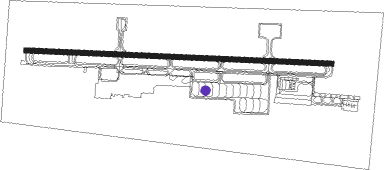
Airport layout - parking location 31
Taxiway locations
Parking locations
|
Nearby beacons
| code | identifier | dist | bearing | frequency |
|---|---|---|---|---|
| AOG | ROTA TACAN | 0.6 | 292° | 108.60 |
| JRZ | JEREZ VOR/DME | 18.1 | 61° | 113 |
| JER | JEREZ NDB | 19.2 | 59° | 433 |
| VJF | VEJER DE LA FRONTERA VOR/DME | 29.9 | 138° | 117.80 |
| EEC | EL COPERO (SEVILLA) NDB | 43.2 | 27° | 327 |
| MRN | MORON (SEVILLE) VOR/DME | 47 | 53° | 115.50 |
| SPP | SEVILLE NDB | 53.2 | 35° | 420 |
| SVL | SEVILLE VOR/DME | 54.5 | 36° | 113.70 |
| GBR | GIBRALTAR TACAN | 56.7 | 117° | 113.60 |
| TNR | TANGER VOR/DME | 58.2 | 155° | 108.05 |
| TNG | TANGER VOR/DME | 59 | 154° | 115.90 |
| TAN | TANGER NDB | 61.1 | 150° | 374 |
Departure and arrival routes
| Transition altitude | 6000ft |
| SID end points | distance | outbound heading | |
|---|---|---|---|
| RW10 | |||
| RD125I | 148mi | 24° | |
| HIJ2Y | 127mi | 34° | |
| ALCO2X | 113mi | 56° | |
| MGA2X, MGA2Y | 95mi | 85° | |
| RD169I | 85mi | 105° | |
| PIMO2X, PIMO2W | 76mi | 109° | |
| ONUB2W | 42mi | 325° | |
| RD123I | 47mi | 341° | |
| RW28 | |||
| RD125I | 148mi | 24° | |
| HIJ2Z | 127mi | 34° | |
| ALCO2Y | 113mi | 56° | |
| MGA2V, MGA2Z | 95mi | 85° | |
| RD169I | 85mi | 105° | |
| PIMO2Y, PIMO2Z | 76mi | 109° | |
| ONUB2X | 42mi | 325° | |
| RD123I | 47mi | 341° | |
| STAR starting points | distance | inbound heading | |
|---|---|---|---|
| ALL | |||
| RD123V | 46.8 | 161° | |
| RD125V | 148.4 | 204° | |
| RD169V | 84.6 | 285° | |
Disclaimer
The information on this website is not for real aviation. Use this data with the X-Plane flight simulator only! Data taken with kind consent from X-Plane 12 source code and data files. Content is subject to change without notice.