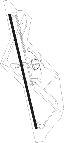
Vila Do Porto - Santa Maria
Airport details
| Country | Portugal |
| State | Autonomous Region of Azores |
| Region | LP |
| Airspace | Santa Maria Oceanic Ctr |
| Municipality | Vila do Porto |
| Elevation | 308ft (94m) |
| Timezone | GMT -1 |
| Coordinates | 36.97389, -25.17111 |
| Magnetic var | |
| Type | land |
| Available since | X-Plane v10.40 |
| ICAO code | LPAZ |
| IATA code | SMA |
| FAA code | n/a |
Communication
| Santa Maria Tower | 118.100 |
| Santa Maria Approach | 119.100 |
Approach frequencies
| ILS-cat-I | RW18 | 110.3 | 18.00mi |
| 2.8° GS | RW18 | 110.3 | 18.00mi |
Nearby beacons
| code | identifier | dist | bearing | frequency |
|---|---|---|---|---|
| VSM | SANTA MARIA VOR/DME | 0.6 | 157° | 112 |
| PD | PONTA DELGADA NDB | 51.6 | 326° | 351 |
| VMG | SAO MIGUEL VOR/DME | 59.3 | 326° | 111.20 |
Departure and arrival routes
| Transition altitude | 4000ft |
| SID end points | distance | outbound heading | |
|---|---|---|---|
| RW18 | |||
| BEKU4S, BEKU4T | 109mi | 63° | |
| DOKA4S, DOKA4T | 88mi | 82° | |
| ETRO4S | 65mi | 116° | |
| GINS4S | 126mi | 255° | |
| GOMO4S | 234mi | 270° | |
| RODI4S | 134mi | 294° | |
| VMG4S | 59mi | 326° | |
| XUVA2S | 37mi | 356° | |
| RW36 | |||
| BEKU5N | 109mi | 63° | |
| DOKA4P, DOKA5N | 88mi | 82° | |
| ETRO4N | 65mi | 116° | |
| GINS5N | 126mi | 255° | |
| GOMO5N | 234mi | 270° | |
| RODI4N | 134mi | 294° | |
| VMG5N | 59mi | 326° | |
| XUVA2N | 37mi | 356° | |
| STAR starting points | distance | inbound heading | |
|---|---|---|---|
| ALL | |||
| GINS3B | 126.1 | 75° | |
| GOMO3B | 234.3 | 90° | |
| RODI3B | 133.6 | 114° | |
| VMG3B | 59.3 | 146° | |
| BEKU3C | 109.2 | 243° | |
| DOKA3C | 87.9 | 262° | |
| ETRO3C | 65.0 | 296° | |
Holding patterns
| STAR name | hold at | type | turn | heading* | altitude | leg | speed limit |
|---|---|---|---|---|---|---|---|
| BEKU3C | VSM | NDB | left | 154 (334)° | 15000ft - 60000ft | 1.5min timed | 280 |
| DOKA3C | VSM | NDB | left | 154 (334)° | 15000ft - 60000ft | 1.5min timed | 280 |
| ETRO3C | VSM | NDB | left | 154 (334)° | 15000ft - 60000ft | 1.5min timed | 280 |
| GINS3B | VSM | NDB | left | 154 (334)° | 15000ft - 60000ft | 1.5min timed | 280 |
| GOMO3B | VSM | NDB | left | 154 (334)° | 15000ft - 60000ft | 1.5min timed | 280 |
| RODI3B | VSM | NDB | left | 154 (334)° | 15000ft - 60000ft | 1.5min timed | 280 |
| VMG3B | VSM | NDB | left | 154 (334)° | 15000ft - 60000ft | 1.5min timed | 280 |
| *) magnetic outbound (inbound) holding course | |||||||
Disclaimer
The information on this website is not for real aviation. Use this data with the X-Plane flight simulator only! Data taken with kind consent from X-Plane 12 source code and data files. Content is subject to change without notice.
