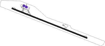
Cayo Largo Del Sur - Vilo Acuna Intl
Airport details
| Country | Cuba |
| State | Isle of Youth |
| Region | MU |
| Airspace | Havana Ctr |
| Elevation | 7ft (2m) |
| Timezone | GMT -5 |
| Coordinates | 21.61611, -81.54556 |
| Magnetic var | |
| Type | land |
| Available since | X-Plane v10.40 |
| ICAO code | MUCL |
| IATA code | CYO |
| FAA code | n/a |
Communication
| Vilo Acuna Intl CAYO LARGO Tower | 118.500 |
| Vilo Acuna Intl CAYO LARGO Approach | 120.100 |
Nearby beacons
| code | identifier | dist | bearing | frequency |
|---|---|---|---|---|
| UCL | CAYO LARGO DEL SUR VOR/DME | 0.9 | 131° | 112.10 |
Departure and arrival routes
| Transition altitude | 3000ft |
| SID end points | distance | outbound heading | |
|---|---|---|---|
| RW12 | |||
| VARC3A | 63mi | 8° | |
| YANT2A | 49mi | 130° | |
| RW30 | |||
| EMUN3B | 63mi | 8° | |
| IKLA3A | 104mi | 210° | |
| STAR starting points | distance | inbound heading | |
|---|---|---|---|
| RW12 | |||
| ESTA4A | 17.9 | 78° | |
| EMUN3A | 17.9 | 154° | |
| RW30 | |||
| VARC3B | 18.8 | 205° | |
| TARTA1 | 19.8 | 336° | |
Instrument approach procedures
| runway | airway (heading) | route (dist, bearing) |
|---|---|---|
| RW12 | CL610 (138°) | CL610 3000ft IGROS (6mi, 186°) 1500ft |
| RW12 | CL611 (92°) | CL611 3000ft IGROS (6mi, 48°) 1500ft |
| RNAV | IGROS 1500ft CL615 (5mi, 114°) 1500ft MUCL (5mi, 115°) 57ft (4933mi, 105°) 1500ft IKLAL (4940mi, 285°) IKLAL (turn) | |
| RW30 | CL620 (266°) | CL620 3000ft PELAO (6mi, 208°) 1500ft |
| RW30 | CL621 (324°) | CL621 3000ft PELAO (6mi, 28°) 1500ft |
| RNAV | PELAO 1500ft BISPI (5mi, 295°) 1500ft MUCL (5mi, 294°) 60ft (4933mi, 105°) 1500ft IKLAL (4940mi, 285°) IKLAL (turn) |
Holding patterns
| STAR name | hold at | type | turn | heading* | altitude | leg | speed limit |
|---|---|---|---|---|---|---|---|
| EMUN3A | EMUNO | VHF | right | 18 (198)° | 4000ft - 14000ft | DME 4.2mi | 230 |
| ESTA4A | ESTAS | VHF | right | 227 (47)° | 4000ft - 14000ft | DME 4.2mi | 230 |
| TARTA1 | TARTA | VHF | right | 180 (0)° | 4000ft - 14000ft | DME 4.2mi | 230 |
| VARC3B | VARCA | VHF | right | 351 (171)° | 4000ft - 14000ft | DME 4.2mi | 230 |
| *) magnetic outbound (inbound) holding course | |||||||
Disclaimer
The information on this website is not for real aviation. Use this data with the X-Plane flight simulator only! Data taken with kind consent from X-Plane 12 source code and data files. Content is subject to change without notice.
