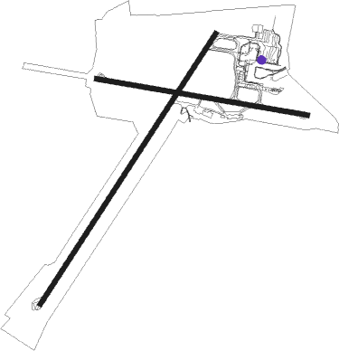
Nadi - Nadi Intl
Airport details
| Country | Fiji |
| State | Western |
| Region | NF |
| Municipality | Nadi |
| Elevation | 59ft (18m) |
| Timezone | GMT +12 |
| Coordinates | -17.75695, 177.44768 |
| Magnetic var | |
| Type | land |
| Available since | X-Plane v10.40 |
| ICAO code | NFFN |
| IATA code | NAN |
| FAA code | n/a |
Communication
| Nadi Intl ATIS | 127.900 |
| Nadi Intl Ground Control | 121.900 |
| Nadi Intl Tower | 118.100 |
| Nadi Intl Approach/Departure | 119.100 |
Approach frequencies
| ILS-cat-I | RW02 | 111.9 | 18.00mi |
| 3° GS | RW02 | 111.9 | 18.00mi |
Nearby Points of Interest:
Sigatoka sand dunes
Nearby beacons
| code | identifier | dist | bearing | frequency |
|---|---|---|---|---|
| VK | NAVAKAI (NADI) NDB | 2.3 | 225° | 405 |
| NN | NADI VOR/DME | 6.8 | 333° | 112.50 |
| MI | MOMI (NADI) NDB | 11 | 221° | 364 |
Departure and arrival routes
| Transition altitude | 11000ft |
| Transition level | 13000ft |
| SID end points | distance | outbound heading | |
|---|---|---|---|
| RW02 | |||
| ALPHA | 106mi | 11° | |
| CHARLI | 101mi | 56° | |
| ECHO, DELTA | 50mi | 124° | |
| FOXTRO | 95mi | 189° | |
| RW09 | |||
| ALPHA | 106mi | 11° | |
| CHARLI | 101mi | 56° | |
| DELTA, ECHO | 50mi | 124° | |
| FOXTRO | 95mi | 189° | |
| RW20 | |||
| ALPHA | 106mi | 11° | |
| CHARLI | 101mi | 56° | |
| DELTA, ECHO | 50mi | 124° | |
| FOXTRO | 95mi | 189° | |
| RW27 | |||
| ALPHA | 106mi | 11° | |
| CHARLI | 101mi | 56° | |
| DELTA, ECHO | 50mi | 124° | |
| FOXTRO | 95mi | 189° | |
| STAR starting points | distance | inbound heading | |
|---|---|---|---|
| RW20 | |||
| AGTA2B | 40.2 | 12° | |
| MIKA2B | 15.1 | 40° | |
Instrument approach procedures
| runway | airway (heading) | route (dist, bearing) |
|---|---|---|
| RW02 | FNNSD (19°) | FNNSD 4700ft FNNSI (5mi, 324°) 3500ft |
| RW02 | FNNSE (38°) | FNNSE 4700ft FNNSI (5mi, 37°) 3500ft |
| RW02 | FNNSG (57°) | FNNSG 4700ft FNNSI (5mi, 105°) 3500ft |
| RNAV | FNNSI 3500ft FNNSF (5mi, 37°) 1910ft FNNSM (5mi, 37°) 318ft (9732mi, 276°) 560ft FNNSH (9732mi, 96°) (9732mi, 276°) 3400ft | |
| RW20 | MOTKI (338°) | MOTKI 4500ft FN664 (4mi, 39°) 3350ft |
| RNAV | FN664 3350ft NIREV (4mi, 2°) 2000ft FN581 (3mi, 298°) 1000ft FN812 (1mi, 246°) 540ft NFFN (2mi, 210°) 90ft MIKAX (15mi, 220°) 3000ft MIKAX (turn) 3000ft |
Holding patterns
| STAR name | hold at | type | turn | heading* | altitude | leg | speed limit |
|---|---|---|---|---|---|---|---|
| AGTA2B | AGTAG | VHF | right | 164 (344)° | > 7000ft | 1.0min timed | ICAO rules |
| KALT2B | KALTA | VHF | right | 295 (115)° | > 5000ft | 1.0min timed | ICAO rules |
| MIKA2B | MIKAX | VHF | left | 205 (25)° | > 3000ft | 1.0min timed | ICAO rules |
| TEDU2B | KALTA | VHF | right | 295 (115)° | > 5000ft | 1.0min timed | ICAO rules |
| *) magnetic outbound (inbound) holding course | |||||||
Disclaimer
The information on this website is not for real aviation. Use this data with the X-Plane flight simulator only! Data taken with kind consent from X-Plane 12 source code and data files. Content is subject to change without notice.

