Palmerston North
Airport details
| Country | New Zealand |
| State | Manawatū-Whanganui |
| Region | NZ |
| Municipality | Palmerston North |
| Elevation | 149ft (45m) |
| Timezone | GMT +12 |
| Coordinates | -40.32056, 175.61694 |
| Magnetic var | |
| Type | land |
| Available since | X-Plane v10.40 |
| ICAO code | NZPM |
| IATA code | PMR |
| FAA code | n/a |
Communication
| Palmerston North ATIS | 129.700 |
| Palmerston North CTAF | 120.600 |
| Palmerston North Ground Control | 121.700 |
| Palmerston North Tower | 120.600 |
| Palmerston North OHAKEA Approach | 128.500 |
| Palmerston North OHAKEA Approach | 123.200 |
| Palmerston North OHAKEA Approach | 125.100 |
Nearby Points of Interest:
Caccia Birch House
-Cameron Blockhouse
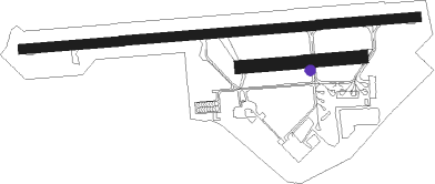
Runway info
Runway 07 / 25  | ||
| length | 1898m (6227ft) | |
| bearing | 90° / 270° | |
| width | 45m (148ft) | |
| surface | asphalt | |
| displ threshold | 139m (456ft) / 80m (262ft) | |
| Runway 07R / 25L | ||
| length | 581m (1906ft) | |
| bearing | 90° / 270° | |
| width | 60m (197ft) | |
| surface | grass | |
Nearby beacons
| code | identifier | dist | bearing | frequency |
|---|---|---|---|---|
| PM | PALMERSTON NORTH VOR/DME | 0.9 | 89° | 113.40 |
| OH | OHAKEA VOR/DME | 12.2 | 296° | 117.10 |
| WU | WHANGANUI NDB | 34.7 | 301° | 382 |
| PP | PARAPARAUMU NDB | 45.3 | 227° | 242 |
| NL | NEWLANDS (WELLINGTON) NDB | 65.2 | 221° | 358 |
Departure and arrival routes
| Transition altitude | 13000ft |
| Transition level | 15000ft |
| SID end points | distance | outbound heading | |
|---|---|---|---|
| RW07 | |||
| DADL2Q | 20mi | 84° | |
| RUXO3Q | 27mi | 287° | |
| TERO3S, DADL3T | 77mi | 332° | |
| TERO3Q, RUXO4S, DADL3S | 31mi | 332° | |
| RW25 | |||
| GUTN2P | 16mi | 156° | |
| GUTN2U | 27mi | 287° | |
| GUTN3R | 31mi | 332° | |
| GUTN3T | 77mi | 332° | |
| STAR starting points | distance | inbound heading | |
|---|---|---|---|
| RW07 | |||
| RINR2B | 20.2 | 63° | |
| MIBU2B | 29.9 | 73° | |
| VIRO2B | 27.0 | 107° | |
| BUVL1B | 14.5 | 137° | |
| TUTS2B | 19.4 | 175° | |
| IRMI1B | 20.0 | 264° | |
| OKEV1B | 16.3 | 336° | |
| RW25 | |||
| AVGU2A | 10.2 | 5° | |
| LUNB2A, LUNB1E | 13.0 | 68° | |
| IDLU3A | 29.9 | 174° | |
| TUTS2E | 19.4 | 175° | |
| APIT2A | 23.2 | 214° | |
| IGPA2A | 15.3 | 223° | |
| IRMI1A | 20.0 | 264° | |
| OKEV1A | 16.3 | 336° | |
Instrument approach procedures
| runway | airway (heading) | route (dist, bearing) |
|---|---|---|
| RW07 | AKNIN (70°) | AKNIN GUTNI (4mi, 0°) 2500ft |
| RW07 | GUTNI (90°) | GUTNI 2500ft |
| RW07 | NIRUB (114°) | NIRUB GUTNI (5mi, 180°) 2500ft |
| RNAV | GUTNI 2500ft LERSO (4mi, 90°) 1440ft NZPM (5mi, 90°) 171ft (8377mi, 283°) 2700ft RUXOX (8373mi, 103°) RINRI (26mi, 260°) 4000ft RINRI (turn) 4000ft | |
| RW25-X | LEKED (179°) | LEKED 4000ft SEKNI (3mi, 108°) 3140ft |
| RNAV | SEKNI 3140ft DANLU (4mi, 157°) 1600ft PM482 (2mi, 246°) 900ft NZPM (2mi, 269°) 201ft GUTNI (9mi, 270°) PM721 (7mi, 195°) AVGUV (10mi, 108°) 6000ft AVGUV (turn) 6000ft | |
| RW25 | BIDEK (257°) | BIDEK UVUSI (5mi, 188°) 3800ft |
| RW25 | NIKIP (286°) | NIKIP UVUSI (5mi, 8°) 3500ft |
| RW25 | UVUSI (271°) | UVUSI 5600ft |
| RNAV | UVUSI 3500ft IVREP (5mi, 275°) 3500ft NZPM (10mi, 270°) 201ft GUTNI (9mi, 270°) AKNIN (4mi, 180°) AVGUV (10mi, 121°) 6000ft AVGUV (turn) |
Holding patterns
| STAR name | hold at | type | turn | heading* | altitude | leg | speed limit |
|---|---|---|---|---|---|---|---|
| AVGU2A | AVGUV | VHF | left | 245 (65)° | > 5100ft | 1.0min timed | 220 |
| AVGU2A | RINRI | VHF | left | 195 (15)° | > 4000ft | 1.0min timed | 210 |
| IGPA2A | IGPAX | VHF | right | 304 (124)° | > 5700ft | 1.0min timed | ICAO rules |
| IRMI1A | UVUSI | VHF | left | 74 (254)° | > 5600ft | 1.0min timed | ICAO rules |
| LUNB1E | RINRI | VHF | left | 195 (15)° | > 4000ft | 1.0min timed | 210 |
| LUNB2A | RINRI | VHF | left | 195 (15)° | > 4000ft | 1.0min timed | 210 |
| MIBU2B | GUTNI | VHF | right | 248 (68)° | > 2500ft | 1.0min timed | ICAO rules |
| RINR2B | GUTNI | VHF | right | 248 (68)° | > 2500ft | 1.0min timed | ICAO rules |
| RINR2B | RINRI | VHF | left | 195 (15)° | > 4000ft | 1.0min timed | 210 |
| VIRO2B | RINRI | VHF | left | 195 (15)° | > 4000ft | 1.0min timed | 210 |
| *) magnetic outbound (inbound) holding course | |||||||
Disclaimer
The information on this website is not for real aviation. Use this data with the X-Plane flight simulator only! Data taken with kind consent from X-Plane 12 source code and data files. Content is subject to change without notice.