Whenuapai
Airport details
| Country | New Zealand |
| State | Auckland |
| Region | NZ |
| Municipality | Upper Harbour |
| Elevation | 100ft (30m) |
| Timezone | GMT +12 |
| Coordinates | -36.78778, 174.63028 |
| Magnetic var | |
| Type | land |
| Available since | X-Plane v10.40 |
| ICAO code | NZWP |
| IATA code | n/a |
| FAA code | n/a |
Communication
| Whenuapai ATIS | 128.300 |
| Whenuapai CTAF | 134.500 |
| Whenuapai Tower | 134.500 |
| Whenuapai AUCKLAND Approach | 124.300 |
Approach frequencies
| ILS-cat-I | RW03 | 110.7 | 18.00mi |
| ILS-cat-I | RW21 | 111.1 | 18.00mi |
| 3° GS | RW03 | 110.7 | 18.00mi |
| 3° GS | RW21 | 111.1 | 18.00mi |
Nearby Points of Interest:
Gluepot Tavern
-Bluestone Store
-Dilworth Building
-Auckland Savings Bank Building
-Auckland Town Hall
-Kenneth Myers Centre
-Albert Barracks Wall
-Stoneways
-Pah Homestead
-Auckland volcanic field
-Chapel of St John the Evangelist, Auckland
-Smelting House ruins
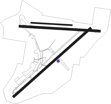
Runway info
Runway 03 / 21  | ||
| length | 2030m (6660ft) | |
| bearing | 59° / 239° | |
| width | 45m (148ft) | |
| surface | asphalt | |
| Runway 08 / 26 | ||
| length | 1580m (5184ft) | |
| bearing | 96° / 276° | |
| width | 45m (148ft) | |
| surface | concrete | |
| Runway 08L / 26R | ||
| length | 806m (2644ft) | |
| bearing | 96° / 276° | |
| width | 27m (87ft) | |
| surface | grass | |
Nearby beacons
| code | identifier | dist | bearing | frequency |
|---|---|---|---|---|
| WP | WHENUAPAI (AUCKLAND) VOR/DME | 0 | 44° | 116.40 |
| AA | AUCKLAND VOR/DME | 15.7 | 140° | 114.80 |
| WI | WAIUKU NDB | 30.1 | 159° | 254 |
| SY | SURREY NDB | 37.3 | 130° | 350 |
| SF | SPRINGFIELD (WHANGAREI) NDB | 55.7 | 343° | 366 |
Departure and arrival routes
| Transition altitude | 13000ft |
| Transition level | 15000ft |
| SID end points | distance | outbound heading | |
|---|---|---|---|
| RW03 | |||
| BAYE2A | 12mi | 60° | |
| BAYE1R | 30mi | 270° | |
| RW08 | |||
| BAYE2B | 12mi | 60° | |
| RW21 | |||
| WYTA2A | 12mi | 239° | |
| WYTA1Q | 30mi | 270° | |
| RW26 | |||
| WYTA2B | 12mi | 239° | |
| STAR starting points | distance | inbound heading | |
|---|---|---|---|
| RW03 | |||
| ARAD2K | 60.7 | 73° | |
| OMLE1K | 29.8 | 90° | |
| BASI2K | 50.7 | 113° | |
| LUPR1K | 30.0 | 226° | |
| EXOP1K | 41.1 | 238° | |
| AA1K | 15.7 | 320° | |
| RW08 | |||
| AA2L | 15.7 | 320° | |
| RW21 | |||
| ARAD1J | 60.7 | 73° | |
| OMLE1J | 29.8 | 90° | |
| BASI2J | 50.7 | 113° | |
| LUPR1J | 30.0 | 226° | |
| EXOP2J | 41.1 | 238° | |
| AA1J | 15.7 | 320° | |
| RW26 | |||
| AA1M | 15.7 | 320° | |
Instrument approach procedures
| runway | airway (heading) | route (dist, bearing) |
|---|---|---|
| RW03 | WYTAK (59°) | WYTAK 3000ft |
| RNAV | WYTAK 3000ft MESUD (7mi, 59°) 1430ft NZWP (5mi, 57°) 153ft BAYES (12mi, 60°) 3000ft BAYES (turn) 3000ft | |
| RW08 | HALEN (117°) | HALEN MAKEE (5mi, 190°) 3000ft |
| RW08 | IGOLF (78°) | IGOLF MAKEE (5mi, 10°) 3000ft |
| RNAV | MAKEE 3000ft AKVAR (5mi, 97°) 2000ft NZWP (6mi, 98°) 118ft WP804 (3mi, 94°) BAYES (10mi, 48°) 3000ft BAYES (turn) 3000ft | |
| RW21 | BAYES (240°) | BAYES 3000ft |
| RNAV | BAYES 3000ft KIBIM (8mi, 240°) 1380ft NZWP (4mi, 240°) 109ft WYTAK (12mi, 239°) 3000ft WYTAK (turn) 3000ft | |
| RW26 | ABUOY (255°) | ABUOY FLAXX (5mi, 190°) 3000ft |
| RW26 | BAZEN (297°) | BAZEN FLAXX (5mi, 10°) 3000ft |
| RNAV | FLAXX 3000ft URBOL (5mi, 276°) 2000ft NZWP (6mi, 275°) 103ft WP604 (3mi, 279°) WYTAK (10mi, 225°) 3000ft WYTAK (turn) 3000ft |
Disclaimer
The information on this website is not for real aviation. Use this data with the X-Plane flight simulator only! Data taken with kind consent from X-Plane 12 source code and data files. Content is subject to change without notice.