Manama - Bahrain Intl
Airport details
| Country | Bahrain |
| State | Muharraq Governorate |
| Region | OB |
| Airspace | Bahrain Ctr |
| Municipality | Muharraq |
| Elevation | 2ft (1m) |
| Timezone | GMT +3 |
| Coordinates | 26.27083, 50.63361 |
| Magnetic var | |
| Type | land |
| Available since | X-Plane v10.32 |
| ICAO code | OBBI |
| IATA code | BAH |
| FAA code | n/a |
Communication
| Bahrain Intl ATIS | 127.200 |
| Bahrain Intl Ground Control | 121.850 |
| Bahrain Intl Tower | 118.500 |
| Bahrain Intl Approach | 125.700 |
Approach frequencies
| ILS-cat-II | RW30R | 110.3 | 18.00mi |
| ILS-cat-II | RW12L | 111.5 | 18.00mi |
| 3° GS | RW30R | 110.3 | 18.00mi |
| 3° GS | RW12L | 111.5 | 18.00mi |
Nearby Points of Interest:
Bahrain Pearling Trail
-Manama
-Zubarah
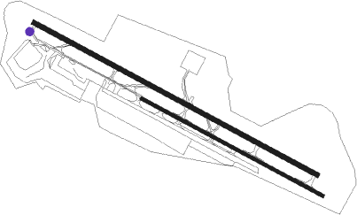
Runway info
Runway 12L / 30R  | ||
| length | 3963m (13002ft) | |
| bearing | 120° / 300° | |
| width | 60m (197ft) | |
| surface | asphalt | |
| displ threshold | 305m (1001ft) / 306m (1004ft) | |
| blast zone | 0m (0ft) / 50m (164ft) | |
| Runway 12R / 30L | ||
| length | 2531m (8304ft) | |
| bearing | 120° / 300° | |
| width | 45m (148ft) | |
| surface | asphalt | |
| displ threshold | 305m (1001ft) / 120m (394ft) | |
Nearby beacons
| code | identifier | dist | bearing | frequency |
|---|---|---|---|---|
| BHR | BAHRAIN VOR/DME | 1.3 | 120° | 111.80 |
| SIA | ISA AB (BAHRAIN) VORTAC | 21 | 187° | 117.60 |
| SI | ISA AB (BAHRAIN) NDB | 22.6 | 185° | 343 |
| DHA | DHAHRAN VORTAC | 26.5 | 269° | 117.20 |
| RT | RAS TANURA NDB | 41.4 | 306° | 286 |
| KFA | DAMMAM VORTAC | 47.9 | 285° | 112.30 |
| NJL | KING ABDULAZIZ NAVAL BASE VORTAC | 64.1 | 306° | 114.80 |
Instrument approach procedures
| runway | airway (heading) | route (dist, bearing) |
|---|---|---|
| RW12L | LOVAL (120°) | LOVAL 2500ft BI502 (5mi, 120°) 1400ft |
| RW12L | OB1N3 (146°) | OB1N3 2500ft BI502 (6mi, 195°) 1400ft |
| RNAV | BI502 1400ft BI501 (4mi, 120°) 1400ft OBBI (5mi, 120°) 58ft (3323mi, 243°) 2500ft | |
| RW12R | LOVAL (120°) | LOVAL 2500ft BI502 (5mi, 120°) 1400ft |
| RW12R | OB1N3 (146°) | OB1N3 2500ft BI502 (6mi, 195°) 1400ft |
| RNAV | BI502 1400ft OB2F1 (5mi, 121°) 1400ft OBBI (5mi, 119°) 58ft (3323mi, 243°) 2500ft | |
| RW30L | DAXEL (300°) | DAXEL 2500ft BI602 (5mi, 300°) 1400ft |
| RW30L | OB3N1 (275°) | OB3N1 2500ft BI602 (6mi, 234°) 1400ft |
| RNAV | BI602 1400ft OB3F1 (4mi, 299°) 1400ft OBBI (6mi, 301°) 58ft (3323mi, 243°) 2500ft | |
| RW30R | DAXEL (300°) | DAXEL 2500ft BI602 (5mi, 300°) 1400ft |
| RW30R | OB3N1 (275°) | OB3N1 2500ft BI602 (6mi, 234°) 1400ft |
| RNAV | BI602 1400ft BI601 (4mi, 300°) 1400ft OBBI (5mi, 300°) 58ft (3323mi, 243°) 2500ft |
Holding patterns
| STAR name | hold at | type | turn | heading* | altitude | leg | speed limit |
|---|---|---|---|---|---|---|---|
| DENVO1 | ALRAS | VHF | right | 120 (300)° | 3000ft - 13000ft | 1.5min timed | 210 |
| DENVO1 | NAGAT | VHF | left | 300 (120)° | 3000ft - 13000ft | 1.5min timed | 210 |
| DENVO1 | OBSAS | VHF | right | 27 (207)° | 3000ft - 13000ft | 1.5min timed | 240 |
| KOBOK1 | ALRAS | VHF | right | 120 (300)° | 3000ft - 13000ft | 1.5min timed | 210 |
| KOBOK1 | NAGAT | VHF | left | 300 (120)° | 3000ft - 13000ft | 1.5min timed | 210 |
| KOBOK1 | OBSAS | VHF | right | 27 (207)° | 3000ft - 13000ft | 1.5min timed | 240 |
| LADNA1 | ALRAS | VHF | right | 120 (300)° | 3000ft - 13000ft | 1.5min timed | 210 |
| LADNA1 | NAGAT | VHF | left | 300 (120)° | 3000ft - 13000ft | 1.5min timed | 210 |
| LADNA1 | OBSAS | VHF | right | 27 (207)° | 3000ft - 13000ft | 1.5min timed | 240 |
| SOGAT1 | ALRAS | VHF | right | 120 (300)° | 3000ft - 13000ft | 1.5min timed | 210 |
| SOGAT1 | NAGAT | VHF | left | 300 (120)° | 3000ft - 13000ft | 1.5min timed | 210 |
| SOGAT1 | OBSAS | VHF | right | 27 (207)° | 3000ft - 13000ft | 1.5min timed | 240 |
| *) magnetic outbound (inbound) holding course | |||||||
Disclaimer
The information on this website is not for real aviation. Use this data with the X-Plane flight simulator only! Data taken with kind consent from X-Plane 12 source code and data files. Content is subject to change without notice.