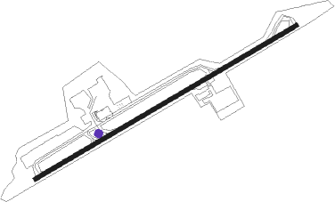
Amman - Amman Marka Intl
Airport details
| Country | Jordan |
| State | Amman |
| Region | OJ |
| Airspace | Amman Ctr |
| Municipality | Marka Sub-District |
| Elevation | 2555ft (779m) |
| Timezone | GMT +2 |
| Coordinates | 31.97270, 35.99157 |
| Magnetic var | |
| Type | land |
| Available since | X-Plane v10.32 |
| ICAO code | OJAM |
| IATA code | ADJ |
| FAA code | n/a |
Communication
| Amman Marka Intl AMMAN Ground Control | 121.700 |
| Amman Marka Intl AMMAN Tower | 118.100 |
| Amman Marka Intl AMMAN Approach | 128.900 |
Approach frequencies
| ILS-cat-I | RW24 | 109.5 | 18.00mi |
| 3° GS | RW24 | 109.5 | 18.00mi |
Nearby beacons
| code | identifier | dist | bearing | frequency |
|---|---|---|---|---|
| AMN | AMMAN VOR/DME | 4.2 | 67° | 116.30 |
| QA | QUEEN ALIA NDB | 15.4 | 157° | 410 |
| QAA | QUEEN ALIA VOR/DME | 16.3 | 145° | 115.20 |
| MDB | MADABA NDB | 17.3 | 208° | 399 |
| QTR | QATRANEH VOR/DME | 43.6 | 175° | 112.90 |
| MZD | METZADA VOR/DME | 49.2 | 223° | 115 |
| RMD | RAMAT DAVID NDB | 58.4 | 311° | 368 |
Departure and arrival routes
| Transition altitude | 13000ft |
| Transition level | 15000ft |
| SID end points | distance | outbound heading | |
|---|---|---|---|
| RW06 | |||
| LOSA1M, LOSA5D | 27mi | 69° | |
| LUDA5D, LUDA1M | 32mi | 83° | |
| KINU5D | 39mi | 120° | |
| KULD5D, KULD1M | 48mi | 140° | |
| QTR5D, QTR01M | 44mi | 175° | |
| MOUA1M | 23mi | 246° | |
| MUVI5D | 25mi | 251° | |
| OSAM1M | 19mi | 264° | |
| RALN5D | 23mi | 265° | |
| RW24 | |||
| LOSA4D, LOSA1N | 27mi | 69° | |
| LUDA1N, LUDA4D | 32mi | 83° | |
| KULD4D, KULD1N | 48mi | 140° | |
| QTR4D, QTR01N | 44mi | 175° | |
| MOUA1N | 23mi | 246° | |
| MUVI4D | 26mi | 253° | |
| OSAM1N | 19mi | 264° | |
| RALN4D | 23mi | 265° | |
| STAR starting points | distance | inbound heading | |
|---|---|---|---|
| RW06 | |||
| OSAM1L | 19.1 | 84° | |
| RALN5A | 23.0 | 85° | |
| LOSA1L, LOSA5A | 27.2 | 249° | |
| LUDA5A, LUDA1L | 32.3 | 263° | |
| ELOX1L | 46.1 | 298° | |
| KULD1L, KULD5A | 48.4 | 320° | |
| QTR5A, QTR01L | 43.6 | 355° | |
| RW24 | |||
| OSAM1K | 19.1 | 84° | |
| RALN4A | 23.0 | 85° | |
| LOSA1K, LOSA4A | 27.2 | 249° | |
| LUDA1K, LUDA4A | 32.3 | 263° | |
| ELOX1K | 46.1 | 298° | |
| KINU4A | 38.8 | 300° | |
| KULD4A, KULD1K | 48.4 | 320° | |
| QTR01K, QTR4A | 43.6 | 355° | |
Instrument approach procedures
| runway | airway (heading) | route (dist, bearing) |
|---|---|---|
| RW06 | EMILO (44°) | EMILO 7000ft SOLOL (5mi, 330°) 5500ft |
| RW06 | MUSAL (89°) | MUSAL 7000ft SOLOL (5mi, 151°) 5500ft |
| RNAV | SOLOL 5500ft ORKAB (5mi, 68°) 4200ft OJAM (6mi, 68°) 2606ft AM064 (1mi, 68°) 2960ft EMILO (13mi, 227°) 7000ft EMILO (turn) | |
| RW24 | IVADO (248°) | IVADO 9000ft NIVLU (6mi, 248°) 7200ft |
| RW24 | LOXER (262°) | LOXER 9000ft NIVLU (7mi, 298°) 7200ft |
| RNAV | NIVLU 7200ft AM240 (10mi, 248°) 4100ft OJAM (6mi, 248°) 2509ft ORKAB (6mi, 248°) 4900ft MUSAL (7mi, 287°) 7000ft MUSAL (turn) |
Holding patterns
| STAR name | hold at | type | turn | heading* | altitude | leg | speed limit |
|---|---|---|---|---|---|---|---|
| LOSA1L | MUSAL | VHF | right | 330 (150)° | > 7000ft | DME 4.0mi | 210 |
| LUDA1L | MUSAL | VHF | right | 330 (150)° | > 7000ft | DME 4.0mi | 210 |
| OSAM1L | MUSAL | VHF | right | 330 (150)° | > 7000ft | DME 4.0mi | 210 |
| *) magnetic outbound (inbound) holding course | |||||||
Disclaimer
The information on this website is not for real aviation. Use this data with the X-Plane flight simulator only! Data taken with kind consent from X-Plane 12 source code and data files. Content is subject to change without notice.
