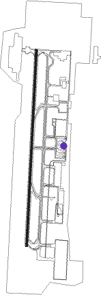
Al Ain - Al Ain Intl
Airport details
| Country | United Arab Emirates |
| State | Abu Dhabi Emirate |
| Region | OM |
| Airspace | Emirates Ctr |
| Municipality | Al Ain International Airport |
| Elevation | 869ft (265m) |
| Timezone | GMT +4 |
| Coordinates | 24.27736, 55.62441 |
| Magnetic var | |
| Type | land |
| Available since | X-Plane v10.30 |
| ICAO code | OMAL |
| IATA code | AAN |
| FAA code | n/a |
Communication
| Al Ain INTL Ground Control | 129.150 |
| Al Ain INTL Tower | 119.850 |
| Al Ain INTL Approach | 119.850 |
Approach frequencies
| ILS-cat-I | RW01 | 111.9 | 18.00mi |
| 3° GS | RW01 | 111.9 | 18.00mi |
Nearby beacons
| code | identifier | dist | bearing | frequency |
|---|---|---|---|---|
| ALA | AL AIN VOR/DME | 0.5 | 296° | 115.90 |
| ALN | AL AIN VOR/DME | 1.4 | 226° | 112.60 |
| MIN | MINHAD VOR/DME | 46.7 | 343° | 115.20 |
| ADV | ABU DHABI VOR/DME | 52.7 | 278° | 114.25 |
| FJV | FUJAIRAH VOR/DME | 63.5 | 42° | 113.80 |
Departure and arrival routes
| Transition altitude | 13000ft |
| Transition level | 15000ft |
| SID end points | distance | outbound heading | |
|---|---|---|---|
| RW01 | |||
| GIDI1H | 26mi | 44° | |
| MURG1H | 28mi | 59° | |
| LABR2H | 13mi | 175° | |
| RETA2H | 19mi | 189° | |
| ROVO1H | 14mi | 276° | |
| RW19 | |||
| GIDI1J | 26mi | 44° | |
| MURG1J | 28mi | 59° | |
| LABR2J | 13mi | 175° | |
| RETA2J | 19mi | 189° | |
| ROVO1J | 14mi | 276° | |
| STAR starting points | distance | inbound heading | |
|---|---|---|---|
| RW01 | |||
| KANI1K | 16.4 | 70° | |
| ROVO2K | 14.4 | 96° | |
| GIDI2K | 25.7 | 224° | |
| ITRA1K | 10.2 | 290° | |
| RW19 | |||
| KANI2L | 16.4 | 70° | |
| ROVO3L | 14.4 | 96° | |
| GIDI2L | 25.7 | 224° | |
| ITRA2L, ITRA2M | 10.2 | 290° | |
Instrument approach procedures
| runway | airway (heading) | route (dist, bearing) |
|---|---|---|
| RW01 | ASVAD (12°) | ASVAD 2500ft AL013 (4mi, 8°) 2500ft |
| RNAV | AL013 2500ft OMAL (8mi, 14°) 915ft AL001 (4mi, 357°) AL002 (6mi, 277°) 2500ft ROVOS (9mi, 252°) 4000ft ROVOS (turn) 4000ft | |
| RW19 | AL007 (152°) | AL007 3500ft AL008 (6mi, 97°) 2500ft |
| RW19 | AL009 (218°) | AL009 3500ft AL008 (6mi, 277°) 2500ft |
| RW19 | AL012 (185°) | AL012 5500ft AL008 (5mi, 188°) 2500ft |
| RNAV | AL008 2500ft AL011 (5mi, 188°) 2500ft OMAL (6mi, 180°) 888ft AL004 (6mi, 195°) AL005 (6mi, 262°) 2500ft ROVOS (11mi, 320°) 4000ft ROVOS (turn) 4000ft |
Disclaimer
The information on this website is not for real aviation. Use this data with the X-Plane flight simulator only! Data taken with kind consent from X-Plane 12 source code and data files. Content is subject to change without notice.
