Jebel Ali - Al Maktoum Intl
Airport details
| Country | United Arab Emirates |
| State | Dubai |
| Region | OM |
| Airspace | Emirates Ctr |
| Elevation | 169ft (52m) |
| Timezone | GMT +4 |
| Coordinates | 24.89449, 55.15297 |
| Magnetic var | |
| Type | land |
| Available since | X-Plane v10.30 |
| ICAO code | OMDW |
| IATA code | DWC |
| FAA code | n/a |
Communication
| Al Maktoum Intl ATIS | 126.475 |
| Al Maktoum Intl Al Maktoum Ground Control | 118.375 |
| Al Maktoum Intl Al Maktoum Tower | 118.625 |
| Al Maktoum Intl Academy Tower | 118.775 |
| Al Maktoum Intl Al Maktoum Approach | 124.025 |
| Al Maktoum Intl Dubai South Approach | 120.400 |
| Al Maktoum Intl Minhad Approach | 122.500 |
| Al Maktoum Intl Dubai South Departure | 121.025 |
| Al Maktoum Intl Dubai North Departure | 126.200 |
Approach frequencies
| ILS-cat-III | RW12 | 111.75 | 18.00mi |
| ILS-cat-III | RW30 | 109.75 | 18.00mi |
| ILS-cat-I | RW31 | 110.55 | 18.00mi |
| 3° GS | RW31 | 110.55 | 18.00mi |
| 3° GS | RW12 | 111.75 | 18.00mi |
| 3° GS | RW30 | 109.75 | 18.00mi |
Nearby Points of Interest:
Dubai Creek
-Sharjah
Runway info
Runway 12 / 30  | ||
| length | 4501m (14767ft) | |
| bearing | 119° / 299° | |
| width | 60m (197ft) | |
| surface | asphalt | |
| blast zone | 135m (443ft) / 137m (449ft) | |
| Runway 13 / 31 | ||
| length | 1839m (6033ft) | |
| bearing | 119° / 299° | |
| width | 30m (98ft) | |
| surface | asphalt | |
| displ threshold | 151m (495ft) / 150m (492ft) | |
| blast zone | 61m (200ft) / 62m (203ft) | |
Airport layout
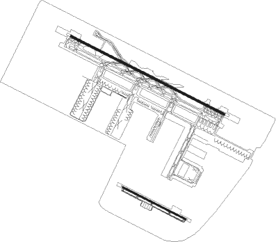
Taxiway locations
|
Parking locations
Nearby beacons
| code | identifier | dist | bearing | frequency |
|---|---|---|---|---|
| MIN | MINHAD VOR/DME | 15.3 | 61° | 115.20 |
| ADV | ABU DHABI VOR/DME | 38.7 | 225° | 114.25 |
| ALA | AL AIN VOR/DME | 44.6 | 143° | 115.90 |
| ALN | AL AIN VOR/DME | 45.4 | 144° | 112.60 |
| ALB | AL BATEEN (ABU DHABI) VOR/DME | 47.2 | 237° | 114 |
| ABM | ABUMUSA ISLAND NDB | 59.4 | 352° | 285 |
| RAV | RAS AL KHAIMAH VOR/DME | 59.9 | 49° | 113.60 |
Departure and arrival routes
| Transition altitude | 13000ft |
| Transition level | 15000ft |
| SID end points | distance | outbound heading | |
|---|---|---|---|
| RW12 | |||
| DAVM4J | 64mi | 27° | |
| NOLS3J | 56mi | 72° | |
| ANVI6J | 43mi | 98° | |
| KUTL3J | 12mi | 262° | |
| MIRO3J | 37mi | 288° | |
| NABI3J | 39mi | 297° | |
| SENP3J | 43mi | 305° | |
| RIDA3J | 43mi | 315° | |
| RW13 | |||
| ANVI2N | 43mi | 98° | |
| MIRO1N | 37mi | 288° | |
| NABI1N | 39mi | 297° | |
| RW30 | |||
| DAVM4L | 64mi | 27° | |
| NOLS3L | 56mi | 72° | |
| ANVI4L | 43mi | 98° | |
| KUTL3L | 12mi | 262° | |
| MIRO3L | 37mi | 288° | |
| NABI3L | 39mi | 297° | |
| SENP3L | 43mi | 305° | |
| RIDA3L | 43mi | 315° | |
| RW31 | |||
| ANVI1P | 43mi | 98° | |
| MIRO1P | 37mi | 288° | |
| NABI1P | 39mi | 297° | |
| STAR starting points | distance | inbound heading | |
|---|---|---|---|
| RW12 | |||
| ELOV3Y | 44.5 | 94° | |
| LORI3Y | 27.4 | 94° | |
| GERU3Y | 39.0 | 99° | |
| DATO5Y | 42.3 | 149° | |
| GONV5Y | 50.3 | 166° | |
| PUVA6Y | 52.2 | 219° | |
| UMAM4Y | 48.3 | 273° | |
| GIDI5Y | 46.0 | 291° | |
| RW13 | |||
| ELOV3Y | 44.5 | 94° | |
| LORI3Y | 27.4 | 94° | |
| GERU3Y | 39.0 | 99° | |
| DATO5Y | 42.3 | 149° | |
| GONV5Y | 50.3 | 166° | |
| PUVA6Y | 52.2 | 219° | |
| UMAM4Y | 48.3 | 273° | |
| GIDI5Y | 46.0 | 291° | |
| RW30 | |||
| ELOV3Z | 44.5 | 94° | |
| LORI3Z | 27.4 | 94° | |
| GERU3Z | 39.0 | 99° | |
| DATO5Z | 42.3 | 149° | |
| GONV5Z | 50.3 | 166° | |
| PUVA6Z | 52.2 | 219° | |
| UMAM4Z | 48.3 | 273° | |
| GIDI5Z | 46.0 | 291° | |
| RW31 | |||
| ELOV3Z | 44.5 | 94° | |
| LORI3Z | 27.4 | 94° | |
| GERU3Z | 39.0 | 99° | |
| DATO5Z | 42.3 | 149° | |
| GONV5Z | 50.3 | 166° | |
| PUVA6Z | 52.2 | 219° | |
| UMAM4Z | 48.3 | 273° | |
| GIDI5Z | 46.0 | 291° | |
Instrument approach procedures
| runway | airway (heading) | route (dist, bearing) |
|---|---|---|
| RW12 | NITRI (120°) | NITRI 3000ft PUSVO (4mi, 119°) 3000ft |
| RNAV | PUSVO 3000ft DW660 (5mi, 119°) 2000ft OMDW (7mi, 122°) 165ft REVUL (12mi, 117°) 3000ft REVUL (turn) 3000ft | |
| RW13 | ORPAT (84°) | ORPAT IVOPU (6mi, 299°) EF670 (4mi, 299°) 2000ft EF671 (3mi, 34°) 2000ft EF672 (4mi, 119°) 2000ft |
| RW13 | TOVLA (100°) | TOVLA DW400 (5mi, 75°) 2000ft EF671 (5mi, 81°) 2000ft EF672 (4mi, 119°) 2000ft |
| RNAV | EF672 2000ft EF667 (6mi, 119°) 2000ft OMDW (5mi, 106°) 205ft EF673 (4mi, 137°) SEVNU (5mi, 169°) 2000ft SEVNU (turn) 2000ft | |
| RW30 | GEXIK (298°) | GEXIK 3000ft REVUL (2mi, 299°) 3000ft |
| RNAV | REVUL 3000ft DW760 (5mi, 299°) 2000ft OMDW (8mi, 297°) 221ft LADMO (14mi, 300°) 3000ft LADMO (turn) 3000ft | |
| RW31 | KUKPO (329°) | KUKPO 3000ft EF870 (7mi, 3°) 2000ft PEBER (3mi, 34°) 2000ft EF871 (4mi, 299°) 2000ft |
| RW31 | SIBVA (334°) | SIBVA 2000ft ODGAK (5mi, 119°) 2000ft EF870 (4mi, 119°) 2000ft PEBER (3mi, 34°) 2000ft EF871 (4mi, 299°) 2000ft |
| RW31 | SINPU (297°) | SINPU 7000ft EF869 (7mi, 281°) PEBER (6mi, 299°) 2000ft EF871 (4mi, 299°) 2000ft |
| RNAV | EF871 2000ft EF866 (4mi, 299°) 2000ft OMDW (8mi, 308°) 205ft EF868 (2mi, 262°) EF872 (3mi, 214°) SIBVA (8mi, 122°) 2000ft SIBVA (turn) 2000ft |
Holding patterns
| STAR name | hold at | type | turn | heading* | altitude | leg | speed limit |
|---|---|---|---|---|---|---|---|
| ELOV3Y | TOVLA | VHF | left | 275 (95)° | 3000ft - 10000ft | 1.0min timed | 210 |
| ELOV3Z | TOVLA | VHF | left | 275 (95)° | 3000ft - 10000ft | 1.0min timed | 210 |
| GERU3Y | TOVLA | VHF | left | 275 (95)° | 3000ft - 10000ft | 1.0min timed | 210 |
| GERU3Z | TOVLA | VHF | left | 275 (95)° | 3000ft - 10000ft | 1.0min timed | 210 |
| GIDI5Y | SINPU | VHF | right | 88 (268)° | 3000ft - 10000ft | 1.0min timed | 210 |
| GIDI5Z | SINPU | VHF | right | 88 (268)° | 3000ft - 10000ft | 1.0min timed | 210 |
| LORI3Y | TOVLA | VHF | left | 275 (95)° | 3000ft - 10000ft | 1.0min timed | 210 |
| LORI3Z | TOVLA | VHF | left | 275 (95)° | 3000ft - 10000ft | 1.0min timed | 210 |
| UMAM4Y | SINPU | VHF | right | 88 (268)° | 3000ft - 10000ft | 1.0min timed | 210 |
| UMAM4Z | SINPU | VHF | right | 88 (268)° | 3000ft - 10000ft | 1.0min timed | 210 |
| *) magnetic outbound (inbound) holding course | |||||||
Disclaimer
The information on this website is not for real aviation. Use this data with the X-Plane flight simulator only! Data taken with kind consent from X-Plane 12 source code and data files. Content is subject to change without notice.