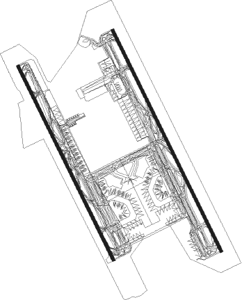
Doha - Doha Hamad Intl
Airport details
| Country | Qatar |
| State | QATAR |
| Region | OT |
| Airspace | Bahrain Ctr |
| Municipality | Doha |
| Elevation | 13ft (4m) |
| Timezone | GMT +3 |
| Coordinates | 25.27456, 51.60838 |
| Magnetic var | |
| Type | land |
| Available since | X-Plane v10.40 |
| ICAO code | OTHH |
| IATA code | DOH |
| FAA code | n/a |
Communication
| Doha Hamad Intl ATIS | 126.850 |
| Doha Hamad Intl Clearance DEL | 118.375 |
| Doha Hamad Intl Ground Control | 121.875 |
| Doha Hamad Intl Ground Control | 121.675 |
| Doha Hamad Intl Tower | 118.025 |
| Doha Hamad Intl Tower | 118.525 |
Approach frequencies
| ILS-cat-III | RW34R | 110.1 | 18.00mi |
| ILS-cat-III | RW34L | 111.9 | 18.00mi |
| ILS-cat-III | RW16L | 108.7 | 18.00mi |
| ILS-cat-III | RW16R | 108.1 | 18.00mi |
| 3° GS | RW34R | 110.1 | 18.00mi |
| 3° GS | RW34L | 111.9 | 18.00mi |
| 3° GS | RW16L | 108.7 | 18.00mi |
| 3° GS | RW16R | 108.1 | 18.00mi |
Runway info
Runway 16L / 34R  | ||
| length | 4864m (15958ft) | |
| bearing | 156° / 336° | |
| width | 60m (197ft) | |
| surface | asphalt | |
| blast zone | 255m (837ft) / 255m (837ft) | |
| Runway 16R / 34L | ||
| length | 4264m (13990ft) | |
| bearing | 156° / 336° | |
| width | 60m (197ft) | |
| surface | asphalt | |
| blast zone | 255m (837ft) / 255m (837ft) | |
Nearby beacons
| code | identifier | dist | bearing | frequency |
|---|---|---|---|---|
| DOH | DOHA/HAMAD INTL VOR/DME | 1.4 | 177° | 114.40 |
| DIA | DOHA INTL VOR/DME | 2.9 | 218° | 112.40 |
| WK | DOHA INTL NDB | 5.6 | 185° | 323 |
| ALD | AL UDEID VORTAC | 18.8 | 237° | 115.20 |
Departure and arrival routes
| Transition altitude | 13000ft |
| Transition level | 15000ft |
| SID end points | distance | outbound heading | |
|---|---|---|---|
| RW16L | |||
| ALVE1M | 41mi | 24° | |
| VAXI1M | 48mi | 62° | |
| ALSE1M | 61mi | 81° | |
| NAML1M | 53mi | 101° | |
| BUND1M | 51mi | 107° | |
| LOXU1M | 16mi | 143° | |
| SALW1M | 59mi | 269° | |
| PATO1M | 45mi | 337° | |
| RW16R | |||
| ALVE1C | 41mi | 24° | |
| VAXI1C | 48mi | 62° | |
| ALSE1C | 61mi | 81° | |
| NAML1C | 53mi | 101° | |
| BUND1C | 51mi | 107° | |
| LOXU1C | 16mi | 143° | |
| SALW1C | 59mi | 269° | |
| PATO1C | 45mi | 337° | |
| RW34L | |||
| ALVE1W | 41mi | 24° | |
| VAXI1W | 48mi | 62° | |
| ALSE1W | 61mi | 81° | |
| NAML1W | 53mi | 101° | |
| BUND1W | 51mi | 107° | |
| SALW1W | 59mi | 269° | |
| PATO1Z, PATO1W | 45mi | 337° | |
| MUXO1W | 14mi | 357° | |
| RW34R | |||
| ALVE1E | 41mi | 24° | |
| VAXI1E | 48mi | 62° | |
| ALSE1E | 61mi | 81° | |
| NAML1E | 53mi | 101° | |
| BUND1E | 51mi | 107° | |
| SALW1E | 59mi | 269° | |
| PATO1E | 45mi | 337° | |
| MUXO1E | 14mi | 357° | |
| STAR starting points | distance | inbound heading | |
|---|---|---|---|
| RW16L | |||
| GINT1P | 29.1 | 89° | |
| BAYA1P | 17.0 | 224° | |
| AFNA1P | 25.1 | 300° | |
| RW16R | |||
| GINT1F | 29.1 | 89° | |
| BAYA1F | 17.0 | 224° | |
| AFNA1F | 25.1 | 300° | |
| RW34L | |||
| GINT1L | 29.1 | 89° | |
| BAYA1L | 17.0 | 224° | |
| AFNA1L | 25.1 | 300° | |
| RW34R | |||
| GINT1R | 29.1 | 89° | |
| BAYA1R | 17.0 | 224° | |
| AFNA1R | 25.1 | 300° | |
Instrument approach procedures
| runway | airway (heading) | route (dist, bearing) |
|---|---|---|
| RW16L | IVANI (177°) | IVANI 5000ft TOVAN (5mi, 250°) 3000ft |
| RW16L | ODBIP (156°) | ODBIP 5000ft TOVAN (5mi, 150°) 3000ft |
| RW16L | TANDO (136°) | TANDO 5000ft TOVAN (6mi, 70°) 3000ft |
| RNAV | TOVAN 3000ft HH601 (5mi, 156°) 3000ft OTHH (10mi, 159°) 63ft HH602 (2mi, 141°) GENOT (13mi, 68°) 4000ft GENOT (turn) 4000ft | |
| RW16R | IVANI (177°) | IVANI 5000ft GOLSI (6mi, 250°) 3000ft |
| RW16R | ODBIP (156°) | ODBIP 5000ft GOLSI (5mi, 163°) 3000ft |
| RW16R | TANDO (136°) | TANDO 5000ft GOLSI (5mi, 70°) 3000ft |
| RNAV | GOLSI 3000ft HH501 (5mi, 156°) 3000ft OTHH (11mi, 153°) 63ft HH502 (2mi, 176°) VEKIS (14mi, 189°) PURVA (11mi, 76°) ASLEB (11mi, 33°) GENOT (7mi, 353°) 2000ft GENOT (turn) 3000ft | |
| RW34L | DANIK (358°) | DANIK 5000ft IMKAT (5mi, 70°) 3000ft |
| RW34L | EMUNA (336°) | EMUNA 5000ft IMKAT (5mi, 330°) 3000ft |
| RW34L | MUXED (316°) | MUXED 5000ft IMKAT (6mi, 250°) 3000ft |
| RNAV | IMKAT 3000ft HH801 (5mi, 336°) 3000ft OTHH (10mi, 340°) 63ft HH802 (2mi, 319°) DARTU (5mi, 320°) 2500ft SIVOT (6mi, 320°) 5000ft BUBOD (8mi, 74°) TATSA (10mi, 107°) GENOT (7mi, 141°) 5000ft GENOT (turn) 5000ft | |
| RW34R | DANIK (358°) | DANIK 5000ft LAGMA (6mi, 70°) 3000ft |
| RW34R | EMUNA (336°) | EMUNA 5000ft LAGMA (5mi, 343°) 3000ft |
| RW34R | MUXED (316°) | MUXED 5000ft LAGMA (5mi, 250°) 3000ft |
| RNAV | LAGMA 3000ft HH901 (5mi, 336°) 3000ft OTHH (11mi, 333°) 63ft HH902 (2mi, 356°) GOMBO (14mi, 36°) GENOT (11mi, 146°) 4000ft GENOT (turn) 4000ft |
Holding patterns
| STAR name | hold at | type | turn | heading* | altitude | leg | speed limit |
|---|---|---|---|---|---|---|---|
| AFNA1F | AFNAN | VHF | right | 88 (268)° | 15000ft - 22000ft | 1.5min timed | 240 |
| AFNA1L | AFNAN | VHF | right | 88 (268)° | 15000ft - 22000ft | 1.5min timed | 240 |
| AFNA1P | AFNAN | VHF | right | 88 (268)° | 15000ft - 22000ft | 1.5min timed | 240 |
| AFNA1R | AFNAN | VHF | right | 88 (268)° | 15000ft - 22000ft | 1.5min timed | 240 |
| BAYA1F | BAYAN | VHF | left | 49 (229)° | 15000ft - 24000ft | 1.5min timed | 240 |
| BAYA1L | BAYAN | VHF | left | 49 (229)° | 15000ft - 24000ft | 1.5min timed | 240 |
| BAYA1P | BAYAN | VHF | left | 49 (229)° | 15000ft - 24000ft | 1.5min timed | 240 |
| BAYA1R | BAYAN | VHF | left | 49 (229)° | 15000ft - 24000ft | 1.5min timed | 240 |
| GINT1F | GINTO | VHF | right | 267 (87)° | 15000ft - 21000ft | 1.5min timed | 240 |
| GINT1L | GINTO | VHF | right | 267 (87)° | 15000ft - 21000ft | 1.5min timed | 240 |
| GINT1P | GINTO | VHF | right | 267 (87)° | 15000ft - 21000ft | 1.5min timed | 240 |
| GINT1R | GINTO | VHF | right | 267 (87)° | 15000ft - 21000ft | 1.5min timed | 240 |
| *) magnetic outbound (inbound) holding course | |||||||
Disclaimer
The information on this website is not for real aviation. Use this data with the X-Plane flight simulator only! Data taken with kind consent from X-Plane 12 source code and data files. Content is subject to change without notice.