Nagasaki
Airport details
| Country | Japan |
| State | Nagasaki Prefecture |
| Region | RJ |
| Airspace | Fukuoka Ctr |
| Municipality | Omura |
| Elevation | 15ft (5m) |
| Timezone | GMT +9 |
| Coordinates | 32.93600, 129.92935 |
| Magnetic var | |
| Type | land |
| Available since | X-Plane v10.40 |
| ICAO code | RJFU |
| IATA code | NGS |
| FAA code | n/a |
Communication
| Nagasaki ATIS | 126.850 |
| Nagasaki Ground Control | 121.600 |
| Nagasaki Tower | 118.500 |
| Nagasaki Tower | 122.700 |
| Nagasaki Tower | 126.200 |
| Nagasaki Approach | 119.175 |
| Nagasaki Approach | 121.025 |
| Nagasaki Departure | 121.000 |
Approach frequencies
| ILS-cat-I | RW32 | 110.9 | 18.00mi |
| 3° GS | RW32 | 110.9 | 18.00mi |
Nearby Points of Interest:
Nagasaki
-Narutaki-juku
-Nagasaki Kunchi
-Dejima
-Former British Consulate, Nagasaki
-Former Latin Divinity School, Nagasaki
-Shitsu Church
-Ōno Village
-Kosuge Slip Dock
-Ōno Church
-Takashima Coal Mine
-Hara Castle
-Port of Miike
-Takashima Kouzaki Site
-Nijinomatsubara
-Kurokoshima
-Saiwai Bridge
-Yoshinogari site
-Mount Yasuman
-Karatsu Bay
-Eta Funayama Kofun
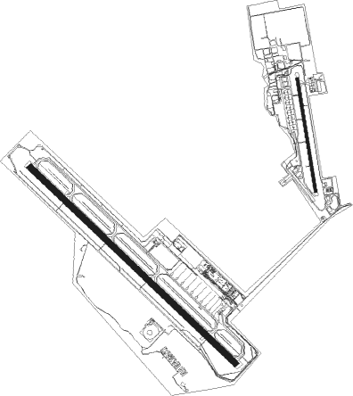
Runway info
Runway 14 / 32  | ||
| length | 3000m (9843ft) | |
| bearing | 133° / 313° | |
| width | 61m (200ft) | |
| surface | asphalt | |
| blast zone | 61m (200ft) / 61m (200ft) | |
| Runway 18 / 36 | ||
| length | 1202m (3944ft) | |
| bearing | 174° / 354° | |
| width | 30m (98ft) | |
| surface | asphalt | |
Nearby beacons
| code | identifier | dist | bearing | frequency |
|---|---|---|---|---|
| JBT | OMURA TACAN | 0.6 | 164° | 114.05 |
| MNE | MINOSHIMA VOR/DME | 1.1 | 216° | 116.30 |
| OLE | NAGASAKI VOR/DME | 1.9 | 200° | 116.60 |
| SGE | SAGA VOR/DME | 22.3 | 60° | 114.75 |
| AKE | AMAKUSA VOR/DME | 29.7 | 153° | 113.45 |
| KUE | KUMAMOTO VOR/DME | 46.4 | 96° | 112.80 |
| IKE | IKI (IKISHIMA) VOR/DME | 49.3 | 349° | 113.20 |
| DGC | FUKUOKA VORTAC | 50 | 32° | 114.50 |
| AHT | ASHIYA TACAN | 67.5 | 37° | 108.60 |
Departure and arrival routes
| Transition altitude | 14000ft |
| Transition level | 14000ft |
| SID end points | distance | outbound heading | |
|---|---|---|---|
| RW14 | |||
| CHIKU4 | 160mi | 73° | |
| SOUTH7 | 49mi | 137° | |
| NORTH9 | 49mi | 349° | |
| RW32 | |||
| CHIKU4 | 160mi | 73° | |
| SOUTH7 | 49mi | 137° | |
| NORTH9 | 49mi | 349° | |
| STAR starting points | distance | inbound heading | |
|---|---|---|---|
| ALL | |||
| FUBUKI, SARUKU | 26.8 | 212° | |
Instrument approach procedures
| runway | airway (heading) | route (dist, bearing) |
|---|---|---|
| RW14 | IORIE (128°) | IORIE 3000ft TENBO (5mi, 133°) 2400ft |
| RW14 | KOHNO (104°) | KOHNO 3000ft TENBO (5mi, 53°) 2400ft |
| RW14 | SARUK (155°) | SARUK 3700ft TENBO (5mi, 233°) 2400ft |
| RNAV | TENBO 2400ft OMRAN (4mi, 133°) 1600ft RJFU (5mi, 119°) 64ft ETARI (13mi, 139°) KOHNO (23mi, 302°) 3000ft KOHNO (turn) 3000ft |
Holding patterns
| STAR name | hold at | type | turn | heading* | altitude | leg | speed limit |
|---|---|---|---|---|---|---|---|
| FUBUKI | TAKAK | VHF | right | 10 (190)° | 5000ft - 14000ft | 1.0min timed | 210 |
| *) magnetic outbound (inbound) holding course | |||||||
Disclaimer
The information on this website is not for real aviation. Use this data with the X-Plane flight simulator only! Data taken with kind consent from X-Plane 12 source code and data files. Content is subject to change without notice.