Busan - Gimhae
Airport details
| Country | South Korea |
| State | Busan Gwang'yeogsi |
| Region | RK |
| Airspace | Incheon Ctr |
| Municipality | Busan |
| Elevation | 13ft (4m) |
| Timezone | GMT +9 |
| Coordinates | 35.18056, 128.93805 |
| Magnetic var | |
| Type | land |
| Available since | X-Plane v10.40 |
| ICAO code | RKPK |
| IATA code | PUS |
| FAA code | n/a |
Communication
| Gimhae ATIS | 126.600 |
| Gimhae DLVRY | 121.725 |
| Gimhae Ground Control | 121.900 |
| Gimhae Tower | 118.450 |
| Gimhae Tower | 118.100 |
| Gimhae ARR | 119.200 |
| Gimhae ARR | 134.400 |
| Gimhae Approach | 125.500 |
| Gimhae Departure | 125.500 |
Approach frequencies
| ILS-cat-II | RW36L | 108.5 | 18.00mi |
| ILS-cat-I | RW36R | 109.5 | 18.00mi |
| 3° GS | RW36R | 109.5 | 18.00mi |
| 3° GS | RW36L | 108.5 | 18.00mi |
Nearby Points of Interest:
Busanjinjiseong
-Yongdusan Park
-Chungnyeolsa
-United Nations Memorial Cemetery
-Dongsam-dong Shell Midden
-Taejongdae
-Gijang Japanese Castle
-Haman Marisan Tumuli
-Bangudae Petroglyphs
-Cheonjeon-ri petroglyphs
-Changnyeong Gyo-dong and Songhyeon-dong Tumuli
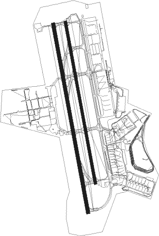
Runway info
Runway 18R / 36L  | ||
| length | 3203m (10509ft) | |
| bearing | 173° / 353° | |
| width | 60m (197ft) | |
| surface | concrete | |
| displ threshold | 600m (1969ft) / 0m (0ft) | |
| blast zone | 255m (837ft) / 255m (837ft) | |
| Runway 18L / 36R | ||
| length | 2746m (9009ft) | |
| bearing | 173° / 353° | |
| width | 46m (151ft) | |
| surface | concrete | |
| blast zone | 255m (837ft) / 255m (837ft) | |
Nearby beacons
| code | identifier | dist | bearing | frequency |
|---|---|---|---|---|
| KHE | KIMHAE (BUSAN) TACAN | 0.5 | 89° | 117 |
| KMH | GIMHAE VOR/DME | 1.1 | 353° | 113.80 |
| PSN | BUSAN VORTAC | 4.6 | 133° | 114 |
| US | ULSAN NDB | 31.2 | 46° | 335 |
| USN | ULSAN VOR/DME | 32.3 | 45° | 111.40 |
| TGU | DALSEONG VORTAC | 41.4 | 331° | 112.20 |
| SCN | SACHEON TACAN | 42.5 | 265° | 110 |
| SAC | SACHEON (CHINJU) VOR/DME | 42.6 | 265° | 115.10 |
| DOC | DONGCHON VOR/DME | 45.7 | 338° | 116.50 |
| NPH | NAVY (POHANG) VORTAC | 53.5 | 30° | 109.60 |
| KPO | POHANG VORTAC | 54.5 | 34° | 112.50 |
| VCE | TSUSHIMA VOR/DME | 57.4 | 156° | 111.45 |
Departure and arrival routes
| Transition altitude | 14000ft |
| Transition level | 14000ft |
| SID end points | distance | outbound heading | |
|---|---|---|---|
| RW18 (ALL) | |||
| BAHDA1, ULSUK3 | 33mi | 227° | |
| RW18L | |||
| BURIM2 | 33mi | 227° | |
| RW18R | |||
| BURIM2 | 33mi | 227° | |
| RW36 (ALL) | |||
| ATLAX2 | 13mi | 37° | |
| BEVSI3, OPONO2, SOORO1 | 33mi | 227° | |
| STAR starting points | distance | inbound heading | |
|---|---|---|---|
| RW18 (ALL) | |||
| GAYHA2 | 15.2 | 98° | |
| RW36 (ALL) | |||
| KEVOX2 | 14.2 | 51° | |
| PEDLO1 | 15.0 | 314° | |
Instrument approach procedures
| runway | airway (heading) | route (dist, bearing) |
|---|---|---|
| RW36L | KEVOX (51°) | KEVOX 6000ft PK711 (6mi, 114°) 5000ft AKEVI (6mi, 85°) 3300ft |
| RW36L | PEDLO (314°) | PEDLO 7000ft AKEVI (9mi, 265°) 3300ft |
| RNAV | AKEVI 3300ft OLMOG (5mi, 353°) 2100ft PK722 (3mi, 353°) 1200ft IKESI (3mi, 353°) 382ft PK723 (3mi, 353°) OPONO (12mi, 298°) 6000ft GAYHA (7mi, 229°) KEVOX (13mi, 155°) 6000ft KEVOX (turn) 10000ft | |
| RW36R | KEVOX (51°) | KEVOX 6000ft PK711 (6mi, 114°) 5000ft BOSPI (6mi, 85°) 3300ft |
| RW36R | PEDLO (314°) | PEDLO 7000ft BOSPI (9mi, 265°) 3300ft |
| RNAV | BOSPI 3300ft NEIAN (5mi, 353°) 2100ft PK712 (3mi, 353°) 1200ft IDIVU (2mi, 353°) 471ft PK713 (3mi, 353°) OPONO (12mi, 298°) 6000ft GAYHA (7mi, 229°) 6000ft KEVOX (13mi, 155°) 6000ft KEVOX (turn) 10000ft | |
| RWNVB | GAYHA (98°) | GAYHA 6000ft OVTUS (7mi, 171°) 5000ft NOORI (8mi, 122°) 4000ft PK731 (3mi, 43°) 3500ft |
| RNAV | PK731 3500ft WAYBI (3mi, 43°) 2600ft ZIKKO (4mi, 43°) 1700ft PK733 (10mi, 43°) 3500ft PK734 (11mi, 302°) 6000ft GAYHA (15mi, 229°) 6000ft GAYHA (turn) 10000ft |
Holding patterns
| STAR name | hold at | type | turn | heading* | altitude | leg | speed limit |
|---|---|---|---|---|---|---|---|
| GAYHA2 | GAYHA | VHF | right | 90 (270)° | 6000ft - 10000ft | 1.0min timed | 210 |
| KEVOX2 | KEVOX | VHF | right | 230 (50)° | 6000ft - 10000ft | DME 5.0mi | 230 |
| PEDLO1 | PEDLO | VHF | right | 92 (272)° | 7000ft - 10000ft | DME 5.0mi | 230 |
| *) magnetic outbound (inbound) holding course | |||||||
Disclaimer
The information on this website is not for real aviation. Use this data with the X-Plane flight simulator only! Data taken with kind consent from X-Plane 12 source code and data files. Content is subject to change without notice.