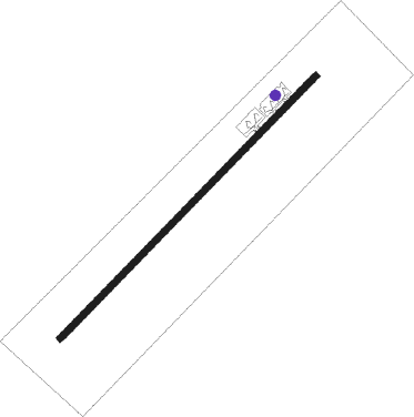
Kalibo
Airport details
| Country | Philippines |
| State | Aklan |
| Region | RP |
| Airspace | Manila Ctr |
| Municipality | Kalibo |
| Elevation | 14ft (4m) |
| Timezone | GMT +8 |
| Coordinates | 11.68036, 122.37647 |
| Magnetic var | |
| Type | land |
| Available since | X-Plane v10.40 |
| ICAO code | RPVK |
| IATA code | KLO |
| FAA code | n/a |
Communication
| Kalibo CTAF | 121.900 |
| Kalibo Tower | 124.200 |
Nearby beacons
| code | identifier | dist | bearing | frequency |
|---|---|---|---|---|
| KL | KALIBO NDB | 0.4 | 48° | 298 |
| KLO | KALIBO VOR/DME | 0.4 | 65° | 113 |
| RXT | ROXAS TACAN | 22.4 | 102° | 113.30 |
| ROX | ROXAS VOR/DME | 22.8 | 102° | 112.90 |
| CAT | DME | 28.6 | 300° | 113.40 |
| CT | CATICLAN NDB | 28.6 | 300° | 379 |
| IOO | ILOILO VOR/DME | 51.2 | 172° | 116.30 |
| BCD | BACOLOD VOR/DME | 66.2 | 145° | 115.30 |
Departure and arrival routes
| Transition altitude | 11000ft |
| Transition level | 13000ft |
| SID end points | distance | outbound heading | |
|---|---|---|---|
| RW05 | |||
| SAGR2P | 43mi | 14° | |
| ROX3A | 23mi | 102° | |
| BUNG2P | 37mi | 123° | |
| GALI2P, GALI3G | 28mi | 144° | |
| BUSO3C | 30mi | 172° | |
| TAPE3A | 52mi | 321° | |
| MINO3C, MINO2P | 42mi | 348° | |
| RW23 | |||
| SAGR4R, SAGR2R | 43mi | 14° | |
| ROX3B | 23mi | 102° | |
| BUNG2R | 37mi | 123° | |
| GALI2R, GALI3H | 28mi | 144° | |
| BUSO3D | 30mi | 172° | |
| TAPE3B | 52mi | 321° | |
| MINO4R, MINO3D, MINO2R | 42mi | 348° | |
| STAR starting points | distance | inbound heading | |
|---|---|---|---|
| RW05 | |||
| TAPE1A | 52.2 | 141° | |
| ATRI1B | 40.2 | 298° | |
| GALI1A | 28.0 | 324° | |
| BUSO1A | 29.5 | 352° | |
| RW23 | |||
| TAPE1R | 52.2 | 141° | |
| ATRI1R | 40.2 | 298° | |
| NASA1R, NASA3R | 34.9 | 308° | |
| BUSO1R | 29.5 | 352° | |
Instrument approach procedures
| runway | airway (heading) | route (dist, bearing) |
|---|---|---|
| RW05-X | VK500 (225°) | VK500 8000ft VK501 (10mi, 212°) 5000ft VK612 (3mi, 206°) VK613 (9mi, 206°) VK615 (5mi, 257°) 2800ft VK616 (4mi, 344°) 2800ft |
| RW05-X | VK600 (351°) | VK600 5500ft VK504 (8mi, 291°) VK615 (3mi, 341°) 2800ft VK616 (4mi, 344°) 2800ft |
| RNAV | VK616 2800ft VK618 (3mi, 34°) 2400ft RPVK (7mi, 49°) 82ft (7305mi, 265°) 800ft VK500 (7312mi, 84°) 4000ft VK500 (turn) 4000ft | |
| RW05-Y | VK600 (351°) | VK600 5500ft VK504 (8mi, 291°) VK506 (5mi, 347°) 2600ft |
| RNAV | VK506 2600ft VK507 (3mi, 4°) 2100ft VK508 (2mi, 27°) 2100ft RPVK (7mi, 49°) 82ft (7305mi, 265°) 800ft VK500 (7312mi, 84°) 4000ft VK500 (turn) 4000ft | |
| RW05-Z | VK500 (225°) | VK500 8000ft VK501 (10mi, 212°) 5000ft VK502 (3mi, 212°) VK503 (7mi, 212°) 2100ft |
| RNAV | VK503 2100ft VK507 (5mi, 287°) 2100ft VK508 (2mi, 27°) 2100ft RPVK (7mi, 49°) 82ft (7305mi, 265°) 800ft VK500 (7312mi, 84°) 4000ft VK500 (turn) 4000ft | |
| RW23 | BARRY (194°) | BARRY 4000ft VK23A (8mi, 139°) 2400ft |
| RW23 | BIBIT (263°) | BIBIT 4000ft VK23A (7mi, 318°) 2400ft |
| RNAV | VK23A 2400ft VK23B (5mi, 229°) 1900ft RPVK (6mi, 229°) 68ft (7305mi, 265°) 1000ft BIBIT (7317mi, 85°) 4000ft BIBIT (turn) 4000ft |
Holding patterns
| STAR name | hold at | type | turn | heading* | altitude | leg | speed limit |
|---|---|---|---|---|---|---|---|
| ATRI1B | VK600 | VHF | right | 102 (282)° | 5500ft - 10000ft | 1.0min timed | 230 |
| ATRI1R | BIBIT | VHF | left | 140 (320)° | 4000ft - 11000ft | 1.0min timed | 230 |
| BUSO1A | VK600 | VHF | right | 102 (282)° | 5500ft - 10000ft | 1.0min timed | 230 |
| BUSO1R | BIBIT | VHF | left | 140 (320)° | 4000ft - 11000ft | 1.0min timed | 230 |
| GALI1A | VK600 | VHF | right | 102 (282)° | 5500ft - 10000ft | 1.0min timed | 230 |
| NASA1R | BIBIT | VHF | left | 140 (320)° | 4000ft - 11000ft | 1.0min timed | 230 |
| NASA3R | BIBIT | VHF | left | 140 (320)° | 4000ft - 11000ft | 1.0min timed | 230 |
| TAPE1A | VK500 | VHF | right | 32 (212)° | 4000ft - 14000ft | 1.0min timed | 230 |
| TAPE1R | BARRY | VHF | right | 320 (140)° | 4000ft - 11000ft | 1.0min timed | 230 |
| *) magnetic outbound (inbound) holding course | |||||||
Disclaimer
The information on this website is not for real aviation. Use this data with the X-Plane flight simulator only! Data taken with kind consent from X-Plane 12 source code and data files. Content is subject to change without notice.
