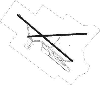
Curitiba - Afonso Pena
Airport details
| Country | Brazil |
| State | Paraná |
| Region | SB |
| Airspace | Curitiba Ctr |
| Municipality | São José dos Pinhais |
| Elevation | 2984ft (910m) |
| Timezone | GMT -3 |
| Coordinates | -25.53167, -49.17611 |
| Magnetic var | |
| Type | land |
| Available since | X-Plane v10.30 |
| ICAO code | SBCT |
| IATA code | CWB |
| FAA code | n/a |
Communication
| Afonso Pena ATIS | 127.800 |
| Afonso Pena Ground Control | 121.900 |
| Afonso Pena CURITIBA Tower | 118.550 |
| Afonso Pena CURITIBA Approach | 119.950 |
| Afonso Pena CURITIBA Approach | 120.650 |
| Afonso Pena CURITIBA Approach | 129.550 |
Approach frequencies
| ILS-cat-II | RW15 | 109.3 | 18.00mi |
| ILS-cat-I | RW33 | 110.3 | 18.00mi |
| 3° GS | RW15 | 109.3 | 18.00mi |
| 3° GS | RW33 | 110.3 | 18.00mi |
Nearby Points of Interest:
Jockey Club do Paraná
-Casa Emílio Romani
-Palácio da Liberdade (Curitiba)
-Paço da Liberdade
-Paraná Public Library
-Casa Barão do Serro Azul
-Antigo Palácio Wolff
-Palácio Garibaldi
-Graciosa State Park
-Antigo Engenho de Mate da Rondinha
-Ponte do Rio dos Papagaios
-Sede da Fazenda Cancela
-Casa Elfrida Lobo

Nearby beacons
| code | identifier | dist | bearing | frequency |
|---|---|---|---|---|
| CTB | CURITIBA VOR/DME | 0.4 | 92° | 116.50 |
| BCH | BACACHERI NDB | 8.2 | 338° | 300 |
| LAA | DME | 35 | 247° | 117.70 |
| PGA | DME | 35 | 91° | 114.10 |
| JNV | JOINVILLE VOR/DME | 46.2 | 151° | 115.10 |
| PGR | GROSSA NDB | 56.6 | 290° | 275 |
Departure and arrival routes
| Transition altitude | 6000ft |
| SID end points | distance | outbound heading | |
|---|---|---|---|
| RW15 | |||
| ANRE1A | 45mi | 18° | |
| SUPL1A | 27mi | 131° | |
| DAGI1A | 47mi | 208° | |
| RORI1A | 100mi | 302° | |
| RW33 | |||
| OPMU1B | 45mi | 18° | |
| DAGI1B | 47mi | 208° | |
| GEGI1B | 40mi | 290° | |
| STAR starting points | distance | inbound heading | |
|---|---|---|---|
| RW15 | |||
| MUDA2A | 58.4 | 65° | |
| MATK2A | 55.0 | 159° | |
| RAXI1A | 104.8 | 233° | |
| ISNI2A | 69.8 | 343° | |
| RW33 | |||
| MUDA1B | 58.4 | 65° | |
| MATK1B | 55.0 | 159° | |
| RAXI1B | 104.8 | 233° | |
| ISNI1B | 69.8 | 343° | |
Instrument approach procedures
| runway | airway (heading) | route (dist, bearing) |
|---|---|---|
| RW11 | CT029 (70°) | CT029 7000ft CT031 (6mi, 24°) 5500ft |
| RW11 | CT042 (92°) | CT042 7000ft CT031 (6mi, 92°) 5500ft |
| RW11 | CT093 (115°) | CT093 7000ft CT031 (6mi, 160°) 5500ft |
| RNAV | CT031 5500ft CT032 (5mi, 92°) 4620ft SBCT (5mi, 94°) 3024ft (3234mi, 63°) 4000ft DUBRI (3225mi, 242°) 7000ft DUBRI (turn) 7000ft | |
| RW15-Z | DODRA (104°) | DODRA 7000ft TEDUG (6mi, 47°) 5500ft |
| RW15-Z | SIBUM (132°) | SIBUM 7000ft TEDUG (6mi, 132°) 5500ft |
| RW15-Z | SOVTA (163°) | SOVTA 7000ft TEDUG (6mi, 227°) 5500ft |
| RNAV | TEDUG 5500ft PULAR (5mi, 132°) 4620ft SBCT (6mi, 133°) 3022ft (3234mi, 63°) 3400ft CT053 (3229mi, 242°) TEKES (22mi, 76°) 6000ft TEKES (turn) 6000ft | |
| RW29 | CT094 (271°) | CT094 7200ft CT056 (6mi, 272°) 5800ft |
| RW29 | CT096 (293°) | CT096 7200ft CT056 (6mi, 340°) 5800ft |
| RW29 | CT097 (249°) | CT097 7200ft CT098 (3mi, 204°) 6500ft CT056 (3mi, 204°) 5800ft |
| RNAV | CT056 5800ft CT099 (2mi, 272°) 5500ft CT057 (3mi, 272°) 4620ft SBCT (6mi, 270°) 3014ft (3234mi, 63°) 4500ft BACOR (3246mi, 243°) 7200ft BACOR (turn) 7200ft | |
| RW33-Z | ALGUD (342°) | ALGUD 7000ft OPVIS (6mi, 47°) 5500ft |
| RW33-Z | EDSUR (283°) | EDSUR 7000ft OPVIS (6mi, 227°) 5500ft |
| RNAV | OPVIS 5500ft CT059 (3mi, 312°) 4900ft BUVBA (2mi, 312°) 4620ft SBCT (6mi, 310°) 3037ft (3234mi, 63°) 3800ft VUPAB (3247mi, 243°) 6000ft VUPAB (turn) 6000ft |
Holding patterns
| STAR name | hold at | type | turn | heading* | altitude | leg | speed limit |
|---|---|---|---|---|---|---|---|
| MATK1B | CT072 | VHF | left | 14 (194)° | 1.0min timed | ICAO rules | |
| MATK2A | CT072 | VHF | left | 14 (194)° | 1.0min timed | ICAO rules | |
| MUDA1B | GERKA | VHF | left | 252 (72)° | 1.0min timed | ICAO rules | |
| RAXI1A | UREBA | VHF | right | 83 (263)° | 1.0min timed | ICAO rules | |
| RAXI1B | ISREM | VHF | left | 83 (263)° | 1.0min timed | ICAO rules | |
| *) magnetic outbound (inbound) holding course | |||||||
Disclaimer
The information on this website is not for real aviation. Use this data with the X-Plane flight simulator only! Data taken with kind consent from X-Plane 12 source code and data files. Content is subject to change without notice.