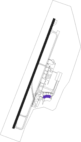
Concepcion - Carriel Sur
Airport details
| Country | Chile |
| State | Biobío Region |
| Region | SC |
| Airspace | Santiago Ctr |
| Municipality | Talcahuano |
| Elevation | 22ft (7m) |
| Timezone | GMT -4 |
| Coordinates | -36.77139, -73.06250 |
| Magnetic var | |
| Type | land |
| Available since | X-Plane v10.40 |
| ICAO code | SCIE |
| IATA code | CCP |
| FAA code | n/a |
Communication
| Carriel Sur Ground Control | 121.900 |
| Carriel Sur Concepcion Tower | 118.600 |
| Carriel Sur Concepcion Approach | 120.500 |
Approach frequencies
| ILS-cat-III | RW02 | 109.9 | 18.00mi |
| 3° GS | RW02 | 109.9 | 18.00mi |
Nearby beacons
| code | identifier | dist | bearing | frequency |
|---|---|---|---|---|
| CAR | CONCEPCION VOR/DME | 1 | 31° | 114.30 |
| MAD | LOS ANGELES VOR/DME | 48.8 | 135° | 116.30 |
Departure and arrival routes
| Transition altitude | 3500ft |
| SID end points | distance | outbound heading | |
|---|---|---|---|
| RW02 | |||
| SOST3L, SOST2J | 61mi | 26° | |
| LODO4M, LODO3J | 61mi | 50° | |
| VUMI2J, VUMI3L | 31mi | 79° | |
| PANE2J, PANE3M | 60mi | 182° | |
| RW02R | |||
| SOST2J, SOST3L | 61mi | 26° | |
| LODO4M, LODO3J | 61mi | 50° | |
| VUMI3L, VUMI2J | 31mi | 79° | |
| PANE3M, PANE2J | 60mi | 182° | |
| RW20 | |||
| DEXO2J | 61mi | 5° | |
| ESID2J | 61mi | 17° | |
| SOST4M, SOST2K | 61mi | 26° | |
| LODO4N, LODO3K | 61mi | 50° | |
| VUMI4M, VUMI2K | 31mi | 79° | |
| PANE2L, PANE3N | 60mi | 182° | |
| RW20L | |||
| DEXO2J | 61mi | 5° | |
| ESID2J | 61mi | 17° | |
| SOST4M, SOST2K | 61mi | 26° | |
| LODO4N, LODO3K | 61mi | 50° | |
| VUMI2K, VUMI4M | 31mi | 79° | |
| PANE2L, PANE3N | 60mi | 182° | |
| STAR starting points | distance | inbound heading | |
|---|---|---|---|
| RW02 | |||
| PANE5B, PANE6A | 59.7 | 2° | |
| ESID2A | 61.1 | 197° | |
| SOST6D | 61.1 | 206° | |
| ARUN6E | 61.1 | 215° | |
| VUMI6C | 30.5 | 259° | |
| ANGO5A, ANGO5C | 56.8 | 339° | |
| RW02R | |||
| PANE5B, PANE6A | 59.7 | 2° | |
| ESID2A | 61.1 | 197° | |
| SOST6D | 61.1 | 206° | |
| ARUN6E | 61.1 | 215° | |
| VUMI6C | 30.5 | 259° | |
| ANGO5C, ANGO5A | 56.8 | 339° | |
| RW20 | |||
| PANE5C | 59.7 | 2° | |
| SOST5C, SOST5A | 61.1 | 206° | |
| ARUN6C | 61.1 | 215° | |
| VUMI4B | 30.5 | 259° | |
| ANGO4B | 56.8 | 339° | |
| RW20L | |||
| PANE5C | 59.7 | 2° | |
| SOST5A, SOST5C | 61.1 | 206° | |
| ARUN6C | 61.1 | 215° | |
| VUMI4B | 30.5 | 259° | |
| ANGO4B | 56.8 | 339° | |
Instrument approach procedures
| runway | airway (heading) | route (dist, bearing) |
|---|---|---|
| RW02-Y | DAPSO (30°) | DAPSO 3500ft |
| RNAV | DAPSO 3500ft PANOV (8mi, 30°) 1700ft IE030 (2mi, 30°) 1020ft SCIE (4mi, 30°) 86ft ARTEN (12mi, 30°) 3500ft ARTEN (turn) 3500ft | |
| RW02-Z | DAPSO (30°) | DAPSO 3500ft |
| RNAV | DAPSO 3500ft PANOV (8mi, 30°) 1700ft SCIE (6mi, 30°) 86ft (4595mi, 63°) 3500ft ARTEN (4588mi, 243°) 3500ft ARTEN (turn) 3500ft | |
| RW02RW | DAPSO (30°) | DAPSO 3500ft |
| RNAV | DAPSO 3500ft IE051 (8mi, 31°) 1700ft IE031 (2mi, 30°) 1020ft SCIE (3mi, 28°) 72ft (4595mi, 63°) 1000ft ARTEN (4588mi, 243°) 3500ft ARTEN (turn) 3500ft | |
| RW20LY | ARTEN (210°) | ARTEN 3500ft |
| RW20LY | DAMIP (238°) | DAMIP 3500ft ARTEN (6mi, 291°) 3500ft |
| RW20LY | RODUT (210°) | RODUT 3500ft ARTEN (6mi, 210°) 3500ft |
| RNAV | ARTEN 3500ft IE050 (6mi, 209°) 1700ft SCIE (6mi, 211°) 65ft (4595mi, 63°) 1000ft DAPSO (4603mi, 243°) 3500ft DAPSO (turn) 3500ft | |
| RW20 | ARTEN (210°) | ARTEN 3500ft |
| RW20 | DAMIP (238°) | DAMIP 3500ft ARTEN (6mi, 291°) 3500ft |
| RW20 | RODUT (210°) | RODUT 3500ft ARTEN (6mi, 210°) 3500ft |
| RNAV | ARTEN 3500ft SIDIV (6mi, 210°) 1700ft SCIE (6mi, 210°) 79ft DAPSO (14mi, 210°) 3500ft DAPSO (turn) 3500ft |
Disclaimer
The information on this website is not for real aviation. Use this data with the X-Plane flight simulator only! Data taken with kind consent from X-Plane 12 source code and data files. Content is subject to change without notice.
