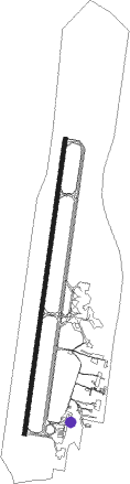
Asunción - Silvio Pettirossi Intl
Airport details
| Country | Paraguay |
| State | Central Department |
| Region | SG |
| Airspace | Asuncion Ctr |
| Municipality | Luque |
| Elevation | 291ft (89m) |
| Timezone | GMT -4 |
| Coordinates | -25.24109, -57.51683 |
| Magnetic var | |
| Type | land |
| Available since | X-Plane v10.40 |
| ICAO code | SGAS |
| IATA code | ASU |
| FAA code | n/a |
Communication
| Silvio Pettirossi Intl Ground | 121.900 |
| Silvio Pettirossi Intl Asuncion Tower | 118.100 |
| Silvio Pettirossi Intl Ascuncion Approach | 119.700 |
| Silvio Pettirossi Intl Ascuncion Approach | 120.000 |
Approach frequencies
| ILS-cat-I | RW20 | 109.5 | 18.00mi |
| 3° GS | RW20 | 109.5 | 18.00mi |
Nearby beacons
| code | identifier | dist | bearing | frequency |
|---|---|---|---|---|
| VAS | ASUNCION VOR/DME | 0.3 | 239° | 115.90 |
| FSA | FORMOSA VOR/DME | 69.6 | 216° | 115.60 |
Departure and arrival routes
| Transition altitude | 3000ft |
| SID end points | distance | outbound heading | |
|---|---|---|---|
| RW02 | |||
| ICORA | 50mi | 34° | |
| ROCIO, ROLOK | 50mi | 97° | |
| ITAPE | 50mi | 145° | |
| UPOVA | 50mi | 172° | |
| EDRAV | 70mi | 181° | |
| ARPAS | 35mi | 216° | |
| KALOM | 35mi | 275° | |
| SUSRU | 50mi | 299° | |
| ORUMA, UKELA | 50mi | 315° | |
| OBLUM | 50mi | 330° | |
| RW20 | |||
| ICORA | 50mi | 34° | |
| ROLOK, ROCIO | 50mi | 97° | |
| ITAPE | 50mi | 145° | |
| KONTO | 92mi | 172° | |
| EDRAV | 70mi | 181° | |
| ARPAS | 35mi | 216° | |
| KALOM | 35mi | 275° | |
| SUSRU | 50mi | 299° | |
| ORUMA, UKELA | 50mi | 315° | |
| OBLUM | 50mi | 330° | |
| STAR starting points | distance | inbound heading | |
|---|---|---|---|
| RW02 | |||
| SAMGU | 96.9 | 1° | |
| ISAGU | 100.1 | 126° | |
| PUGNA | 100.2 | 135° | |
| VUPIR | 100.2 | 145° | |
| DEVOS | 99.5 | 263° | |
| ESDIM | 99.6 | 277° | |
| KONTO | 91.8 | 352° | |
| RW20 | |||
| SAMGU | 96.9 | 1° | |
| ISAGU | 100.1 | 126° | |
| PUGNA | 100.2 | 135° | |
| VUPIR | 100.2 | 145° | |
| DEVOS | 99.5 | 263° | |
| ESDIM | 99.6 | 277° | |
| KONTO | 91.8 | 352° | |
Instrument approach procedures
| runway | airway (heading) | route (dist, bearing) |
|---|---|---|
| RW02-Z | ATESO (14°) | ATESO 3000ft VURDO (7mi, 14°) 1930ft |
| RW02-Z | MULSO (338°) | MULSO 3000ft VURDO (7mi, 281°) 1930ft |
| RW02-Z | TELIT (49°) | TELIT 3000ft VURDO (7mi, 101°) 1930ft |
| RNAV | VURDO 1930ft OSUNU (5mi, 14°) 1930ft 25THR (3mi, 14°) 1140ft SGAS (3mi, 16°) 340ft (3660mi, 66°) 3000ft MULSO (3659mi, 246°) 3000ft MULSO (turn) 3000ft | |
| RW20-Z | BIVAL (164°) | BIVAL 3000ft LONEL (7mi, 120°) 1890ft |
| RW20-Z | LITUM (193°) | LITUM 3000ft LONEL (7mi, 194°) 1890ft |
| RW20-Z | PAKOR (227°) | PAKOR 3000ft LONEL (7mi, 281°) 1890ft |
| RNAV | LONEL 1890ft BURVA (5mi, 194°) 1890ft 25TH2 (3mi, 194°) 1095ft SGAS (3mi, 191°) 299ft (3660mi, 66°) 3000ft PAKOR (3649mi, 246°) 3000ft PAKOR (turn) 3000ft |
Holding patterns
| STAR name | hold at | type | turn | heading* | altitude | leg | speed limit |
|---|---|---|---|---|---|---|---|
| DEVOS | DEVOS | VHF | right | 83 (263)° | 1.0min timed | ICAO rules | |
| ESDIM | ESDIM | VHF | left | 111 (291)° | 1.0min timed | ICAO rules | |
| ISAGU | ISAGU | VHF | right | 330 (150)° | 1.0min timed | ICAO rules | |
| KONTO | KONTO | VHF | right | 162 (342)° | 1.0min timed | ICAO rules | |
| PUGNA | PUGNA | VHF | right | 347 (167)° | 1.0min timed | ICAO rules | |
| SAMGU | SAMGU | VHF | left | 194 (14)° | 1.0min timed | ICAO rules | |
| VUPIR | VUPIR | VHF | right | 3 (183)° | 1.0min timed | ICAO rules | |
| *) magnetic outbound (inbound) holding course | |||||||
Disclaimer
The information on this website is not for real aviation. Use this data with the X-Plane flight simulator only! Data taken with kind consent from X-Plane 12 source code and data files. Content is subject to change without notice.