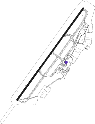
Barranquilla - Ernesto Cortissoz Intl
Airport details
| Country | Colombia |
| State | Atlántico |
| Region | SK |
| Airspace | Barranquilla Ctr |
| Municipality | Soledad |
| Elevation | 98ft (30m) |
| Timezone | GMT -5 |
| Coordinates | 10.89225, -74.77282 |
| Magnetic var | |
| Type | land |
| Available since | X-Plane v10.40 |
| ICAO code | SKBQ |
| IATA code | BAQ |
| FAA code | n/a |
Communication
| Ernesto Cortissoz Intl ATIS | 127.500 |
| Ernesto Cortissoz Intl MET | 125.000 |
| Ernesto Cortissoz Intl Barranquilla Information | 124.850 |
| Ernesto Cortissoz Intl Ernesto Cortissoz Tower SMC | 121.900 |
| Ernesto Cortissoz Intl Ernesto Cortissoz Tower | 118.100 |
| Ernesto Cortissoz Intl Barranquilla App North | 119.100 |
| Ernesto Cortissoz Intl Barranquilla ACC North | 128.400 |
| Ernesto Cortissoz Intl Barranquilla ACC South | 124.200 |
Approach frequencies
| ILS-cat-I | RW05 | 109.9 | 18.00mi |
| 3° GS | RW05 | 109.9 | 18.00mi |
Nearby Points of Interest:
Barranquilla's Carnival
-Saint-Roch Church
-Teatro Amira de la Rosa
-Museum of Poet Julio Florez
-Ciénaga Grande de Santa Marta
Nearby beacons
| code | identifier | dist | bearing | frequency |
|---|---|---|---|---|
| BAQ | BARRANQUILLA VOR/DME | 7.7 | 222° | 113.70 |
| STA | SANTA MARTA VOR/DME | 31.6 | 82° | 116.60 |
| CT | CARTAGENA NDB | 52.9 | 236° | 255 |
| CTG | CARTAGENA VOR/DME | 59.6 | 227° | 112.30 |
Departure and arrival routes
| Transition altitude | 18000ft |
| Transition level | 19000ft |
| SID end points | distance | outbound heading | |
|---|---|---|---|
| RW05 | |||
| EVPI1A | 63mi | 4° | |
| EDRE2A | 44mi | 7° | |
| TIGR1A | 58mi | 47° | |
| ENTI1C | 38mi | 66° | |
| STA3C | 32mi | 82° | |
| VUMB1B | 29mi | 103° | |
| EGOK1B | 29mi | 120° | |
| UMKI1B | 34mi | 143° | |
| DARN2B | 47mi | 162° | |
| ISOT2B | 59mi | 171° | |
| NINL1A | 193mi | 180° | |
| VOVL1B | 84mi | 183° | |
| UGRE1A | 73mi | 199° | |
| UGSO1A | 79mi | 207° | |
| CTG2E | 60mi | 227° | |
| VARO2D | 58mi | 279° | |
| KAKU1A | 55mi | 327° | |
| MORG2C | 49mi | 338° | |
| STAR starting points | distance | inbound heading | |
|---|---|---|---|
| ALL | |||
| VOVL2A | 83.7 | 3° | |
| KAKU1B | 55.4 | 147° | |
| MORG3A | 49.4 | 158° | |
| ENTI2A | 38.2 | 246° | |
| STA5A | 31.6 | 262° | |
| ISOT4A | 58.7 | 351° | |
| RW05 | |||
| LOLU1A | 56.6 | 10° | |
| CZU1B | 98.2 | 18° | |
| UGSO1D | 78.9 | 27° | |
| CTG1A | 59.6 | 47° | |
| VARO1C | 57.9 | 99° | |
| KAKU1C | 55.4 | 147° | |
| MORG1B | 49.4 | 158° | |
| EDRE1B | 44.0 | 187° | |
| ENTI1B | 38.2 | 246° | |
| STA2B | 31.6 | 262° | |
| VUMB1A | 28.5 | 283° | |
| EGOK1A | 28.8 | 300° | |
| UMKI1A | 33.9 | 323° | |
| DARN1A | 46.5 | 342° | |
Instrument approach procedures
| runway | airway (heading) | route (dist, bearing) |
|---|---|---|
| RW05 | EROLA (42°) | EROLA 3000ft |
| RW05 | GIKTI (68°) | GIKTI 4000ft EROLA (6mi, 130°) 3000ft |
| RW05 | VALOP (15°) | VALOP 4000ft EROLA (6mi, 310°) 3000ft |
| RNAV | EROLA 3000ft NUVUP (5mi, 41°) 2000ft BQ402 (3mi, 41°) 1000ft SKBQ (4mi, 44°) 157ft (4508mi, 98°) 1200ft OPSUR (4512mi, 278°) 4000ft OPSUR (turn) 4000ft | |
| RW23 | ASIVI (190°) | ASIVI 4000ft MIKID (6mi, 131°) 2400ft |
| RW23 | UKEKI (220°) | UKEKI 4000ft MIKID (6mi, 221°) 2400ft |
| RW23 | VUBON (249°) | VUBON 4000ft MIKID (6mi, 311°) 2400ft |
| RNAV | MIKID 2400ft SAVRI (5mi, 221°) 1690ft SD23 (2mi, 221°) 900ft SKBQ (3mi, 215°) 103ft (4508mi, 98°) 660ft KOSVA (4511mi, 278°) 5000ft KOSVA (turn) 5000ft |
Disclaimer
The information on this website is not for real aviation. Use this data with the X-Plane flight simulator only! Data taken with kind consent from X-Plane 12 source code and data files. Content is subject to change without notice.