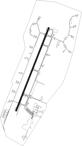
Taldykorgan
Airport details
| Country | Kazakhstan |
| State | Jetisu Region |
| Region | UA |
| Airspace | Almaty Ctr |
| Municipality | Eskeldi District |
| Elevation | 1943ft (592m) |
| Timezone | GMT +6 |
| Coordinates | 45.11109, 78.43807 |
| Magnetic var | |
| Type | land |
| Available since | X-Plane v10.40 |
| ICAO code | UAAT |
| IATA code | TDK |
| FAA code | n/a |
Communication
| Taldykorgan ATC Taldykorgan Tower | 127.300 |
Nearby beacons
| code | identifier | dist | bearing | frequency |
|---|---|---|---|---|
| TDK | TALDYKORGAN VOR/DME | 0.4 | 239° | 116.10 |
| T | TALDYKORGAN NDB | 0.5 | 230° | 625 |
| K | TALDYKORGAN NDB | 1.9 | 30° | 625 |
| TK | TALDYKORGAN NDB | 2 | 219° | 303 |
| KR | TALDYKORGAN NDB | 3.8 | 33° | 303 |
Departure and arrival routes
| Transition altitude | 10000ft |
| SID end points | distance | outbound heading | |
|---|---|---|---|
| RW02 | |||
| BESL3E, BESL3A | 81mi | 35° | |
| LUSO3A, LUSO3E | 53mi | 64° | |
| MIPL3A, MIPL3E | 43mi | 212° | |
| DIPE4A, DIPE4E | 34mi | 299° | |
| RW20 | |||
| BESL3F, BESL3B | 81mi | 35° | |
| LUSO3B, LUSO3F | 53mi | 64° | |
| MIPL3B, MIPL3F | 43mi | 212° | |
| DIPE4B, DIPE4F | 34mi | 299° | |
| STAR starting points | distance | inbound heading | |
|---|---|---|---|
| RW02 | |||
| MIPL3C, MIPL3G | 42.6 | 32° | |
| DIPE4C, DIPE4G | 34.2 | 119° | |
| BESL3C, BESL3G | 80.5 | 215° | |
| LUSO3G, LUSO3C | 52.8 | 244° | |
| RW20 | |||
| MIPL3H, MIPL3D | 42.6 | 32° | |
| DIPE4D, DIPE4H | 34.2 | 119° | |
| BESL3H, BESL3D | 80.5 | 215° | |
| LUSO3D, LUSO3H | 52.8 | 244° | |
Holding patterns
| STAR name | hold at | type | turn | heading* | altitude | leg | speed limit |
|---|---|---|---|---|---|---|---|
| BESL3C | T | NDB | right | 116 (296)° | > 4000ft | 1.0min timed | ICAO rules |
| BESL3D | K | NDB | left | 53 (233)° | > 4000ft | 1.0min timed | ICAO rules |
| BESL3G | TDK | NDB | right | 21 (201)° | > 7000ft | 1.0min timed | ICAO rules |
| BESL3H | TDK | NDB | right | 21 (201)° | > 7000ft | 1.0min timed | ICAO rules |
| DIPE4C | T | NDB | right | 116 (296)° | > 4000ft | 1.0min timed | ICAO rules |
| DIPE4D | K | NDB | left | 53 (233)° | > 4000ft | 1.0min timed | ICAO rules |
| DIPE4G | TDK | NDB | right | 21 (201)° | > 7000ft | 1.0min timed | ICAO rules |
| DIPE4H | TDK | NDB | right | 21 (201)° | > 7000ft | 1.0min timed | ICAO rules |
| LUSO3C | T | NDB | right | 116 (296)° | > 4000ft | 1.0min timed | ICAO rules |
| LUSO3D | K | NDB | left | 53 (233)° | > 4000ft | 1.0min timed | ICAO rules |
| LUSO3G | TDK | NDB | right | 21 (201)° | > 7000ft | 1.0min timed | ICAO rules |
| LUSO3H | TDK | NDB | right | 21 (201)° | > 7000ft | 1.0min timed | ICAO rules |
| MIPL3C | T | NDB | right | 116 (296)° | > 4000ft | 1.0min timed | ICAO rules |
| MIPL3D | K | NDB | left | 53 (233)° | > 4000ft | 1.0min timed | ICAO rules |
| MIPL3G | TDK | NDB | right | 21 (201)° | > 7000ft | 1.0min timed | ICAO rules |
| MIPL3H | TDK | NDB | right | 21 (201)° | > 7000ft | 1.0min timed | ICAO rules |
| *) magnetic outbound (inbound) holding course | |||||||
Disclaimer
The information on this website is not for real aviation. Use this data with the X-Plane flight simulator only! Data taken with kind consent from X-Plane 12 source code and data files. Content is subject to change without notice.