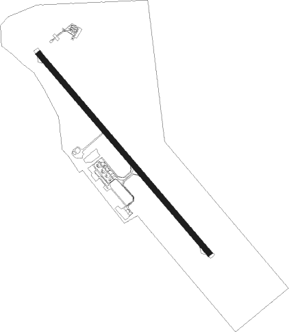
Kaluga
Airport details
| Country | Russian Federation |
| State | Kaluga Oblast |
| Region | UU |
| Airspace | Moscow Ctr |
| Municipality | Kaluga |
| Elevation | 666ft (203m) |
| Timezone | GMT +3 |
| Coordinates | 54.54839, 36.36693 |
| Magnetic var | |
| Type | land |
| Available since | X-Plane v10.40 |
| ICAO code | UUBC |
| IATA code | KLF |
| FAA code | n/a |
Communication
| Kaluga ATIS | 126.800 |
| Kaluga Tower | 120.300 |
Approach frequencies
| ILS-cat-I | RW31 | 111.7 | 18.00mi |
| 3° GS | RW31 | 111.7 | 18.00mi |
Nearby Points of Interest:
The Chizhevsky House Museum
-Church of Saint Nicholas in Kozinka
-Yakovlev house
-Kaluga Svyato-Lavrentiev friary
-Kaluga Puppet Theater for Young Spectators
-Church of the Intercession on the Moat
-Church of Saint George za verkhom
-Assembly of the Nobility (Kaluga)
-Uspensky monastery, Ilyinskoye
Nearby beacons
| code | identifier | dist | bearing | frequency |
|---|---|---|---|---|
| KLG | KALUGA VOR/DME | 0.2 | 38° | 114 |
| WI | GRABTSEVO (KALUGA) NDB | 1.1 | 316° | 286 |
| FR | GRABTSEVO (KALUGA) NDB | 1.2 | 123° | 286 |
| IN | SUKHOTINO NDB | 33.4 | 86° | 10.550 |
| WZ | KAMENKA NDB | 45.8 | 43° | 230 |
| IKM | DME | 45.9 | 43° | 111.60 |
| DR | SKURYGINO NDB | 52.6 | 56° | 415 |
| GD | MALOYE SKURATOVO NDB | 63.3 | 145° | 975 |
| KU | DME | 63.3 | 145° | 115.20 |
Departure and arrival routes
| Transition altitude | 2635ft |
| SID end points | distance | outbound heading | |
|---|---|---|---|
| RW13 | |||
| OTPA1L, OTPA1F, OTPA1D | 34mi | 147° | |
| OBAR1D, OBAR1F, OBAR1L, OBAR1N | 33mi | 242° | |
| BAMD1D, BAMD1F, BAMD1L | 28mi | 279° | |
| RW31 | |||
| OTPA1H, OTPA1G, OTPA1M | 34mi | 147° | |
| OBAR1M, OBAR1H, OBAR1G | 33mi | 242° | |
| BAMD1M, BAMD1G, BAMD1H | 28mi | 279° | |
| STAR starting points | distance | inbound heading | |
|---|---|---|---|
| ALL | |||
| OBAR1A | 32.5 | 62° | |
| BAMD1A | 27.8 | 99° | |
| GITI1A | 13.0 | 135° | |
| SOTO1A | 14.7 | 237° | |
| OTPA1A | 34.4 | 327° | |
| RW13 | |||
| OBAR1E, OBAR1B | 32.5 | 62° | |
| BAMD1B, BAMD1E | 27.8 | 99° | |
| GITI1E, GITI1B | 13.0 | 135° | |
| SOTO1E, SOTO1B | 14.7 | 237° | |
| OTPA1E, OTPA1B | 34.4 | 327° | |
| RW31 | |||
| OBAR1K, OBAR1C | 32.5 | 62° | |
| BAMD1C, BAMD1K | 27.8 | 99° | |
| GITI1K, GITI1C | 13.0 | 135° | |
| SOTO1K, SOTO1C | 14.7 | 237° | |
| OTPA1K, OTPA1C | 34.4 | 327° | |
Instrument approach procedures
| runway | airway (heading) | route (dist, bearing) |
|---|---|---|
| RW13 | BC513 (175°) | BC513 2500ft BC413 (6mi, 247°) 2000ft |
| RW13 | BC613 (113°) | BC613 2500ft BC413 (5mi, 89°) 2000ft |
| RNAV | BC413 2000ft BC213 (5mi, 128°) 2000ft UUBC (5mi, 130°) 716ft (3733mi, 214°) 1070ft BC014 (3732mi, 34°) BC813 (8mi, 24°) 2200ft BC513 (10mi, 309°) 2500ft | |
| RW31 | BC431 (348°) | BC431 2300ft BC331 (6mi, 67°) 2000ft |
| RW31 | BC631 (284°) | BC631 2300ft BC331 (6mi, 247°) 2000ft |
| RW31 | BC831 (308°) | BC831 2300ft BC331 (6mi, 309°) 2000ft |
| RNAV | BC331 2000ft BC231 (6mi, 309°) 2000ft SDF31 (2mi, 308°) 1300ft UUBC (3mi, 306°) 671ft (3733mi, 214°) 1070ft BC034 (3734mi, 34°) BC913 (11mi, 101°) 2100ft BC631 (5mi, 129°) 2300ft |
Holding patterns
| STAR name | hold at | type | turn | heading* | altitude | leg | speed limit |
|---|---|---|---|---|---|---|---|
| BAMD1A | KLG | NDB | right | 134 (314)° | > 2300ft | 1.0min timed | 230 |
| BAMD1B | WI | FIX | right | 134 (314)° | > 2300ft | 1.0min timed | 230 |
| BAMD1C | FR | FIX | right | 134 (314)° | > 2300ft | 1.0min timed | 230 |
| GITI1A | KLG | NDB | right | 134 (314)° | > 2300ft | 1.0min timed | 230 |
| GITI1B | WI | FIX | right | 134 (314)° | > 2300ft | 1.0min timed | 230 |
| GITI1C | FR | FIX | right | 134 (314)° | > 2300ft | 1.0min timed | 230 |
| GITI1E | BC813 | VHF | right | 134 (314)° | > 2200ft | 1.0min timed | 230 |
| GITI1K | BC913 | VHF | left | 314 (134)° | > 2100ft | 1.0min timed | 230 |
| OBAR1A | KLG | NDB | right | 134 (314)° | > 2300ft | 1.0min timed | 230 |
| OBAR1B | WI | FIX | right | 134 (314)° | > 2300ft | 1.0min timed | 230 |
| OBAR1C | FR | FIX | right | 134 (314)° | > 2300ft | 1.0min timed | 230 |
| OTPA1A | KLG | NDB | right | 134 (314)° | > 2300ft | 1.0min timed | 230 |
| OTPA1B | WI | FIX | right | 134 (314)° | > 2300ft | 1.0min timed | 230 |
| OTPA1C | FR | FIX | right | 134 (314)° | > 2300ft | 1.0min timed | 230 |
| OTPA1E | BC813 | VHF | right | 134 (314)° | > 2200ft | 1.0min timed | 230 |
| SOTO1A | KLG | NDB | right | 134 (314)° | > 2300ft | 1.0min timed | 230 |
| SOTO1B | WI | FIX | right | 134 (314)° | > 2300ft | 1.0min timed | 230 |
| SOTO1C | FR | FIX | right | 134 (314)° | > 2300ft | 1.0min timed | 230 |
| SOTO1E | BC813 | VHF | right | 134 (314)° | > 2200ft | 1.0min timed | 230 |
| SOTO1K | BC913 | VHF | left | 314 (134)° | > 2100ft | 1.0min timed | 230 |
| *) magnetic outbound (inbound) holding course | |||||||
Disclaimer
The information on this website is not for real aviation. Use this data with the X-Plane flight simulator only! Data taken with kind consent from X-Plane 12 source code and data files. Content is subject to change without notice.