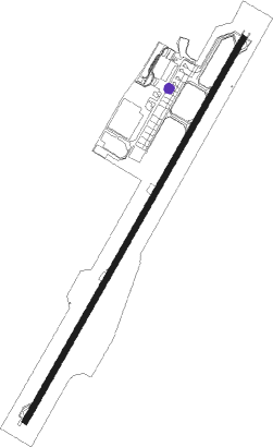
Langkawi - Langkawi Intl
Airport details
| Country | Malaysia |
| State | Kedah |
| Region | WM |
| Airspace | Kuala Lumpur Ctr |
| Municipality | Langkawi |
| Elevation | 25ft (8m) |
| Timezone | GMT +8 |
| Coordinates | 6.33945, 99.73356 |
| Magnetic var | |
| Type | land |
| Available since | X-Plane v10.40 |
| ICAO code | WMKL |
| IATA code | LGK |
| FAA code | n/a |
Communication
| Langkawi Intl ATIS | 128.200 |
| Langkawi Intl Ground Control | 121.800 |
| Langkawi Intl Tower | 118.500 |
| Langkawi Intl Approach | 119.400 |
| Langkawi Intl Departure | 119.400 |
Approach frequencies
| ILS-cat-I | RW03 | 110.7 | 18.00mi |
| 3° GS | RW03 | 110.7 | 18.00mi |
Nearby beacons
| code | identifier | dist | bearing | frequency |
|---|---|---|---|---|
| VPL | LANGKAWI VOR/DME | 1.1 | 39° | 114.10 |
| AT | ALOR STAR NDB | 39.5 | 106° | 385 |
| VAS | ALOR SETAR VOR/DME | 40.6 | 103° | 113.60 |
| HTY | HAT YAI VOR/DME | 52.9 | 48° | 115.30 |
| VBT | BUTTERWORTH VORTAC | 65 | 143° | 113.30 |
| SK | SONGKHLA NDB | 72.7 | 46° | 410 |
| SKL | SONGKHLA VOR/DME | 72.7 | 46° | 113.50 |
Departure and arrival routes
| Transition altitude | 11000ft |
| Transition level | 13000ft |
| SID end points | distance | outbound heading | |
|---|---|---|---|
| RW21 | |||
| MULO1D | 41mi | 103° | |
| MULO1B | 18mi | 126° | |
| ISTE1D, ISTE1B | 84mi | 134° | |
| ANDO1D, ANDO1B | 25mi | 140° | |
| KAPK1B, KAPK1D | 26mi | 152° | |
| RUVT1B, RUVT1D | 76mi | 162° | |
| AKRA1D, AKRA1B | 111mi | 291° | |
| STAR starting points | distance | inbound heading | |
|---|---|---|---|
| RW03 | |||
| AKRA1G | 110.7 | 111° | |
| AKRA1E | 24.5 | 113° | |
| VPL1G, SAGE1G | 40.6 | 283° | |
| KAPK1E | 25.9 | 332° | |
| KAPK1G, DAKO1E | 71.0 | 334° | |
Instrument approach procedures
| runway | airway (heading) | route (dist, bearing) |
|---|---|---|
| RW03-Y | AGTOV (54°) | AGTOV 3000ft IBIRO (5mi, 104°) 2100ft |
| RW03-Y | DAKOV (34°) | DAKOV 3000ft IBIRO (7mi, 33°) 2100ft |
| RW03-Y | RIGSU (14°) | RIGSU 3000ft IBIRO (5mi, 324°) 2100ft |
| RNAV | IBIRO 2100ft KL501 (3mi, 34°) 2100ft WMKL (8mi, 34°) 66ft GUDNO (12mi, 110°) SATNI (10mi, 207°) 3000ft | |
| RW03-Z | DAKOV (34°) | DAKOV 3000ft VIKEM (5mi, 32°) 2100ft LEBUK (9mi, 34°) 1100ft |
| RW03-Z | KAPKO (332°) | KAPKO 4200ft SUNOG (19mi, 313°) 2100ft KL430 (2mi, 328°) 1800ft LEBUK (4mi, 1°) 1100ft |
| RNAV | LEBUK 1100ft WMKL (5mi, 33°) 69ft KL412 (turn) KL418 (5mi, 101°) 3000ft SATNI (12mi, 168°) 3000ft |
Holding patterns
| STAR name | hold at | type | turn | heading* | altitude | leg | speed limit |
|---|---|---|---|---|---|---|---|
| DAKO1E | DAKOV | VHF | left | 214 (34)° | > 3000ft | 1.0min timed | 230 |
| *) magnetic outbound (inbound) holding course | |||||||
Disclaimer
The information on this website is not for real aviation. Use this data with the X-Plane flight simulator only! Data taken with kind consent from X-Plane 12 source code and data files. Content is subject to change without notice.