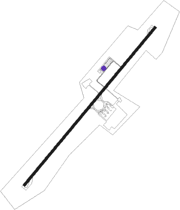
Kuala Terengganu - Kuala Terengganu Sultan Mahmud
Airport details
| Country | Malaysia |
| State | Terengganu |
| Region | WM |
| Airspace | Kuala Lumpur Ctr |
| Municipality | Kuala Nerus |
| Elevation | 20ft (6m) |
| Timezone | GMT +8 |
| Coordinates | 5.38619, 103.10339 |
| Magnetic var | |
| Type | land |
| Available since | X-Plane v10.40 |
| ICAO code | WMKN |
| IATA code | TGG |
| FAA code | n/a |
Communication
| Kuala Terengganu Sultan Mahmud TERENGGANU Ground Control | 121.600 |
| Kuala Terengganu Sultan Mahmud TERENGGANU Tower | 123.600 |
Approach frequencies
| ILS-cat-I | RW04 | 108.1 | 18.00mi |
| 3° GS | RW04 | 108.1 | 18.00mi |
Nearby beacons
| code | identifier | dist | bearing | frequency |
|---|---|---|---|---|
| VKT | KUALA TERENGGANU VOR/DME | 0 | 189° | 115.40 |
| VKR | KUALA TERENGGANU VOR/DME | 2 | 220° | 112.90 |
| VGK | GONG KEDAK VORTAC | 44.7 | 303° | 116.60 |
| VKP | KERTEH VOR/DME | 54.8 | 159° | 113.30 |
| VKB | KOTA BHARU VOR/DME | 66.3 | 315° | 112.30 |
Departure and arrival routes
| Transition altitude | 11000ft |
| Transition level | 13000ft |
| SID end points | distance | outbound heading | |
|---|---|---|---|
| RW04 | |||
| IKUKOC | 23mi | 18° | |
| GUNBOC | 35mi | 208° | |
| LASOBA, LASOBC | 27mi | 246° | |
| PALNOA, PALNOC | 28mi | 265° | |
| RW22 | |||
| IKUKOD | 23mi | 18° | |
| LASOBB | 32mi | 238° | |
| LASOBD | 27mi | 246° | |
| PALNOB, PALNOD | 28mi | 265° | |
| STAR starting points | distance | inbound heading | |
|---|---|---|---|
| RW04 | |||
| GUNBOE, GUNBOG | 35.1 | 28° | |
| PALNOE, PALNOG | 27.7 | 85° | |
| RW22 | |||
| GUNBOH, GUNBOF | 35.1 | 28° | |
| PALNOF, PALNOH | 27.7 | 85° | |
| IKUKOH | 23.1 | 198° | |
Instrument approach procedures
| runway | airway (heading) | route (dist, bearing) |
|---|---|---|
| RW04-Y | IDSOD (44°) | IDSOD 3600ft TUSVO (4mi, 44°) 2500ft |
| RNAV | TUSVO 2500ft KN511 (4mi, 44°) 2500ft KN512 (3mi, 44°) 1500ft WMKN (6mi, 43°) 77ft (6189mi, 267°) 1000ft KN513 (6191mi, 87°) MEGUT (16mi, 224°) 5500ft MEGUT (turn) 5500ft | |
| RW04-Z | EMROV (28°) | EMROV 9000ft KN435 (11mi, 25°) 6400ft LANUS (6mi, 25°) 4600ft KN423 (12mi, 25°) 1800ft ABVAD (3mi, 35°) 1000ft |
| RW04-Z | KALSO (44°) | KALSO 4900ft SASVU (7mi, 44°) 2700ft KN408 (4mi, 44°) 2700ft KN404 (3mi, 44°) 1900ft ABVAD (3mi, 44°) 1000ft |
| RW04-Z | OMUNO (326°) | OMUNO 3000ft KN455 (2mi, 215°) 3000ft KN452 (6mi, 263°) 3000ft ABVAD (6mi, 358°) 1000ft |
| RNAV | ABVAD 1000ft WMKN (4mi, 43°) 77ft KN493 (3mi, 47°) KN496 (7mi, 130°) OMUNO (6mi, 215°) 3000ft | |
| RW22-Y | ATKUL (253°) | ATKUL 2500ft ARIMI (5mi, 315°) 1500ft |
| RW22-Y | IKUKO (198°) | IKUKO 6500ft ARIMI (15mi, 182°) 1500ft |
| RW22-Y | POLOS (197°) | POLOS 2500ft ARIMI (5mi, 135°) 1500ft |
| RNAV | ARIMI 1500ft KN406 (4mi, 225°) 1500ft WMKN (5mi, 226°) 70ft (6189mi, 267°) 1500ft KN514 (6184mi, 87°) POLOS (11mi, 44°) 2500ft | |
| RW22-Z | EMROV (28°) | EMROV 11000ft AKNIT (19mi, 41°) 6500ft TELUK (15mi, 35°) 3000ft KN523 (4mi, 35°) 3000ft KN521 (2mi, 18°) 3000ft MOLSA (5mi, 293°) 1000ft |
| RW22-Z | VENEV (225°) | VENEV 1500ft KN504 (5mi, 224°) 1500ft MOLSA (2mi, 224°) 1000ft |
| RNAV | MOLSA 1000ft WMKN (4mi, 227°) 70ft KN593 (5mi, 223°) KN596 (7mi, 130°) TELUK (5mi, 35°) 3000ft |
Disclaimer
The information on this website is not for real aviation. Use this data with the X-Plane flight simulator only! Data taken with kind consent from X-Plane 12 source code and data files. Content is subject to change without notice.
