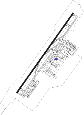
Shantou - Jieyang Chaoshan Intl'
Airport details
| Country | China |
| State | Guangdong Province |
| Region | ZG |
| Airspace | Guangzhou Ctr |
| Municipality | Jiedong County |
| Elevation | 51ft (16m) |
| Timezone | GMT +8 |
| Coordinates | 23.55333, 116.50166 |
| Magnetic var | |
| Type | land |
| Available since | X-Plane v10.40 |
| ICAO code | ZGOW |
| IATA code | SWA |
| FAA code | n/a |
Communication
| Jieyang Chaoshan Intl' ATIS | 126.650 |
| Jieyang Chaoshan Intl' Chaoshan Ground | 130.850 |
| Jieyang Chaoshan Intl' Chaoshan Tower | 118.350 |
| Jieyang Chaoshan Intl' Shantou Approach | 120.650 |
Approach frequencies
| ILS-cat-I | RW22 | 108.7 | 18.00mi |
| ILS-cat-I | RW04 | 109.3 | 18.00mi |
| 3° GS | RW22 | 108.7 | 18.00mi |
| 3° GS | RW04 | 109.3 | 18.00mi |
Nearby Points of Interest:
Former Residence of Ding Richang
-Ancestral Hall of Tan Hiok Nee
-Residence of the Imperial Son Xu
Runway info
| Runway 04 / 22 | ||
| length | 3203m (10509ft) | |
| bearing | 42° / 222° | |
| width | 45m (148ft) | |
| surface | asphalt | |
| blast zone | 60m (197ft) / 100m (328ft) | |
Nearby beacons
| code | identifier | dist | bearing | frequency |
|---|---|---|---|---|
| CSS | CHAOSHAN VOR/DME | 1.7 | 218° | 110.60 |
| JCS | NIULING VOR/DME | 5.6 | 297° | 116.60 |
| SWA | SHANTOU VOR/DME | 16.1 | 113° | 112.60 |
Departure and arrival routes
| Transition altitude | 8858ft |
| SID end points | distance | outbound heading | |
|---|---|---|---|
| RW04 | |||
| DAB9ZD, DAB1ZD | 41mi | 31° | |
| SAP2ZD, SAP8ZD | 36mi | 56° | |
| SWA2ZD, SWA8ZD | 16mi | 113° | |
| DOT2ZD, DOT8ZD | 53mi | 202° | |
| RW22 | |||
| DAB9WD, DAB1WD | 41mi | 31° | |
| SAP2WD, SAP8WD | 36mi | 56° | |
| SWA2WD, SWA8WD | 16mi | 113° | |
| DOT2WD, DOT8WD | 53mi | 202° | |
| STAR starting points | distance | inbound heading | |
|---|---|---|---|
| RW04 | |||
| DOT3ZA, DOT4ZA, DOT8ZA | 53.4 | 22° | |
| DAB1ZA | 40.5 | 211° | |
| SAP2ZA | 36.1 | 236° | |
| SWA2ZA, SWA8ZA | 16.1 | 293° | |
| RW22 | |||
| DOT8WA, DOT2WA | 53.4 | 22° | |
| DAB2WA, DAB1WA | 40.5 | 211° | |
| SAP4WA | 36.1 | 236° | |
| SWA2WA, SWA8WA | 16.1 | 293° | |
Holding patterns
| STAR name | hold at | type | turn | heading* | altitude | leg | speed limit |
|---|---|---|---|---|---|---|---|
| DAB1WA | D006W | VHF | right | 6 (186)° | > 8860ft | 1.0min timed | 205 |
| DAB1WA | JCS | NDB | right | 33 (213)° | > 5910ft | 1.0min timed | 205 |
| DAB1ZA | D006W | VHF | right | 6 (186)° | > 8860ft | 1.0min timed | 205 |
| DAB1ZA | JCS | NDB | right | 33 (213)° | > 5910ft | 1.0min timed | 205 |
| DAB2WA | D006W | VHF | right | 6 (186)° | > 8860ft | 1.0min timed | 205 |
| DAB9WA | OW558 | VHF | right | 6 (186)° | > 8860ft | 1.0min timed | 205 |
| DAB9ZA | JCS | NDB | right | 33 (213)° | > 5910ft | 1.0min timed | 205 |
| DAB9ZA | OW558 | VHF | right | 6 (186)° | > 8860ft | 1.0min timed | 205 |
| DOT2WA | JCS | NDB | right | 33 (213)° | > 5910ft | 1.0min timed | 205 |
| DOT3ZA | JCS | NDB | right | 33 (213)° | > 5910ft | 1.0min timed | 205 |
| DOT8WA | JCS | NDB | right | 33 (213)° | > 5910ft | 1.0min timed | 205 |
| SAP2ZA | JCS | NDB | right | 33 (213)° | > 5910ft | 1.0min timed | 205 |
| SAP3WA | JCS | NDB | right | 33 (213)° | > 5910ft | 1.0min timed | 205 |
| SAP8ZA | JCS | NDB | right | 33 (213)° | > 5910ft | 1.0min timed | 205 |
| SWA2WA | JCS | NDB | right | 33 (213)° | > 5910ft | 1.0min timed | 205 |
| SWA2ZA | JCS | NDB | right | 33 (213)° | > 5910ft | 1.0min timed | 205 |
| SWA8WA | JCS | NDB | right | 33 (213)° | > 5910ft | 1.0min timed | 205 |
| SWA8ZA | JCS | NDB | right | 33 (213)° | > 5910ft | 1.0min timed | 205 |
| *) magnetic outbound (inbound) holding course | |||||||
Disclaimer
The information on this website is not for real aviation. Use this data with the X-Plane flight simulator only! Data taken with kind consent from X-Plane 12 source code and data files. Content is subject to change without notice.