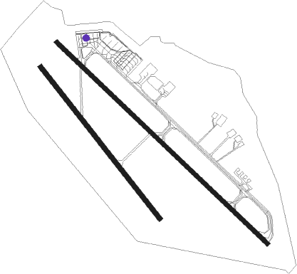
Ulaanbaatar - Buyant-ukhaa Intl
Airport details
| Country | Mongolia |
| State | Ulaanbaatar |
| Region | ZM |
| Airspace | Ulaanbaatar Ctr |
| Elevation | 4362ft (1330m) |
| Timezone | GMT +8 |
| Coordinates | 47.83816, 106.77930 |
| Magnetic var | |
| Type | land |
| Available since | X-Plane v10.40 |
| ICAO code | ZMUB |
| IATA code | ULN |
| FAA code | n/a |
Communication
| Buyant-Ukhaa Intl ATIS | 125.000 |
| Buyant-Ukhaa Intl Buyant-Ukhaa Tower | 132.000 |
| Buyant-Ukhaa Intl Ulaanbatar Approach | 120.000 |
| Buyant-Ukhaa Intl Ulaanbatar Departure | 120.000 |
Approach frequencies
| ILS-cat-I | RW14 | 110.3 | 18.00mi |
| 2.6° GS | RW14 | 110.3 | 18.00mi |
Nearby beacons
| code | identifier | dist | bearing | frequency |
|---|---|---|---|---|
| IM | ULAANBAATAR NDB | 1.9 | 302° | 450 |
| UDA | ULAANBAATAR VOR/DME | 2.5 | 303° | 116 |
| DA | ULAANBAATAR NDB | 3.4 | 304° | 520 |
| SER | SERGELEN VOR/DME | 11.7 | 168° | 116.90 |
Departure and arrival routes
| Transition altitude | 9850ft |
| Transition level | 11800ft |
| SID end points | distance | outbound heading | |
|---|---|---|---|
| RW32 | |||
| ANIK2B, ANIK2E, ANIK2F, ANIK3A | 112mi | 130° | |
| SER2F, SER1B | 12mi | 168° | |
| TANA1B, TANA1F | 38mi | 240° | |
| GERE2A, GERE2E | 74mi | 277° | |
| MODO2E, MODO3A | 118mi | 287° | |
| BUGA2E, BUGA2A | 64mi | 352° | |
Instrument approach procedures
| runway | airway (heading) | route (dist, bearing) |
|---|---|---|
| RW14 | BATUK (104°) | BATUK 8860ft NOMIN (7mi, 59°) 7550ft |
| RW14 | ERDEN (157°) | ERDEN 9850ft NOMIN (7mi, 239°) 7550ft |
| RW14 | MARAL (126°) | MARAL 8860ft NOMIN (7mi, 127°) 7550ft |
| RNAV | NOMIN 7550ft BADAR (5mi, 127°) 6570ft UB14M (5mi, 127°) 4861ft ZMUB (3mi, 124°) BAGAL (8mi, 259°) 6890ft BAGAL (turn) 6890ft |
Disclaimer
The information on this website is not for real aviation. Use this data with the X-Plane flight simulator only! Data taken with kind consent from X-Plane 12 source code and data files. Content is subject to change without notice.

