Baghdad - Baghdad Intl
Airport details
| Country | Iraq |
| State | Baghdad Governorate |
| Region | OR |
| Airspace | Baghdad Ctr |
| Municipality | Baghdad |
| Elevation | 112ft (34m) |
| Timezone | GMT +3 |
| Coordinates | 33.27639, 44.23254 |
| Magnetic var | |
| Type | land |
| Available since | X-Plane v10.32 |
| ICAO code | ORBI |
| IATA code | BGW |
| FAA code | n/a |
Communication
| Baghdad Intl ATIS | 126.925 |
| Baghdad Intl Ground Control | 121.400 |
| Baghdad Intl Tower | 118.900 |
| Baghdad Intl Approach | 122.400 |
| Baghdad Intl Departure | 128.200 |
Approach frequencies
| ILS-cat-I | RW33R | 110.1 | 18.00mi |
| ILS-cat-I | RW15L | 110.7 | 18.00mi |
| 3° GS | RW33R | 110.1 | 18.00mi |
| 3° GS | RW15L | 110.7 | 18.00mi |
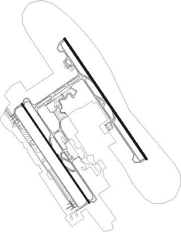
Runway info
Runway 15L / 33R  | ||
| length | 4008m (13150ft) | |
| bearing | 146° / 326° | |
| width | 60m (197ft) | |
| surface | concrete | |
| blast zone | 120m (394ft) / 122m (400ft) | |
| Runway 15R / 33L | ||
| length | 3307m (10850ft) | |
| bearing | 146° / 326° | |
| width | 45m (148ft) | |
| surface | concrete | |
| blast zone | 60m (197ft) / 60m (197ft) | |
Nearby beacons
| code | identifier | dist | bearing | frequency |
|---|---|---|---|---|
| BGD | BAGHDAD VOR/DME | 1 | 335° | 112.90 |
Instrument approach procedures
| runway | airway (heading) | route (dist, bearing) |
|---|---|---|
| RW15R | BOVAB (142°) | BOVAB NORSU (5mi, 145°) 2700ft CR15R (3mi, 145°) 2700ft |
| RW15R | LONOR (307°) | LONOR TOKPI (48mi, 296°) KUPDU (24mi, 325°) NORSU (5mi, 64°) 2700ft CR15R (3mi, 145°) 2700ft |
| RW15R | PARAP (128°) | PARAP NORSU (5mi, 103°) 2700ft CR15R (3mi, 145°) 2700ft |
| RNAV | CR15R 2700ft GIDOM (3mi, 145°) 1800ft ORBI (5mi, 135°) 164ft DATUK (13mi, 150°) 5000ft | |
| RW33L | DATIX (343°) | DATIX DATUK (5mi, 18°) 2700ft CR33L (3mi, 326°) 2700ft |
| RW33L | LONOR (307°) | LONOR MEKBU (41mi, 298°) DATUK (5mi, 326°) 2700ft CR33L (3mi, 326°) 2700ft |
| RW33L | TOKPI (354°) | TOKPI DATUK (5mi, 64°) 2700ft CR33L (3mi, 326°) 2700ft |
| RNAV | CR33L 2700ft DEBNI (3mi, 326°) 1800ft ORBI (7mi, 334°) 161ft NORSU (11mi, 320°) 5000ft |
Disclaimer
The information on this website is not for real aviation. Use this data with the X-Plane flight simulator only! Data taken with kind consent from X-Plane 12 source code and data files. Content is subject to change without notice.