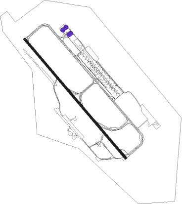
Dhaka - Hazrat Shahjalal International Airport
Airport details
| Country | Bangladesh |
| State | Dhaka Division |
| Region | VG |
| Airspace | Dhaka Ctr |
| Municipality | Dhaka |
| Elevation | 26ft (8m) |
| Timezone | GMT +6 |
| Coordinates | 23.84094, 90.41090 |
| Magnetic var | |
| Type | land |
| Available since | X-Plane v10.40 |
| ICAO code | VGHS |
| IATA code | DAC |
| FAA code | n/a |
Communication
| Hazrat Shahjalal International Airport DHAKA ATIS | 127.400 |
| Hazrat Shahjalal International Airport DHAKA Ground Control | 121.800 |
| Hazrat Shahjalal International Airport DHAKA Tower | 118.300 |
| Hazrat Shahjalal International Airport DHAKA Approach | 121.300 |
Approach frequencies
| ILS-cat-I | RW32 | 108.5 | 18.00mi |
| ILS-cat-I | RW14 | 109.5 | 18.00mi |
| 3° GS | RW32 | 108.5 | 18.00mi |
| 3° GS | RW14 | 109.5 | 18.00mi |
Nearby beacons
| code | identifier | dist | bearing | frequency |
|---|---|---|---|---|
| DCN | DHAKA NDB | 0.3 | 74° | 298 |
| DAC | DHAKA VOR/DME | 1 | 173° | 112.70 |
| DC | TEJGAON NDB | 3.6 | 203° | 252 |
| DA | HAZRAT SHAHJALAL INTL (DHAKA) NDB | 7.1 | 318° | 375 |
| AAT | AGARTALA VOR/DME | 45.5 | 87° | 116.10 |
| AT | AGARTALA NDB | 45.8 | 87° | 237 |
| CML | CUMILLA VOR/DME | 49.3 | 118° | 115.50 |
Departure and arrival routes
| Transition altitude | 4000ft |
| Transition level | 6000ft |
| SID end points | distance | outbound heading | |
|---|---|---|---|
| RW14 | |||
| NIKL1A, NIKLI1 | 34mi | 53° | |
| ADMIL1 | 51mi | 139° | |
| NUPU1A, NUPUR1 | 51mi | 148° | |
| KAKB1A | 51mi | 187° | |
| IKOG1A | 50mi | 239° | |
| IBAN1A | 50mi | 243° | |
| BATE1A | 48mi | 288° | |
| TEGA1A | 38mi | 301° | |
| RW32 | |||
| NIKLI2 | 34mi | 53° | |
| ADMIL2 | 51mi | 139° | |
| NUPUR2 | 51mi | 148° | |
| KAKBO2 | 51mi | 187° | |
| IKOGU2 | 50mi | 239° | |
| IBANU2 | 50mi | 243° | |
| BATEL2 | 48mi | 288° | |
| TEGAK2 | 38mi | 301° | |
Instrument approach procedures
| runway | airway (heading) | route (dist, bearing) |
|---|---|---|
| RW14 | BONSI (111°) | BONSI 3000ft FIRSI (6mi, 56°) 1800ft |
| RW14 | HORIN (140°) | HORIN 3000ft FIRSI (6mi, 142°) 1800ft |
| RW14 | RAJEN (171°) | RAJEN 3000ft FIRSI (6mi, 236°) 1800ft |
| RNAV | FIRSI 1800ft TURAG (4mi, 141°) 1800ft VGHS (7mi, 137°) 77ft (5428mi, 255°) 2000ft KAWLA (5435mi, 75°) 2000ft KAWLA (turn) 2000ft | |
| RW32 | BUXIL (292°) | BUXIL 4000ft PIKUL (6mi, 236°) 1800ft |
| RW32 | PADMA (358°) | PADMA 3000ft PIKUL (6mi, 56°) 1800ft |
| RW32 | TUMPA (323°) | TUMPA 3000ft PIKUL (6mi, 322°) 1800ft |
| RNAV | PIKUL 1800ft MEGHA (4mi, 322°) 1800ft VGHS (6mi, 327°) 77ft (5428mi, 255°) 3000ft KAWLA (5435mi, 75°) 3000ft KAWLA (turn) 3000ft |
Disclaimer
The information on this website is not for real aviation. Use this data with the X-Plane flight simulator only! Data taken with kind consent from X-Plane 12 source code and data files. Content is subject to change without notice.
