Sydney - Sydney Kingsford Smith Intl
Airport details
| Country | Australia |
| State | New South Wales |
| Region | YM |
| Airspace | Melbourne Ctr |
| Municipality | Sydney |
| Elevation | 20ft (6m) |
| Timezone | GMT +10 |
| Coordinates | -33.93967, 151.19167 |
| Magnetic var | |
| Type | land |
| Available since | X-Plane v10.40 |
| ICAO code | YSSY |
| IATA code | SYD |
| FAA code | n/a |
Communication
| Sydney Kingsford Smith Intl ATIS | 126.250 |
| Sydney Kingsford Smith Intl CLD | 133.800 |
| Sydney Kingsford Smith Intl Ground Control (E of RWY 16R/34L) | 121.700 |
| Sydney Kingsford Smith Intl Ground Control (W of RWY 16R/34L) | 126.500 |
| Sydney Kingsford Smith Intl Tower (RWYs 16R/34L & 07/25) | 120.500 |
| Sydney Kingsford Smith Intl Tower (RWY 16L/34R) | 124.700 |
| Sydney Kingsford Smith Intl Approach N/E | 124.400 |
| Sydney Kingsford Smith Intl PRM E (Monitor) | 133.950 |
| Sydney Kingsford Smith Intl Approach S/W | 128.300 |
| Sydney Kingsford Smith Intl PRM W (Monitor) | 119.450 |
| Sydney Kingsford Smith Intl DIR E | 125.300 |
| Sydney Kingsford Smith Intl DIR W | 126.100 |
| Sydney Kingsford Smith Intl Departure N/E | 123.000 |
| Sydney Kingsford Smith Intl Departure S/W/NW | 129.700 |
Approach frequencies
| ILS-cat-II | RW16L | 110.9 | 18.00mi |
| ILS-cat-II | RW34L | 110.1 | 18.00mi |
| ILS-cat-II | RW16R | 109.5 | 18.00mi |
| ILS-cat-II | RW34R | 109.3 | 18.00mi |
| ILS-cat-I | RW07 | 109.9 | 18.00mi |
| ILS-cat-I | RW25 | 109.7 | 18.00mi |
| 3° GS | RW07 | 109.9 | 18.00mi |
| 3° GS | RW34R | 109.3 | 18.00mi |
| 3° GS | RW16R | 109.5 | 18.00mi |
| 3° GS | RW25 | 109.7 | 18.00mi |
| 3° GS | RW34L | 110.1 | 18.00mi |
| 3° GS | RW16L | 110.9 | 18.00mi |
Nearby Points of Interest:
Sydney Airport Air Traffic Control Tower
-sir joseph banks hotel
-Timber Slab Cottage, Tempe
-Kyeemagh Market Gardens
-Newtown railway station
-Premier Street Sewer Vent and Cottages
-Waterloo Town Hall
-Marrickville Town Hall
-Eveleigh Railway Workshops
-Sandgate, Randwick
-The Ritz Cinema
-Eveleigh Chief Mechanical Engineer's office
-Redfern Post Office
-Ventnor
-The Women's College building, Newtown
-Nugal Hall
-Avonmore Terrace
-Highbury
-Randwick Post Office
-Royal Prince Alfred Hospital - Victoria & Albert Pavilions
-St Jude's Church, Randwick
-Fitzroy Terrace, Redfern
-University Oval, Sydney
-Petersham Reservoir
-Centennial Parklands
Runway info
Runway 16R / 34L  | ||
| length | 3973m (13035ft) | |
| bearing | 165° / 345° | |
| width | 45m (148ft) | |
| surface | asphalt | |
| displ threshold | 86m (282ft) / 0m (0ft) | |
| blast zone | 90m (295ft) / 189m (620ft) | |
| Runway 07 / 25 | ||
| length | 2524m (8281ft) | |
| bearing | 77° / 257° | |
| width | 45m (148ft) | |
| surface | asphalt | |
| displ threshold | 0m (0ft) / 100m (328ft) | |
| blast zone | 148m (486ft) / 60m (197ft) | |
| Runway 16L / 34R | ||
| length | 2445m (8022ft) | |
| bearing | 165° / 345° | |
| width | 45m (148ft) | |
| surface | asphalt | |
| displ threshold | 231m (758ft) / 38m (125ft) | |
| blast zone | 90m (295ft) / 90m (295ft) | |
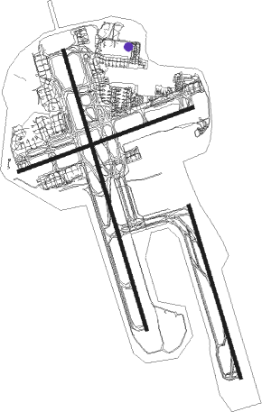
Airport layout - parking location H416
Taxiway locations
|
Parking locations
|
Nearby beacons
| code | identifier | dist | bearing | frequency |
|---|---|---|---|---|
| SY | DME | 0.5 | 246° | 112.10 |
| BK | BANKSTOWN (SYDNEY) NDB | 10.1 | 273° | 416 |
| RIC | RICHMOND TACAN | 27.9 | 310° | 110.70 |
| RIC | RICHMOND NDB | 29.2 | 310° | 347 |
| WOL | WOLLONGONG NDB | 42.1 | 213° | 239 |
Departure and arrival routes
| Transition altitude | 10000ft |
| Transition level | 11000ft |
| SID end points | distance | outbound heading | |
|---|---|---|---|
| RW07 | |||
| FISHA8 | 42mi | 213° | |
| RW16L | |||
| KEVIN6 | 33mi | 55° | |
| ABBEY3 | 42mi | 213° | |
| RW16R | |||
| DEENA7 | 42mi | 213° | |
| RW34L | |||
| WOL2 | 42mi | 213° | |
| KADOM1 | 47mi | 284° | |
| RIC5 | 28mi | 310° | |
| RW34R | |||
| ENTRA5 | 33mi | 55° | |
| MARUB6 | 42mi | 213° | |
| STAR starting points | distance | inbound heading | |
|---|---|---|---|
| ALL | |||
| ODALE7 | 34.7 | 77° | |
| MEPIL3 | 32.2 | 182° | |
| RW07 | |||
| RIVET3 | 20.5 | 66° | |
| BORE3A | 14.5 | 166° | |
| MARLN5 | 29.5 | 276° | |
| RW16 (ALL) | |||
| RIVET3 | 20.5 | 66° | |
| BORE3A | 14.5 | 166° | |
| MARLN5 | 29.5 | 276° | |
| RW16R | |||
| BORE3P | 42.8 | 168° | |
| RW25 | |||
| RIVET3 | 20.5 | 66° | |
| BORE3A | 14.5 | 166° | |
| MARLN5 | 29.5 | 276° | |
| RW34 (ALL) | |||
| RIVET3 | 20.5 | 66° | |
| RW34L | |||
| BORE3A | 14.5 | 166° | |
| MARLN5 | 29.5 | 276° | |
| RW34R | |||
| BORE3A | 14.5 | 166° | |
| MARLN5 | 29.5 | 276° | |
Instrument approach procedures
| runway | airway (heading) | route (dist, bearing) |
|---|---|---|
| RW16L | TONUX (164°) | TONUX 4000ft SSYNI (7mi, 165°) 2560ft |
| RNAV | SSYNI 2560ft SSYNF (2mi, 165°) 1930ft SSYNM (6mi, 166°) 66ft (8205mi, 283°) 600ft SSYNH (8205mi, 103°) (8205mi, 283°) 3000ft |
Holding patterns
| STAR name | hold at | type | turn | heading* | altitude | leg | speed limit |
|---|---|---|---|---|---|---|---|
| MEPIL3 | MEPIL | VHF | right | 350 (170)° | 1.0min timed | ICAO rules | |
| *) magnetic outbound (inbound) holding course | |||||||
Disclaimer
The information on this website is not for real aviation. Use this data with the X-Plane flight simulator only! Data taken with kind consent from X-Plane 12 source code and data files. Content is subject to change without notice.