Queenstown
Airport details
| Country | New Zealand |
| State | Otago |
| Region | NZ |
| Municipality | Queenstown-Lakes District |
| Elevation | 1166ft (355m) |
| Timezone | GMT +12 |
| Coordinates | -45.02426, 168.74016 |
| Magnetic var | |
| Type | land |
| Available since | X-Plane v10.40 |
| ICAO code | NZQN |
| IATA code | ZQN |
| FAA code | n/a |
Communication
| Queenstown ATIS | 126.400 |
| Queenstown CTAF | 118.100 |
| Queenstown Delivery | 121.900 |
| Queenstown Tower | 118.100 |
| Queenstown Approach | 128.900 |
| Queenstown DepartureARTURE | 125.750 |
Nearby Points of Interest:
Hulbert House
-Arrowtown Chinese Settlement
-Arrow Kilwinning Lodge
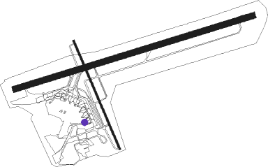
Runway info
Runway 05 / 23  | ||
| length | 1887m (6191ft) | |
| bearing | 81° / 261° | |
| width | 45m (148ft) | |
| surface | asphalt | |
| displ threshold | 63m (207ft) / 52m (171ft) | |
| Runway 14 / 32 | ||
| length | 889m (2917ft) | |
| bearing | 154° / 334° | |
| width | 15m (49ft) | |
| surface | asphalt | |
| displ threshold | 70m (230ft) / 101m (331ft) | |
Nearby beacons
| code | identifier | dist | bearing | frequency |
|---|---|---|---|---|
| QN | QUEENSTOWN VOR/DME | 3 | 47° | 113.60 |
| LX | ALEXANDRA NDB | 32.4 | 101° | 386 |
Departure and arrival routes
| Transition altitude | 13000ft |
| Transition level | 15000ft |
| SID end points | distance | outbound heading | |
|---|---|---|---|
| RW05 | |||
| BRG9 | 105mi | 37° | |
| EPDE3C, EPDE3P, ANPO3A | 54mi | 60° | |
| SUNG4P | 51mi | 108° | |
| IPNO3A, IPNO4C | 80mi | 316° | |
| RW23 | |||
| ANPO3F, ANPO3S, ANPO3T, ANPO4D, ANPO3B | 54mi | 60° | |
| SUNG4S, SUNG4Q, SUNG3U, REDO2A | 51mi | 108° | |
| IPNO4D, IPNO3B | 80mi | 316° | |
| STAR starting points | distance | inbound heading | |
|---|---|---|---|
| RW05 | |||
| SUNG3A | 26.4 | 13° | |
| UBDA3A | 25.9 | 139° | |
| ELRU2A | 52.5 | 250° | |
| RW23 | |||
| SUNG4B | 26.4 | 13° | |
| UBDA4B | 25.9 | 139° | |
| ELRU4B | 52.5 | 250° | |
Instrument approach procedures
| runway | airway (heading) | route (dist, bearing) |
|---|---|---|
| RW05-Y | IBABU (95°) | IBABU QN577 (4mi, 251°) 10000ft QN573 (7mi, 208°) 9500ft QN571 (3mi, 124°) 8400ft QN569 (3mi, 87°) 7300ft QN565 (2mi, 70°) 6500ft MOPGA (2mi, 69°) 5700ft OMUBO (7mi, 69°) 3100ft |
| RNAV | OMUBO 3100ft QN555 (2mi, 69°) 2412ft QN550 (1mi, 58°) 2025ft QN545 (2mi, 65°) 1470ft NZQN (turn) 1208ft QN547 (turn) QN551 (3mi, 57°) QN553 (3mi, 305°) 6000ft QN557 (3mi, 205°) QN560 (4mi, 159°) TUNRI (5mi, 185°) 9000ft QN878 (10mi, 185°) QN882 (3mi, 201°) SUNGU (7mi, 215°) SUNGU (turn) 10000ft | |
| RW05-Z | IBABU (95°) | IBABU QN577 (4mi, 251°) 10000ft QN573 (7mi, 208°) 9200ft QN571 (3mi, 124°) 8200ft QN569 (3mi, 87°) 7100ft QN565 (2mi, 70°) 6300ft MOPGA (2mi, 69°) 5500ft OMUBO (7mi, 69°) 3100ft |
| RNAV | OMUBO 3100ft QN555 (2mi, 69°) QN550 (1mi, 58°) QN545 (2mi, 65°) NZQN (turn) 1208ft QN547 (turn) QN552 (1mi, 74°) QN556 (2mi, 281°) 6000ft QN560 (4mi, 164°) TUNRI (5mi, 185°) 9000ft QN878 (10mi, 185°) QN882 (3mi, 201°) SUNGU (7mi, 215°) SUNGU (turn) 10000ft | |
| RW23-Y | ATKIL (249°) | ATKIL 10000ft QN780 (4mi, 261°) 8600ft QN775 (4mi, 244°) 9000ft QN770 (3mi, 200°) 7800ft ATVUP (3mi, 175°) 6800ft |
| RW23-Y | UGPED (210°) | UGPED 10000ft QN779 (7mi, 92°) 9000ft QN774 (4mi, 110°) 7800ft ATVUP (3mi, 151°) 6800ft |
| RNAV | ATVUP 6800ft QN760 (4mi, 229°) 5200ft QN755 (3mi, 278°) 4200ft LARAV (3mi, 294°) 3300ft QN745 (2mi, 277°) 2646ft QN741 (1mi, 262°) 2190ft QN735 (turn) 1824ft QN725 (1mi, 258°) 1391ft NZQN (1mi, 252°) 1221ft QN727 (turn) KABAP (2mi, 240°) 3200ft NOLUV (1mi, 189°) 4000ft QN732 (2mi, 135°) RUXAK (3mi, 132°) 9000ft QN737 (2mi, 170°) QN878 (9mi, 185°) QN882 (3mi, 201°) SUNGU (7mi, 215°) SUNGU (turn) 10000ft | |
| RW23-Z | ATKIL (249°) | ATKIL 10000ft QN780 (4mi, 261°) 8600ft QN775 (4mi, 244°) 8600ft QN770 (3mi, 200°) 7500ft ATVUP (3mi, 175°) 6700ft |
| RW23-Z | UGPED (210°) | UGPED 10000ft QN779 (7mi, 92°) 8700ft QN774 (4mi, 110°) 7600ft ATVUP (3mi, 151°) 6700ft |
| RNAV | ATVUP 6700ft QN760 (4mi, 229°) 5100ft QN755 (3mi, 278°) 4200ft LARAV (3mi, 294°) 3300ft QN745 (2mi, 277°) 2650ft QN741 (1mi, 262°) 2190ft QN735 (turn) QN725 (1mi, 258°) NZQN (1mi, 252°) 1221ft QN727 (turn) KABAP (2mi, 240°) 3200ft NOLUV (1mi, 189°) 4000ft QN732 (2mi, 135°) RUXAK (3mi, 132°) 9000ft QN737 (2mi, 170°) QN878 (9mi, 185°) QN882 (3mi, 201°) SUNGU (7mi, 215°) SUNGU (turn) 10000ft | |
| RWNVF | IBABU (95°) | IBABU QN529 (4mi, 251°) 8600ft LETPO (7mi, 135°) 8600ft |
| RNAV | LETPO 8600ft GUSAS (6mi, 79°) 6200ft QN581 (8mi, 66°) 4120ft QN523 (4mi, 66°) QN596 (10mi, 101°) QN527 (11mi, 30°) EKVOX (9mi, 77°) 10000ft | |
| RWNVG | ATKIL (249°) | ATKIL QN780 (4mi, 261°) 8500ft ONADU (5mi, 229°) 8300ft GIVAK (5mi, 191°) 7700ft |
| RWNVG | UGPED (210°) | UGPED ONADU (11mi, 92°) 7700ft GIVAK (5mi, 191°) 7700ft |
| RNAV | GIVAK 7700ft IKABA (4mi, 256°) 5800ft QN603 (6mi, 278°) 4100ft QN611 (2mi, 278°) ENKUV (6mi, 241°) OLREK (3mi, 251°) 9000ft TULVU (3mi, 251°) VAPLI (6mi, 251°) IBVUK (8mi, 185°) SUNGU (14mi, 131°) 10000ft SUNGU (turn) 10000ft | |
| RWNVH | ATKIL (249°) | ATKIL QN780 (4mi, 261°) 8500ft ONADU (5mi, 229°) 8300ft GIVAK (5mi, 191°) 7700ft |
| RWNVH | UGPED (210°) | UGPED ONADU (11mi, 92°) 7700ft GIVAK (5mi, 191°) 7700ft |
| RNAV | GIVAK 7700ft IKABA (4mi, 256°) 5800ft QN603 (6mi, 278°) 4100ft QN611 (2mi, 278°) ENKUV (6mi, 241°) 4500ft OLREK (3mi, 251°) TULVU (3mi, 251°) 7000ft VAPLI (6mi, 251°) IBVUK (8mi, 185°) SUNGU (14mi, 131°) 10000ft SUNGU (turn) 10000ft |
Holding patterns
| STAR name | hold at | type | turn | heading* | altitude | leg | speed limit |
|---|---|---|---|---|---|---|---|
| ELRU2A | EKVOX | VHF | left | 37 (217)° | > 8600ft | 1.0min timed | 230 |
| ELRU4B | EKVOX | VHF | left | 37 (217)° | > 8600ft | 1.0min timed | 230 |
| SUNG3A | SUNGU | VHF | left | 159 (339)° | 8600ft - 60000ft | 1.0min timed | 230 |
| SUNG4B | SUNGU | VHF | left | 159 (339)° | 8600ft - 60000ft | 1.0min timed | 230 |
| UBDA3A | UBDAM | VHF | left | 300 (120)° | 11400ft - 60000ft | 1.0min timed | 230 |
| UBDA4B | UBDAM | VHF | left | 300 (120)° | 11400ft - 60000ft | 1.0min timed | 230 |
| *) magnetic outbound (inbound) holding course | |||||||
Disclaimer
The information on this website is not for real aviation. Use this data with the X-Plane flight simulator only! Data taken with kind consent from X-Plane 12 source code and data files. Content is subject to change without notice.